Earth Day marks a spring milestone and an all time record for Milwaukee
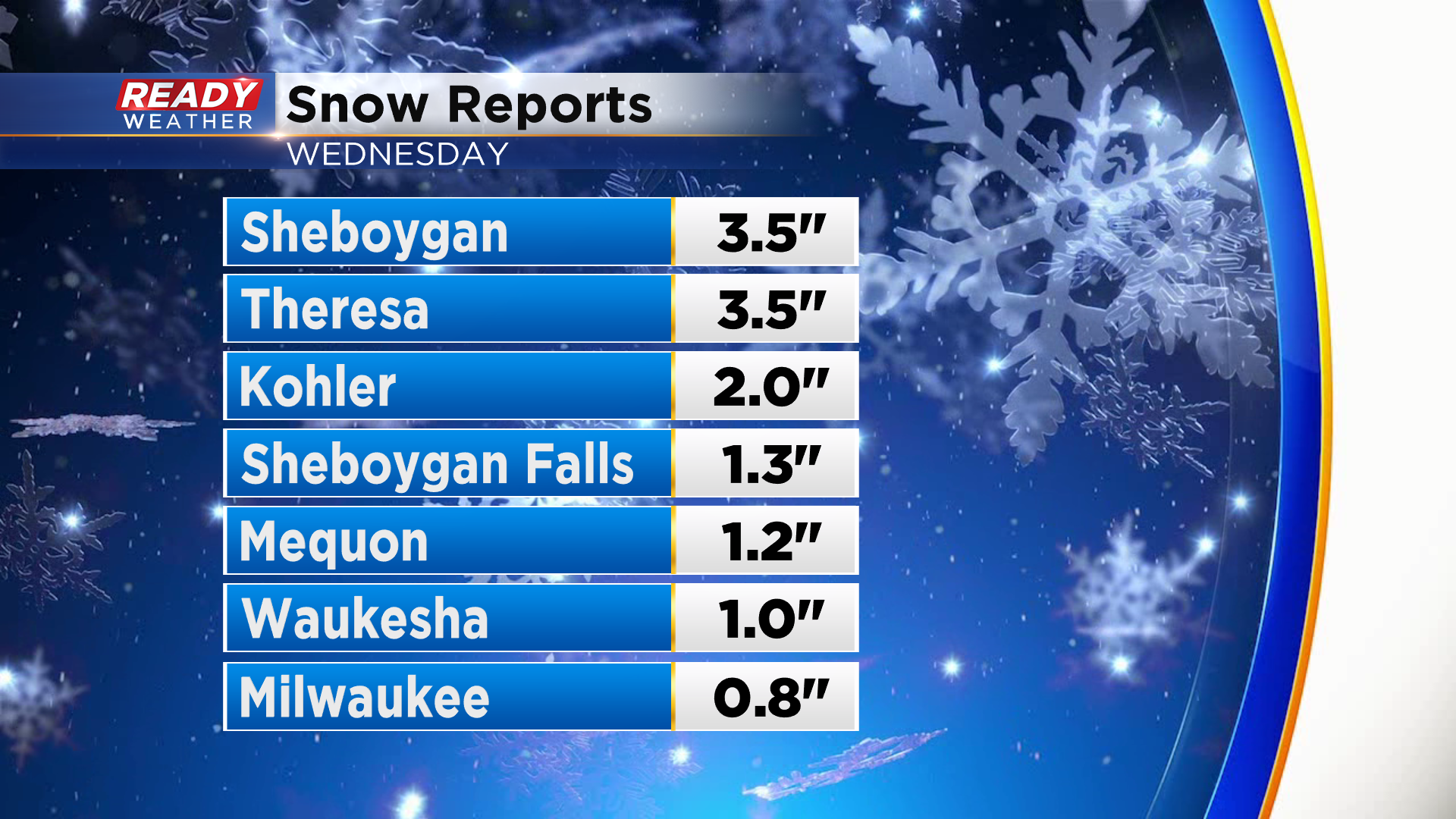
Southeast Wisconsin is having quite the winter whiplash this week! Wednesday's snow showers dropped anywhere from a dusting to up to 3.5" in parts of the area.
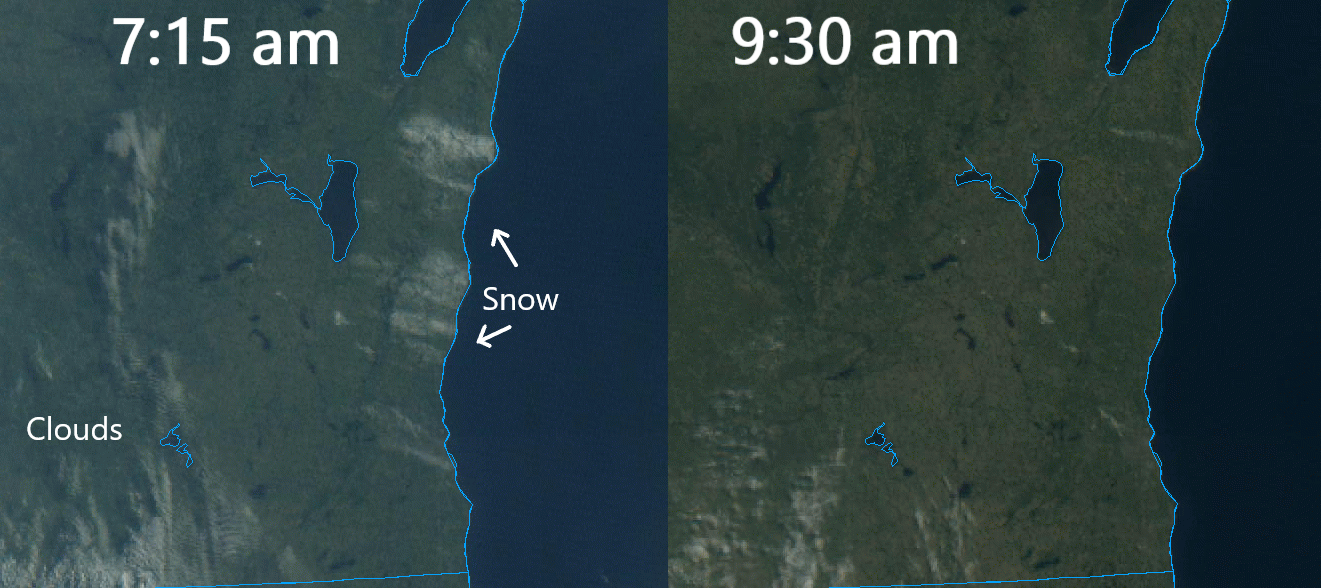
Thankfully the late April sunshine is strong and melted the snow pretty quickly this morning.
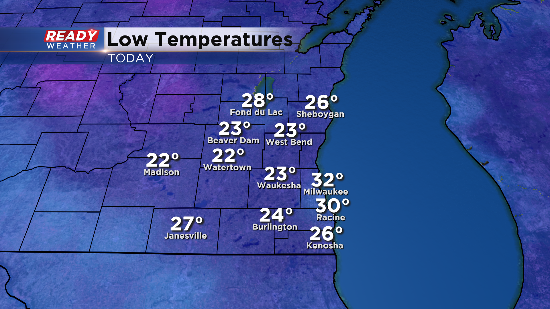
The clearing skies and snow on the ground lead to a cold start this morning with lows in the low 20s inland and 32°.
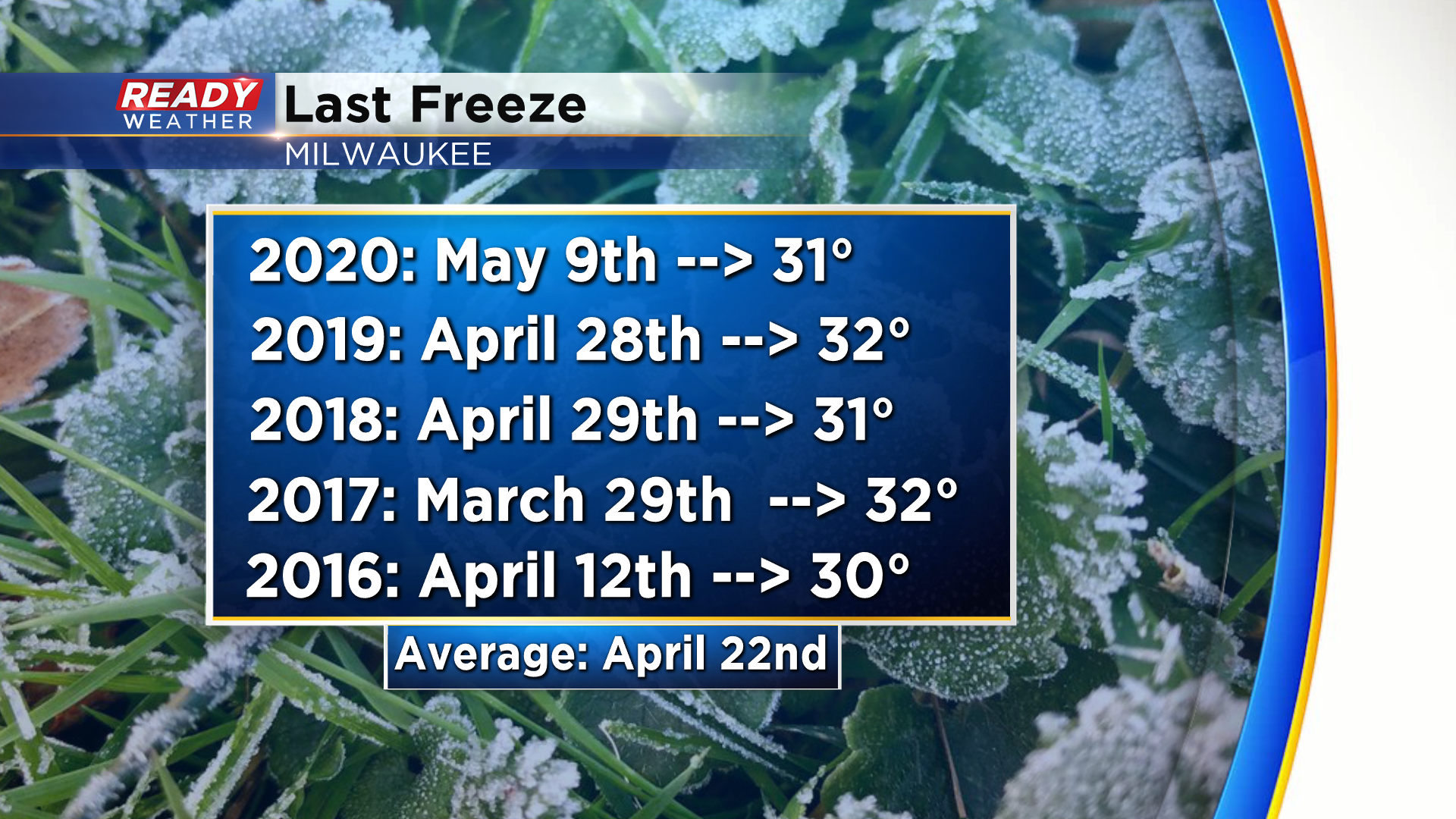
Based on the new 30 year climate normals, today marks the average date of Milwaukee's last freeze of the season. Over the last 5 years, our last freeze has been as early as the end of March, and as late as May 9th.
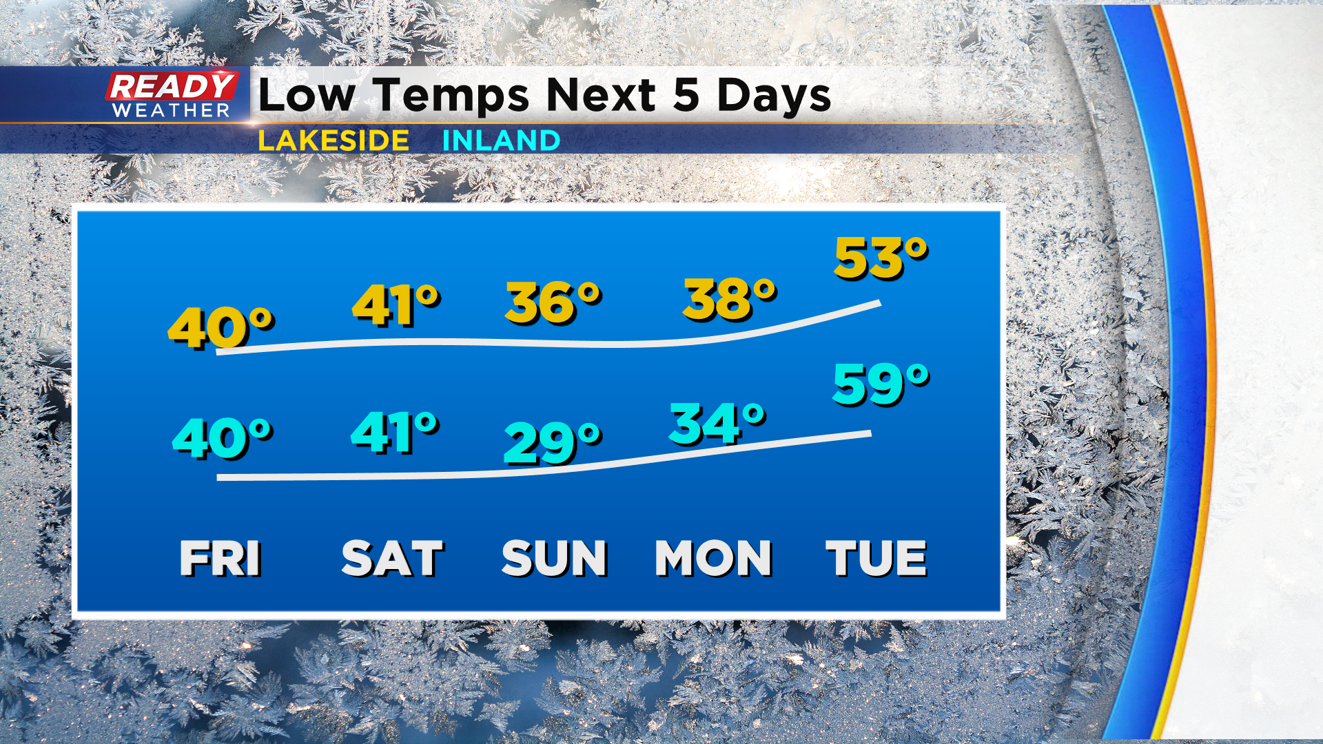
There's no freeze in the forecast for lakeside areas over the next 5 days, but inland spots could slip below freezing Sunday morning if the clouds clear out fast enough Saturday night.
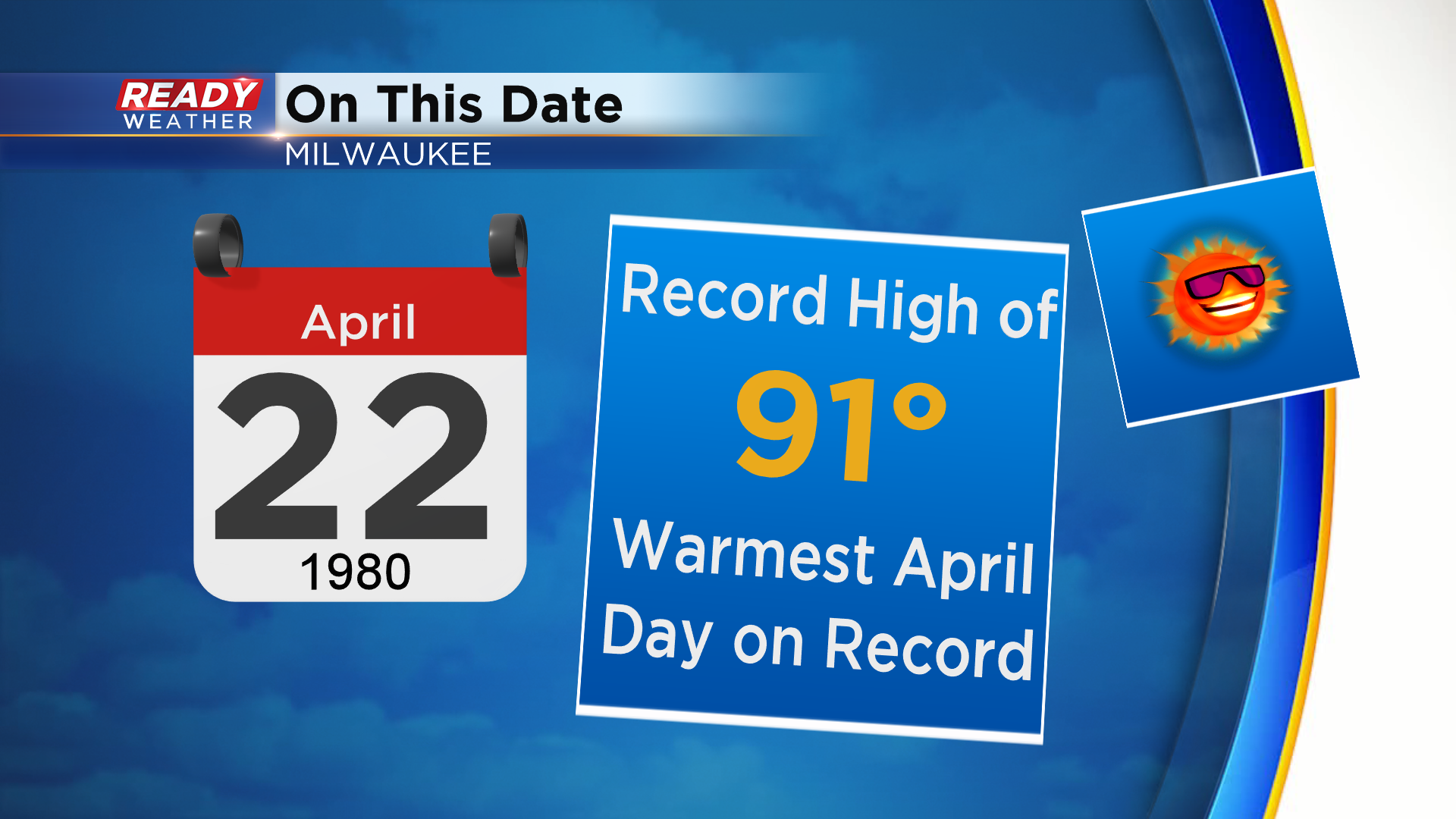
While we've experienced some winter whiplash this week, it's nothing compared to the extreme temperature swing we had in 1980. On this day in 1980, Milwaukee had its hottest April day on record with a high of 91°. 36 hours later it was 29° and snowing.
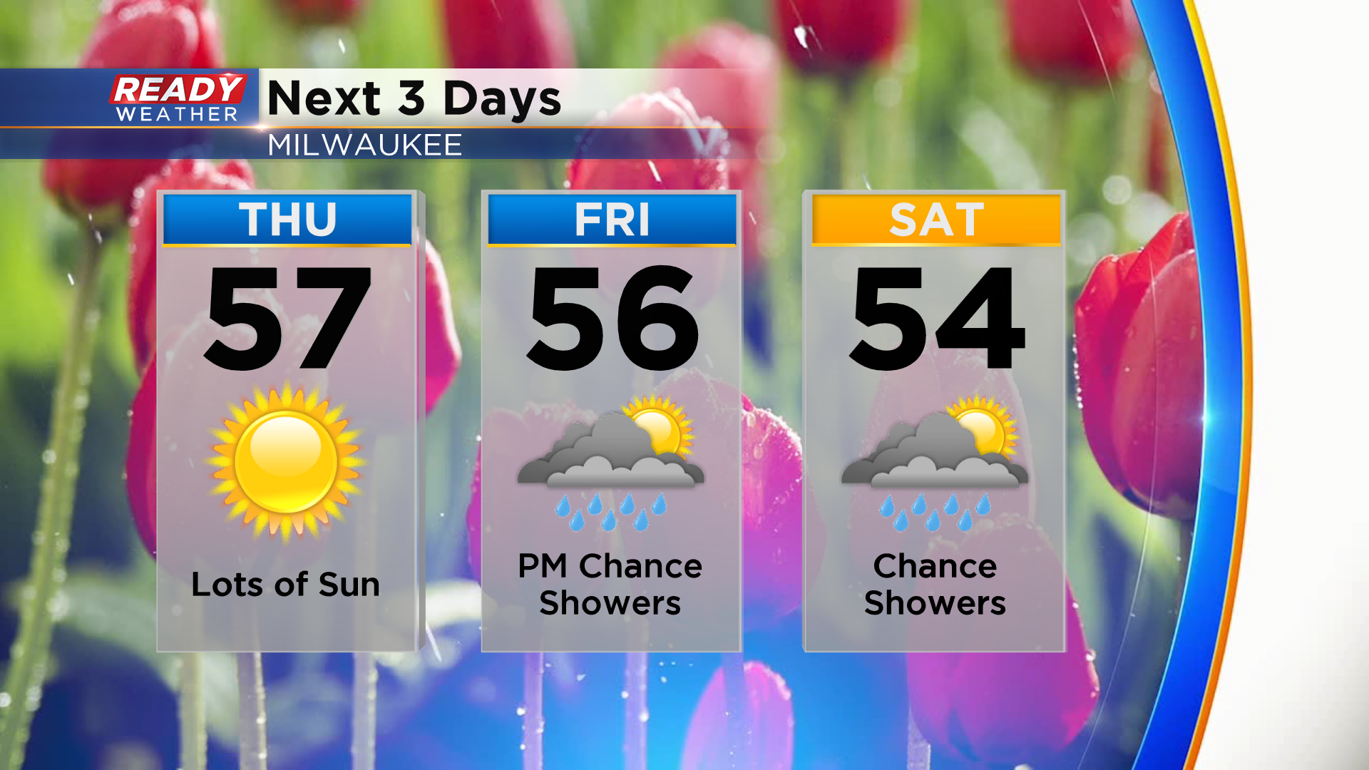
Thankfully we don't have any extreme temperature swings or snow in the forecast for the next few days. Temperatures will be closer to normal in the mid to upper 50s, but light shower chances return Friday afternoon and could linger into Saturday.
There are some summer-like temperatures on the horizon. Download the CBS 58 Ready Weather App to see what day could be in the 70s.
