Snow is expected to arrive across the entire area overnight!
Overnight Update April 2, 2024
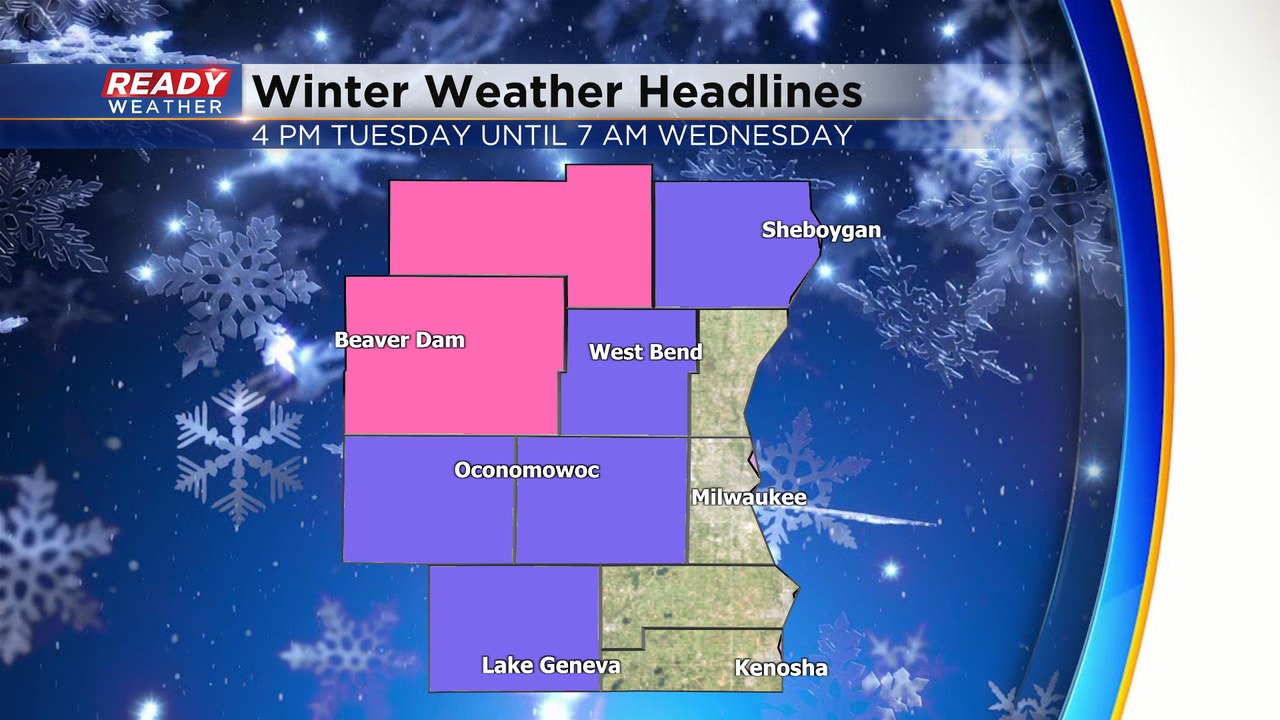
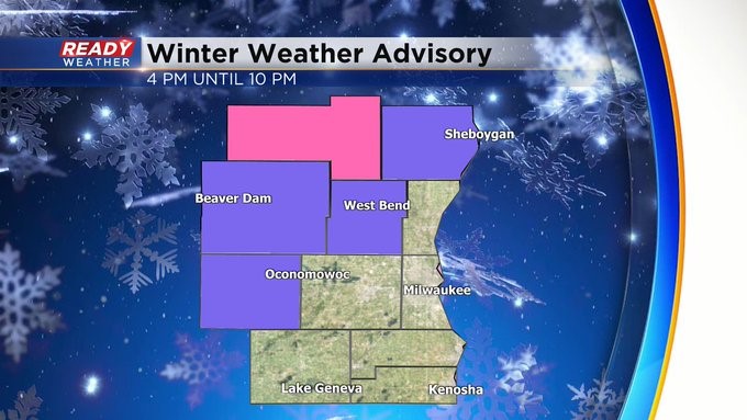
The Winter Weather Advisory and the Winter Storm Warning goes until. The wind will increase tonight into Wednesday. Areas of heavy snow and wind could create isolated power outages. Look for a reduction in visibility as well.
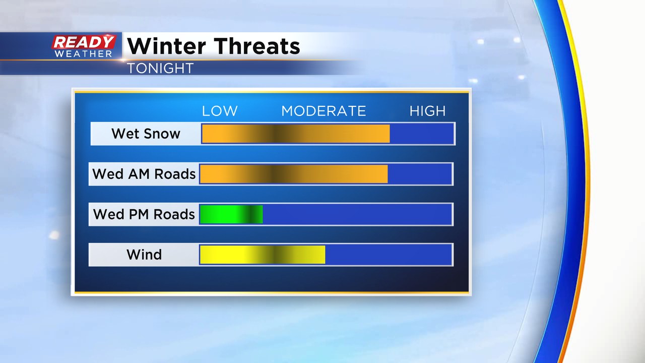
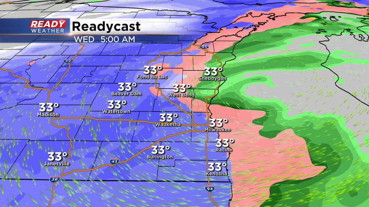
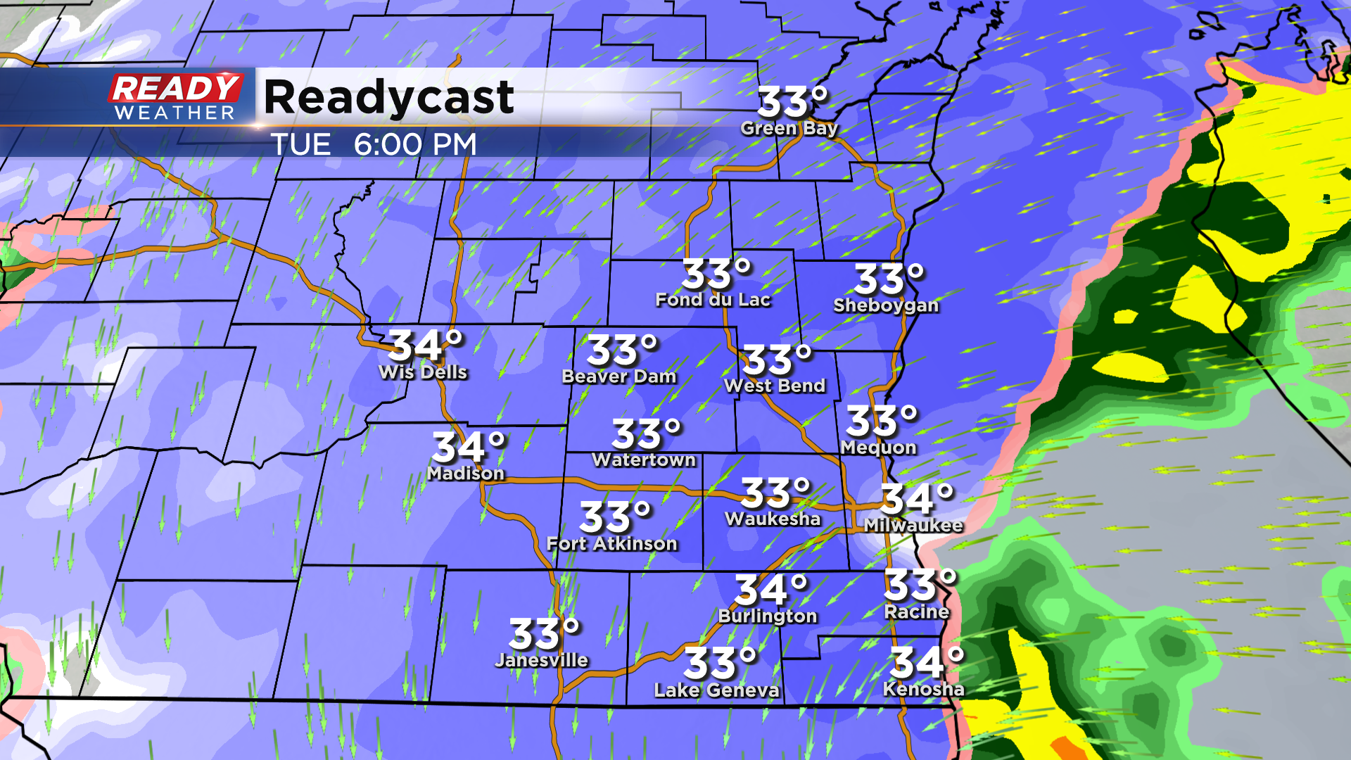
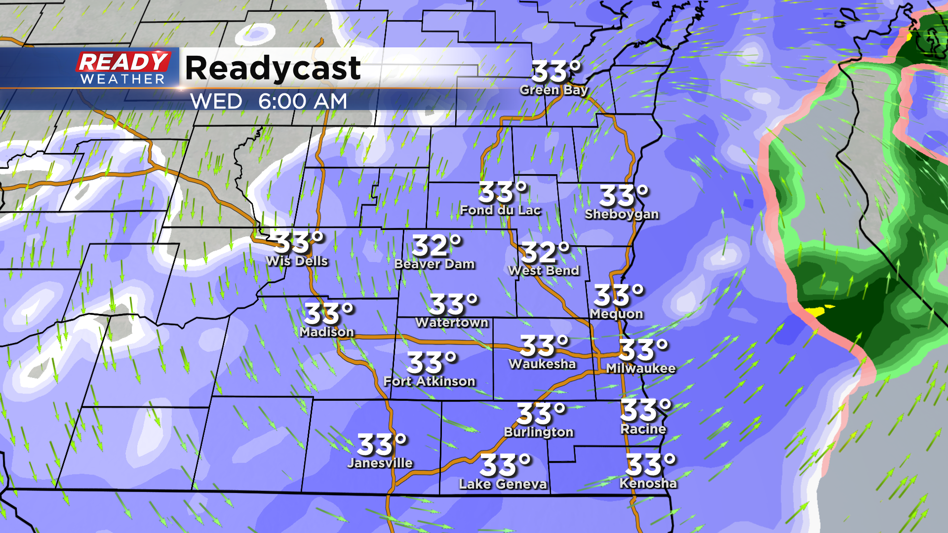
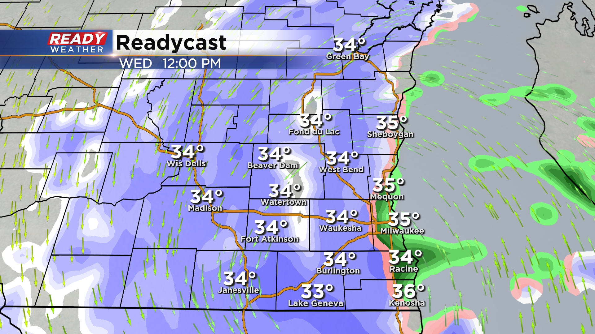
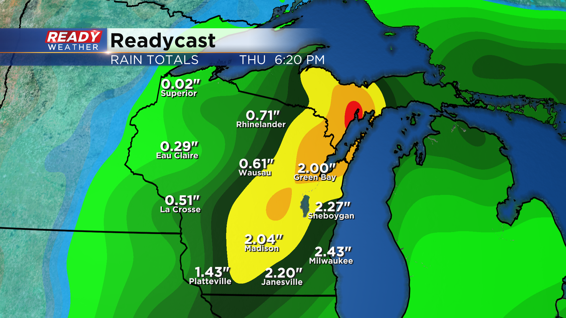
The models bring in more snow overnight into Wednesday morning. Areas that experienced heavy rainfall will likely experience snow by morning. Several more inches are possible into Wednesday morning.
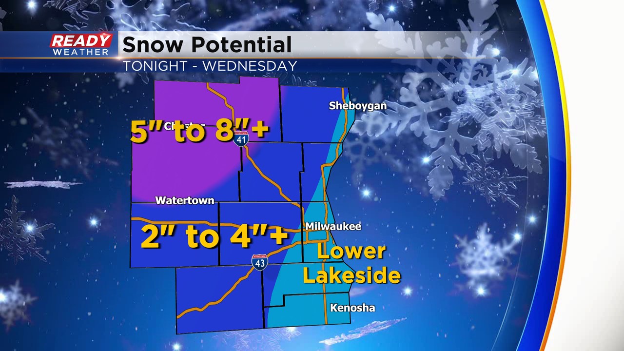
The best accumulating snow will occur tonight into Wednesday morning. 5" to 8" is possible for our winter storm warned counites. 2" to 4" is possible within the advisory. Lower totals are expected near the lakefront.
___________________________________________________________________________________________________________
MILWAUKEE (CBS 58) -- You never quite know what to expect when it comes to April weather. Case in point, this forecast over the course of the next day or two.
Closer to the lakeside areas, you can expect mainly rain throughout the day. But inland, you'll see a changeover during the day from rain to mix.
Lakeside, the switch will occur by late in the day or early evening. Once the snow starts, it won't stop until early Thursday morning. The wind will play a big factor too with gusts 30 to 40 mph from the north. It'll start as northeast winds on Tuesday
In terms of snowfall amounts, the thinking is still the same as it was on Monday. 1-3"+ lakeside areas and 4-6"+ inland. The snow will be heavy, and the gusty winds could cause power outages and downed tree limbs, especially Tuesday night into Wednesday.
The advisories so far, mainly north and west of the metro.


Behind the system, we really quiet down. Highs will be near 50 by the weekend. As far as the solar eclipse weather on Monday, it's still up in the air. Several computer models hint at clouds with possible showers. But we'll keep on top of this as we get closer.
