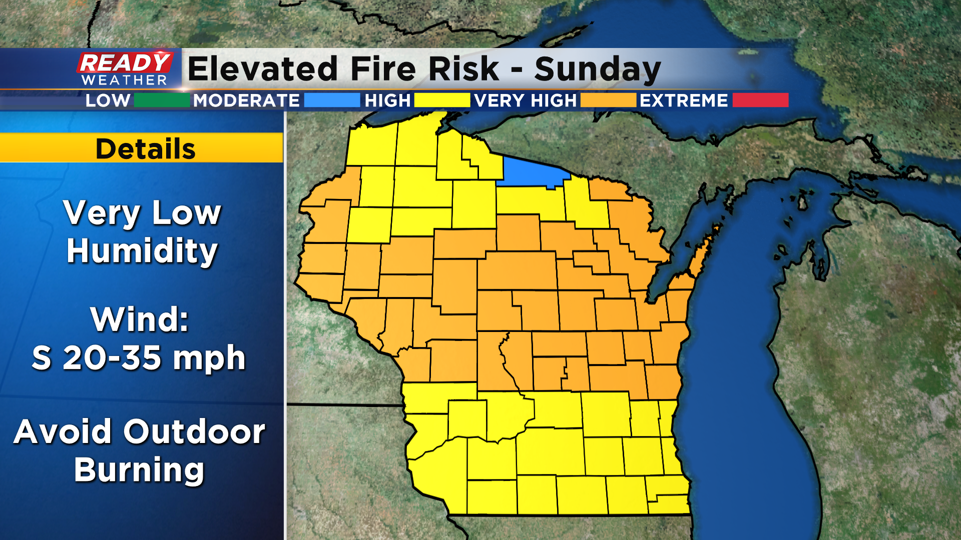
Dry and mild first weekend of spring leads to elevated fire danger


There were 35 wildfires across Wisconsin on Saturday, burning over 100 acres. High to very high fire danger will continue across most of the Badger State again on Sunday as very dry air remains in place and winds gust between 20-35 mph. Avoid any outdoor burning today as any fire that sparks will spread quickly.
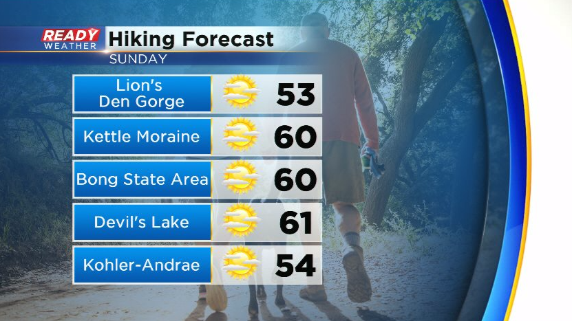
Temps should make it to 60° everywhere on Sunday expect right along the lakeshore. While it'll be a nice day for a hike, the wind will be a lot stronger than Saturday, but that should keep the lake breeze at bay until mid to late afternoon.
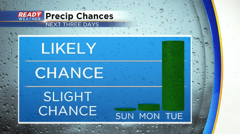
More clouds roll in late afternoon and evening with more clouds than sun expected on Monday. We can't rule out an isolated shower brushing western Fond du Lac/far northwestern Dodge counties briefly on Monday, but the better chance will come on Tuesday when rain and a few rumbles of thunder are likely.
Download the CBS 58 Ready Weather App to track the rain chances going into the middle of the week.