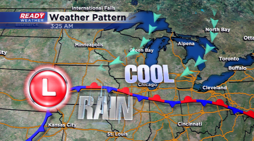
Drier and cooler weather pattern
Although some showers are still lingering this morning, the rest of the week does look a little drier for the Badger State. The front that brought all of the rain is still sitting south and will finally budge on out by the end of the week. Our problem right now is the low pressure system is parked to our southwest and not really moving. Eventually, it will head southeast of the area and bring the rain and storms with it.
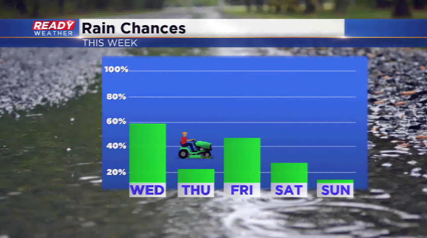
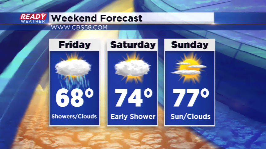
There could be a few showers or storms on Thursday night and Friday; however, it’s a scattered chance at this point and could actually stay south of the area. For now, we will keep the spotty chances in. With the low then shaving northeast into Michigan, there could be an isolated shower for Friday night and early Saturday. The weekend appears to bring a draw of drier air and a mix of sun/clouds. It will not be a hot weekend either with highs in the 70s.
So, yes, there could be some rain in the forecast, but nothing like we saw earlier this week. Rainfall totals were between 2”-5” in SE Wisconsin with minor flooding. The Fox River near New Munster remains under a Flood Warning with rising waters. The rain chances will not pack the punch it did earlier this week with less favorable dynamics. Next week appears to bring another wave of heat and humidity; let’s see if will bring more showers and storms.