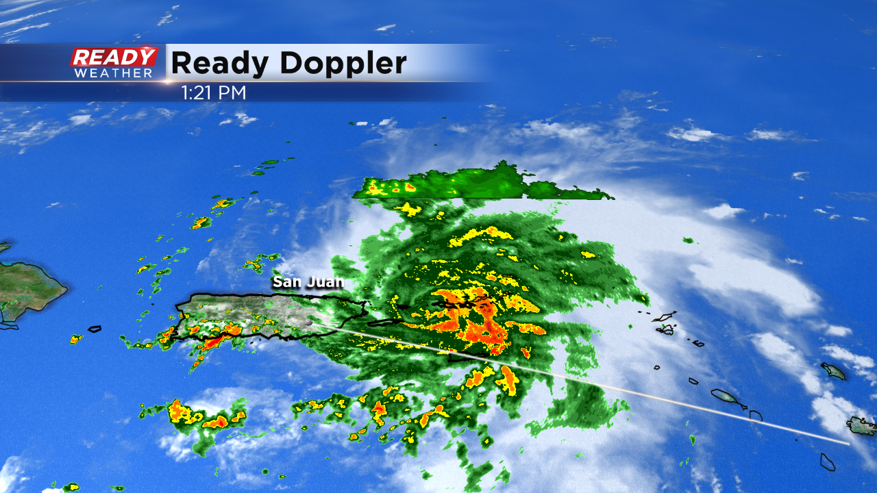
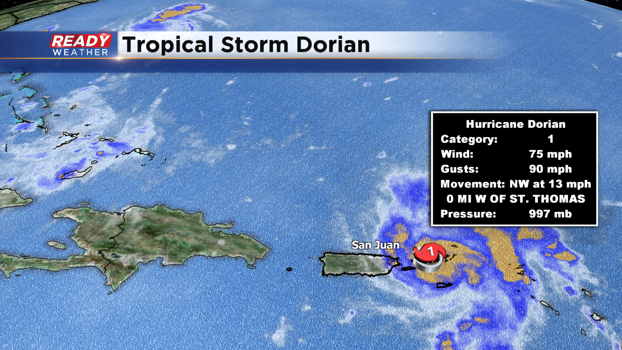
Dorian has now reached hurricane strength as a Category one at this time. Here's the current radar:
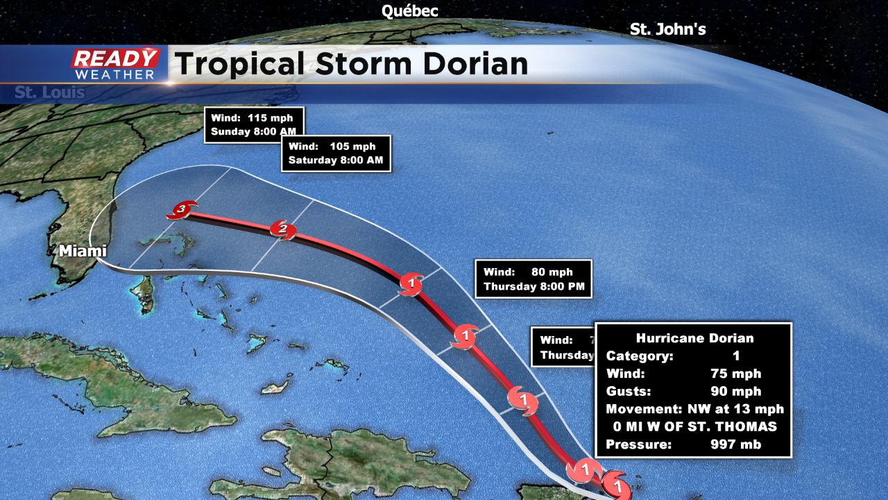
Winds are now sustained at 75 mph, a low end cat one. However, winds are expected to increase in the coming days. Dorian could become a major hurricane as a Category 3, with winds of 115 mph before any US landfall, which could happen on Labor Day.
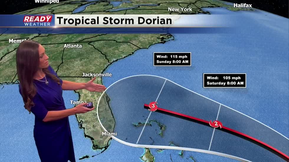
This is the latest projection with our in house Readycast. A rather strong blocking high is sitting out in the central Atlantic. That is keep Dorian on a more westward path toward the US coast. This path could change in the coming days but will be a big talker right through the weekend.
This is the latest full track which shows the slow and steady increase in intensity as it moves into the open waters. Heavy rainfall over a half foot along with surge will be something to watch for the US and British Virgin Islands and the Bahamas this weekend.
Then all eyes will be on the U.S. Atlantic coast from Florida right up into the Carolinas as the storm continues to evolve in the coming days. Stay tuned!
I'm meteorologist Rebecca Schuld