


We were expecting a warm and humid day Tuesday and that's exactly what we got. Almost everyone in southeast Wisconsin made it into the 90s with Sheboygan seeing the warmest temps with a high of 94*. When you add on the mugginess some spots felt as warm as 100*.

The 93* high temperature in Milwaukee was warm enough to break a 76-year-old record of 90*. We were also watching the record for Wednesday morning. The record warmest low temperature was 70* but we dipped to 69* so no record there.

After all the heat and humidity we saw a line of storms form in Minnesota and move through Wisconsin. Those storms arrived in our northwest counties with some vigor around 8 pm. As storms rolled in they gusted above 70 mph at times so there is no surprise that there was a lot of tree damage and as many as 20,000 customers without power.
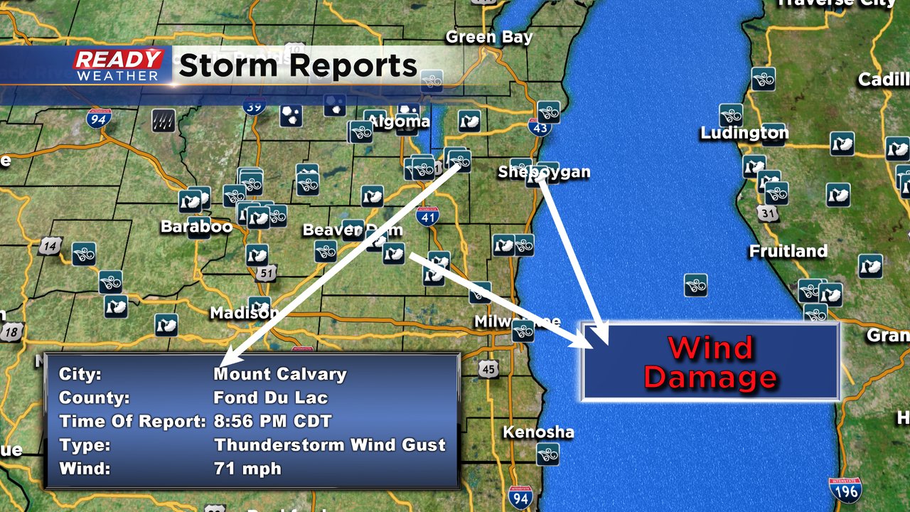
Storms gradually decreased in intensity as they moved through our local area with the bulk of the damage confined to areas north of I-94. Check out some of the damage photos here:
Here's a look at storm damage in Hartford this morning. Are you seeing anything in your area? pic.twitter.com/vonvTlK5Tp
— CBS 58 News (@CBS58) June 3, 2020
Latest pics of some of the damage that last nights storm did in Sheboygan. The main damage was along Washington Ave and 11th St. @CBS58 for the latest. @CBS58Drew @JustinTGee @SamKuffelWx @RebeccaSchuld @mikeywx8 pic.twitter.com/4j76AkH5lq
— Andy Brovelli CBS 58 ??? (@ABrovelli) June 3, 2020
Expect another warm and muggy day Wednesday with highs in the low 80s. Some more comfortable air arrives Thursday but then the humidity comes back for Friday with scattered storms. Download the CBS 58 Ready Weather app to track the next chance for storms.