Cooler than normal to begin the week before heat and humidity return


It's been a rather blah Saturday across the area with plenty of clouds and spotty, light showers.
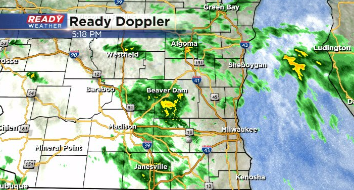
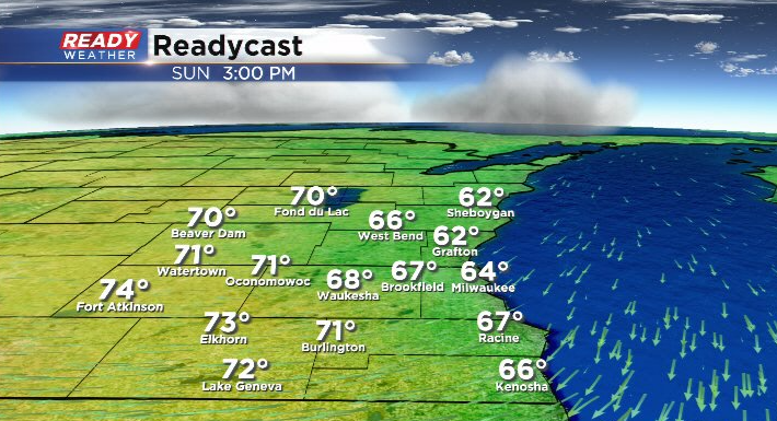
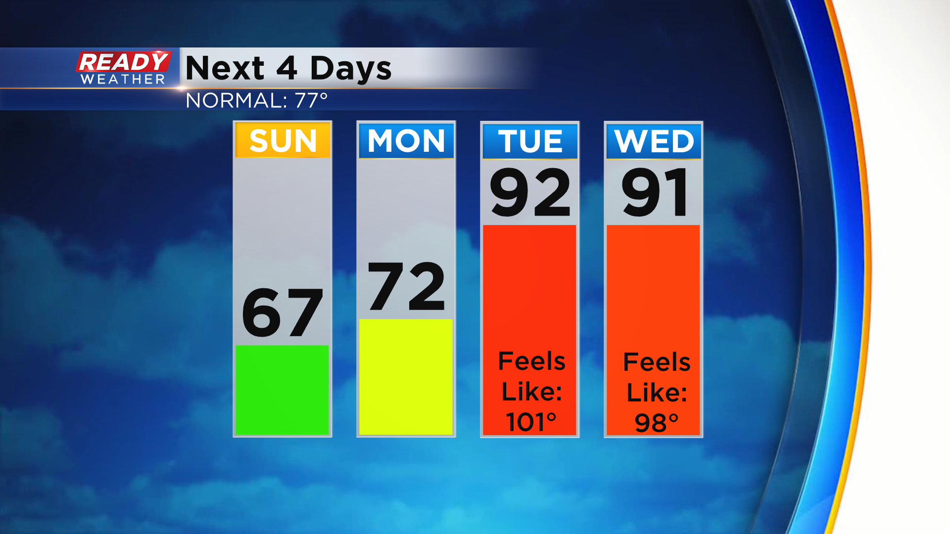
Shower chances will continue through this evening, tapering off overnight as a cold front moves through from the north. This cold front will shift our winds to the northeast on Sunday, holding temps in the 60s lakeside and low to mid 70s well inland. This will likely keep shower chances southwest of our area on Sunday
Monday is a different story. As a warm front sits to our south, we'll be watching for a complex of storms to track north of it across the Badger state. Where exactly this area of storms will track is still a bit uncertain this far out, but it looks like it may impact at least some parts of southeast Wisconsin around midday or early afternoon Monday.
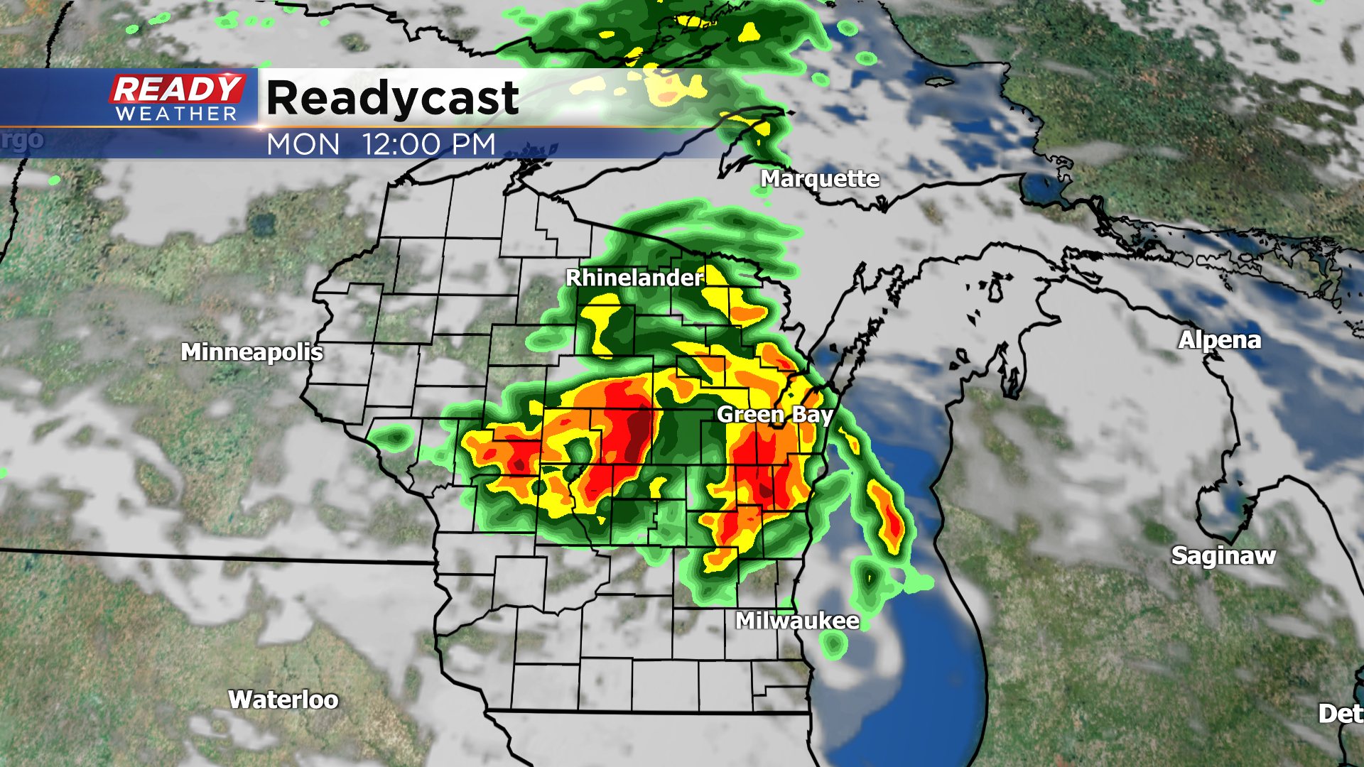
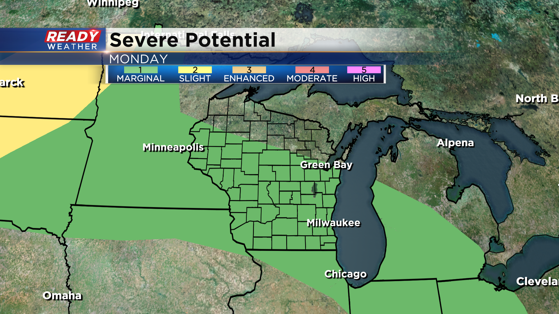
Depending on the timing, this area of storms could be strong to severe. Right now all of southeast Wisconsin is under a level 1 of 5, Marginal Risk, for severe storms on Monday.
The actual warm front will lift through the area early Tuesday morning, allowing temps to skyrocket into the lower 90s area-wide. Factor in dew points in the low 70s and it'll feel more like the 100°-105° both Tuesday and Wednesday.
A cold front moves through Wednesday night, which will bring another chance for showers and storms and get rid of the humidity for the second half of the week. Download the CBS 58 Ready Weather App to get the latest updates on Monday's potential severe weather.