Cold today, more snow this week

-
3:41

The Brass Tap owner shares craft beer and game day food pairings...
-
4:43

Toy expert shares top picks for upcoming travel season
-
2:16

One last round of precipitation before a nice drying trend heading...
-
3:31

’Who has access to that data?’: Flock cameras and the debate...
-
2:00

CBS 58’s Hometown Athlete: Makhi Rodgers overcomes adversity...
-
2:21

Fight over noise from The Rock continues in Franklin; Common...
-
2:42

’This is a safe space’: Milwaukee group holds sober event...
-
3:00

Senate passes bills legalizing online sports betting, banning...
-
2:57

MCTS free rides program returns for St. Patrick’s Day ☘️
-
1:49

Drivers still stuck, frustrated day after blizzard turns roads...
-
1:55

Cold weather doesn’t stop patrons from celebrating St. Patrick’s...
-
0:57

Milwaukee County municipalities develop safety action plans,...

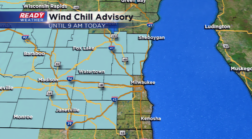
Winds have calmed down a touch compared to the very gusty winds we experienced on Sunday. Those winds are still blowing rather hard and ushering in Canadian air. Due to this lethal combination, most of the viewing area is under a Wind Chill Advisory until 9 am. The only counties not in this advisory are Milwaukee, Racine, and Kenosha.
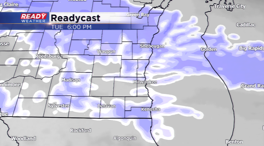
Another weather maker moves in by Tuesday afternoon into Wednesday. This will drive in the threat of snowfall for southeastern Wisconsin. By the time is moves out on Wednesday, a few inches of snowfall will be possible. The computer models have been going back and forth on the intensity and track of a winter storm late this week. If it does take a bee-line to the region, it could mean even more accumulating snow. Stay tuned!