


Skies clear out heading into Friday morning and the gusty winds subside, allowing temps to tumble into the teens area-wide by sunrise.
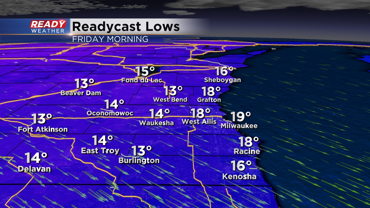
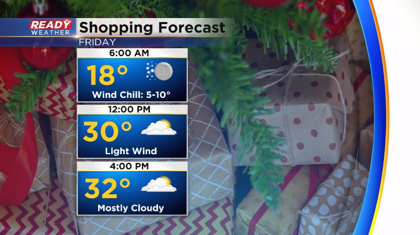
We'll still have a breeze around 5-10 mph, making it feel like the single digits to around 10° for the shoppers out before and around sunrise. Temperatures will stay at or below freezing all day Friday with more clouds than sun.
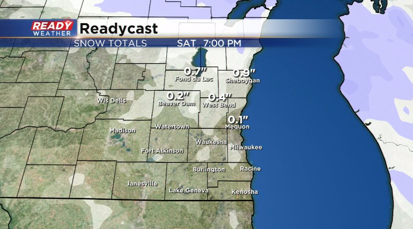
After a dry day Friday, we're tracking a quick moving low pressure system that's expected to track right through southeast Wisconsin on Saturday. That track would keep the majority of the accumulating snow across the northern half of the state, but there's still some uncertainty in the exact track, so that may shift south a bit.
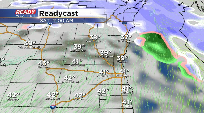
A few wrap around rain/snow showers will be possible regardless later in the day Saturday, but the best chance at an inch or so of snow will be in Fond du Lac and Sheboygan and areas north.
Download the CBS 58 Ready Weather App to see the full forecast.