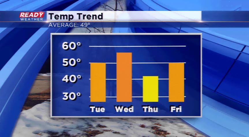
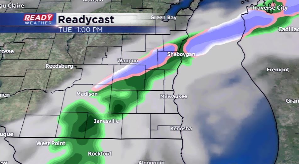
A weak disturbance along with a cold front will produce light showers today into the early afternoon. The most the region will pick up will be about 0.10” of rainfall. Light snow showers or flurries could mix in our northern counties this morning. There could be some clearing taking place behind the front by later parts of this afternoon and evening. This will set the stage for nice weather for Wednesday. Highs look to skyrocket well into the 50s tomorrow.
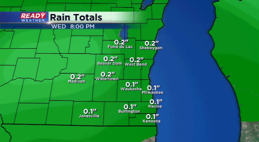
Yet again another wave comes in for Wednesday night and Thursday will produce light rain or snow showers. Temperatures will cool significantly by Thursday into the upper 30s and lower 40s. Expect the winds to pick up as well on Thursday into Thursday night. The temperatures again climb above average for the weekend with the potential of more 60s coming around for Saturday and Sunday. It looks to be a great weekend ahead.