Clocks spring ahead while temps fall back below normal


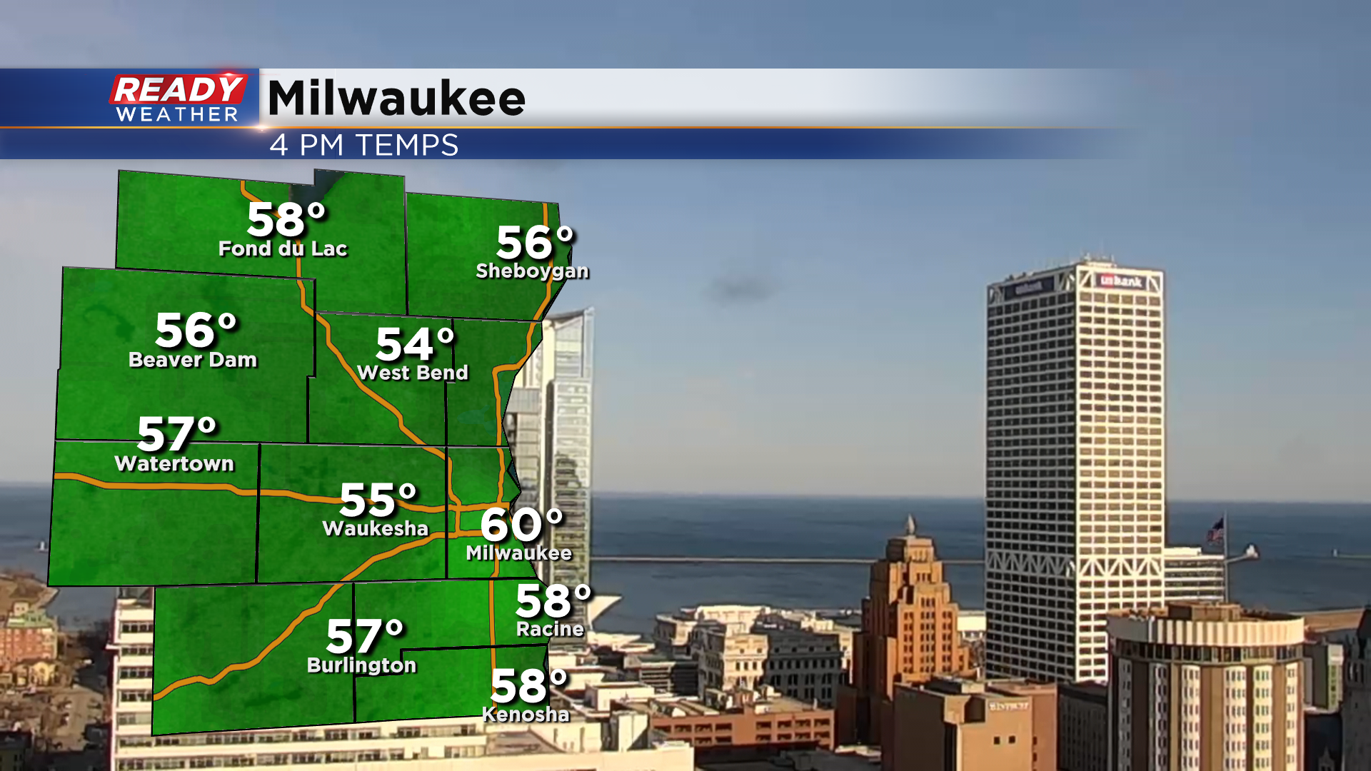
It's been another fantastic Saturday across southeast Wisconsin with plenty of sunshine and temperatures in the upper 50s to 60°.
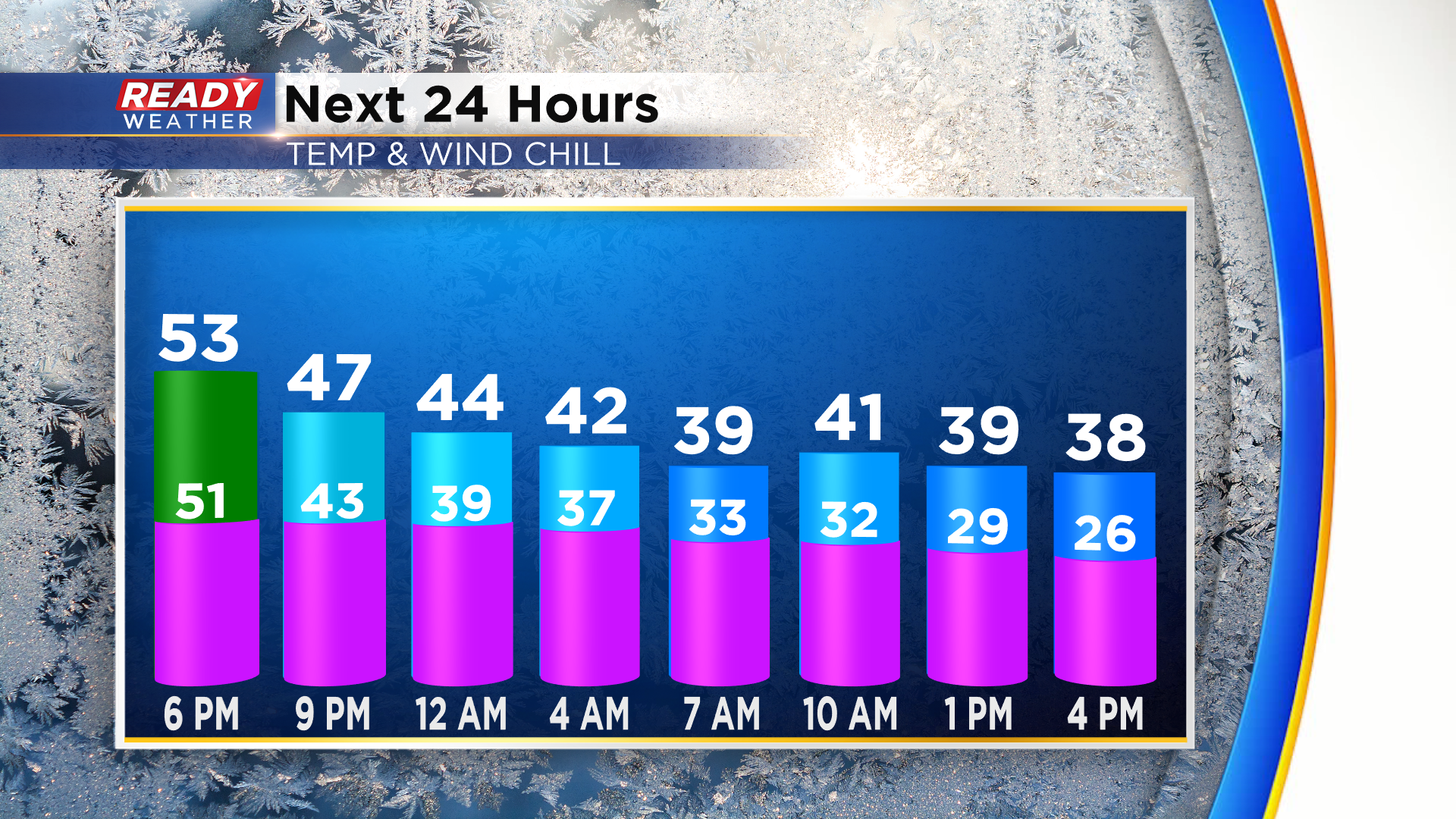
Temperatures will remain mild in the 40s through this evening, but a cold front will move through early Sunday morning and turn our winds to the northeast. It'll be a breezy northeast wind with gusts of 20-30 mph, which will make it feel quite chilly, especially in the afternoon as temps fall through the 30s.
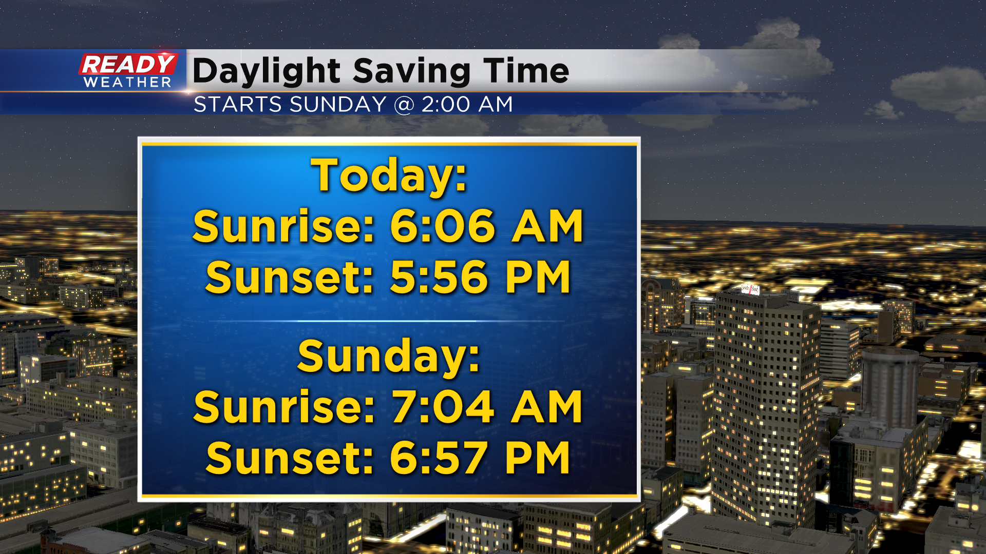
Not only will have a cold front move through tonight, it's also the start of Daylight Saving Time! Remember to turn your clocks forward an hour before you go to bed tonight, and change the batteries in your smoke detector!
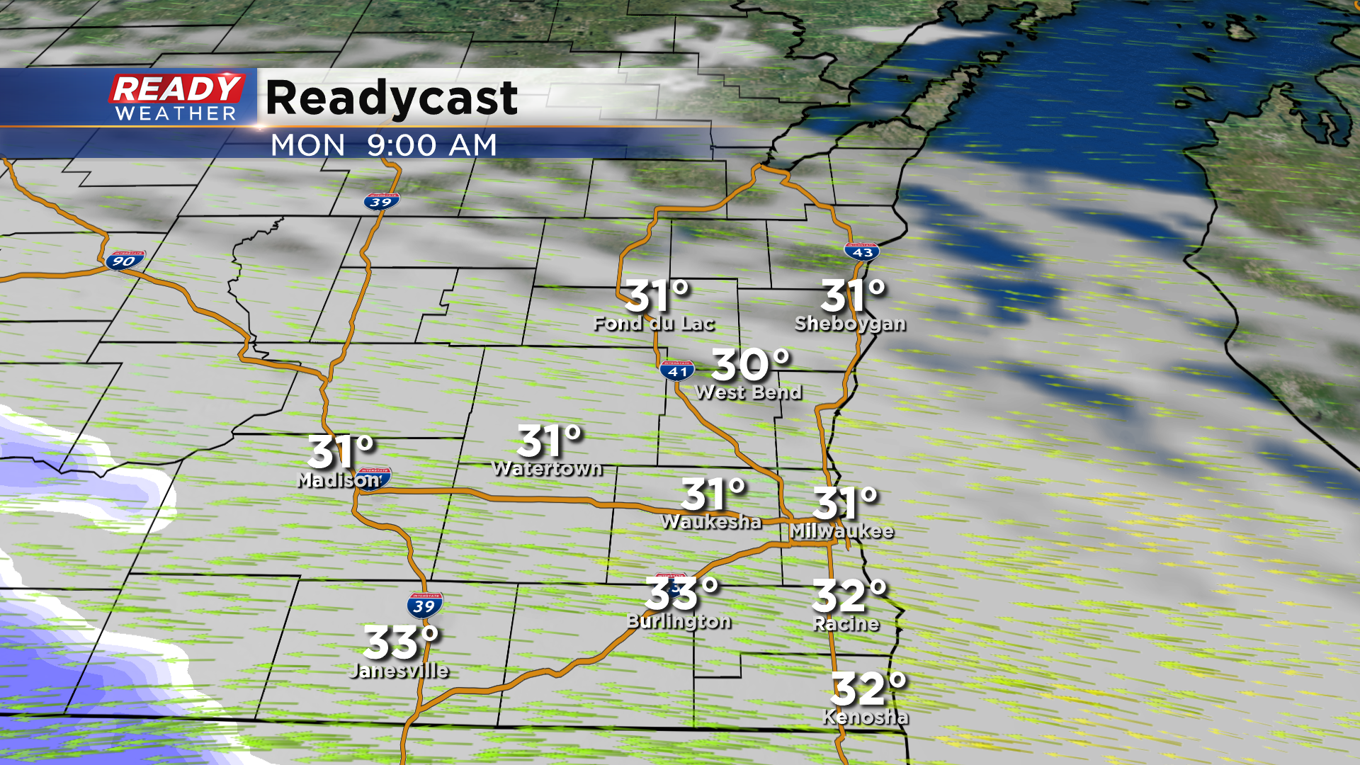
While the clocks spring ahead, our temperatures will fall back below normal to start the week with highs in the 30s on Monday. Clouds will increase heading into Monday morning, but our dry easterly wind should keep any wet snow to our west during most of the morning hours.
Wet snow will move in from southwest to northeast during the afternoon and continue into the evening. There may be some freezing drizzle Monday night as the snow ends, but that's fairly uncertain.
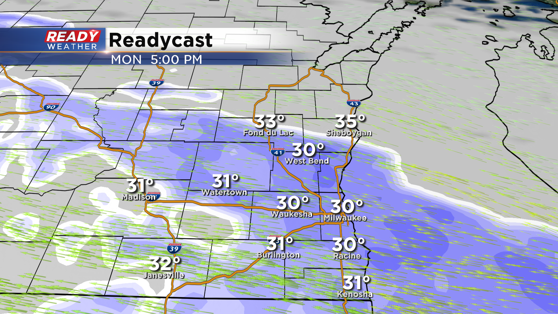
Due to the wet nature of the snow and temps near or slightly above freezing, 0.5" to 2" of slushy accumulation is possible, with highest totals SW of Milwaukee, and lightest amounts near Sheboygan.
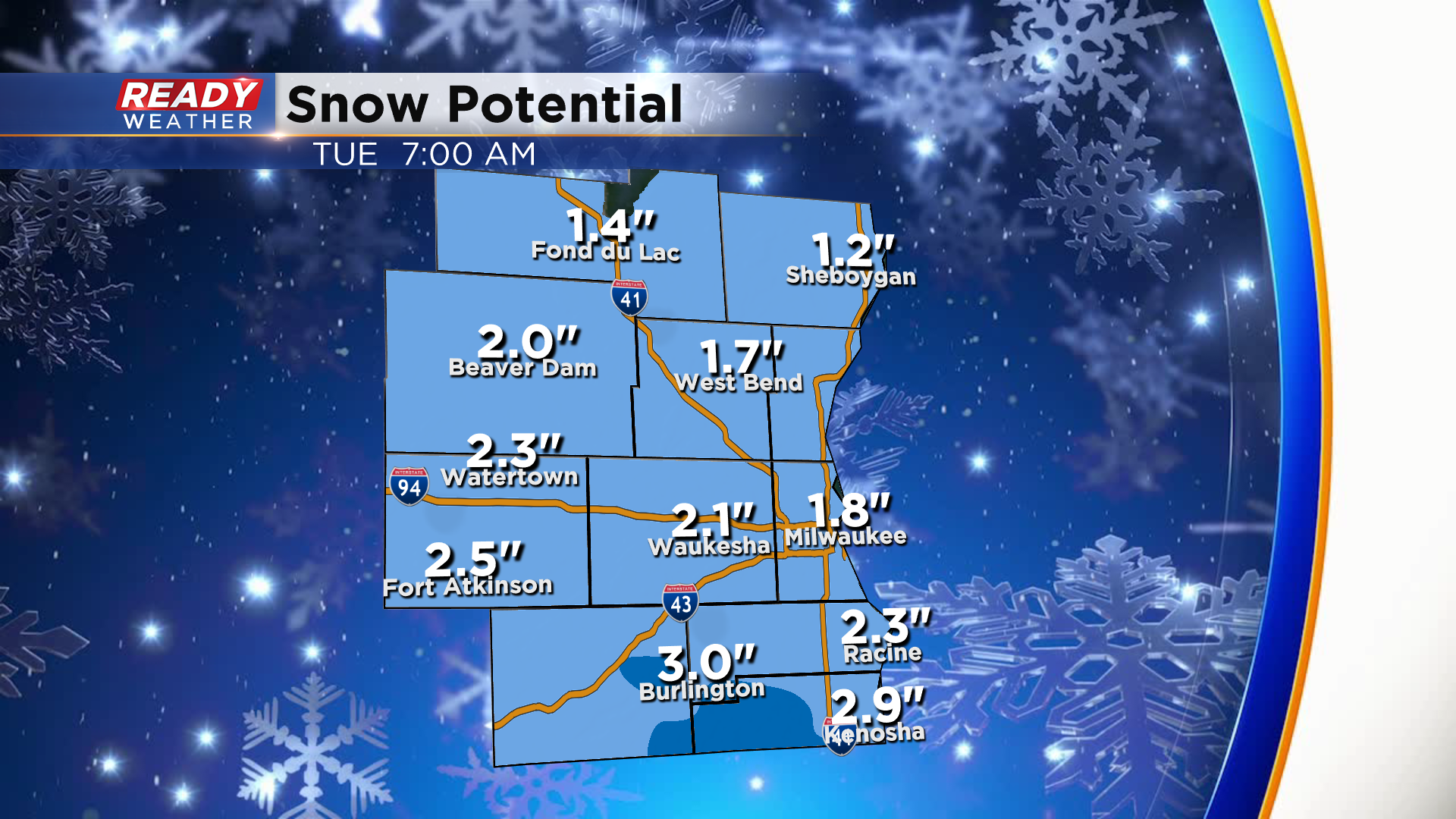
There's still a bit of uncertainty as to what time the wet snow will start reaching the ground on Monday, which could impact precipitation type and snow totals. If snow is able to start reaching the ground late Monday morning, snow totals may need to be increased by an inch or so. Expect slushy and slippery roads late Monday afternoon into the evening. Download the CBS 58 Ready Weather App to track the incoming wet snow and to get any Advisories sent to your phone.