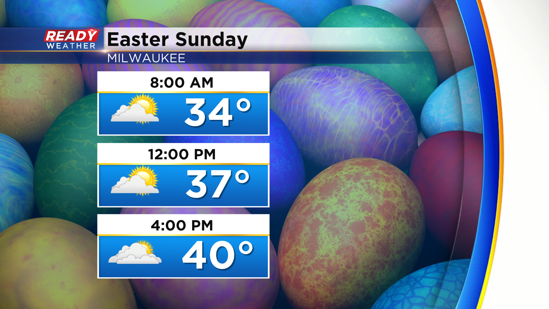
Chilly for Easter Sunday followed by wet snow to start the work week


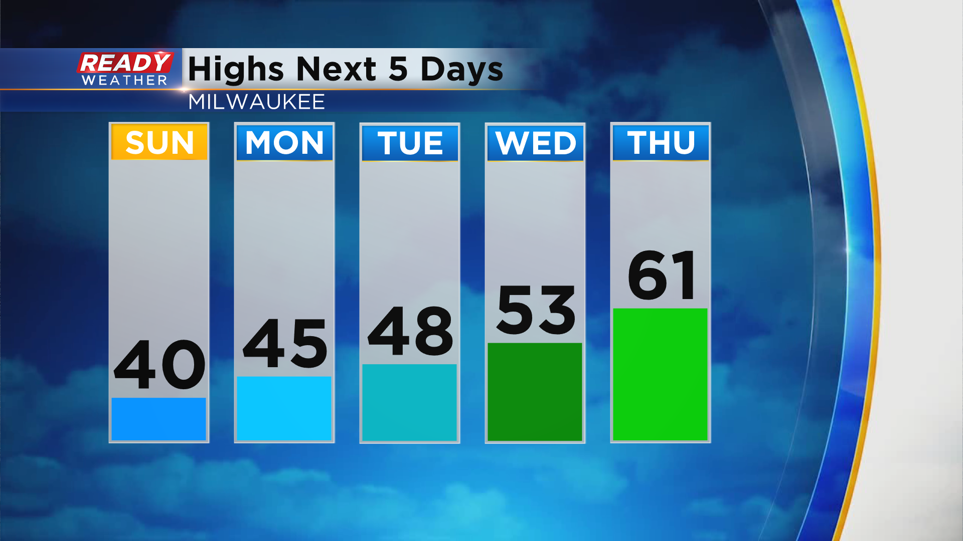
It's been a rather cool, but dry start to the holiday weekend with highs topping out in the upper 30s to mid 40s under partly sunny skies. We'll remain on the chilly side on Easter Sunday thanks to an easterly wind at 5-15 mph, but there will be times of sunshine mixing with the clouds. Temps looks to top out around 40° lakeside and mid 40s inland.
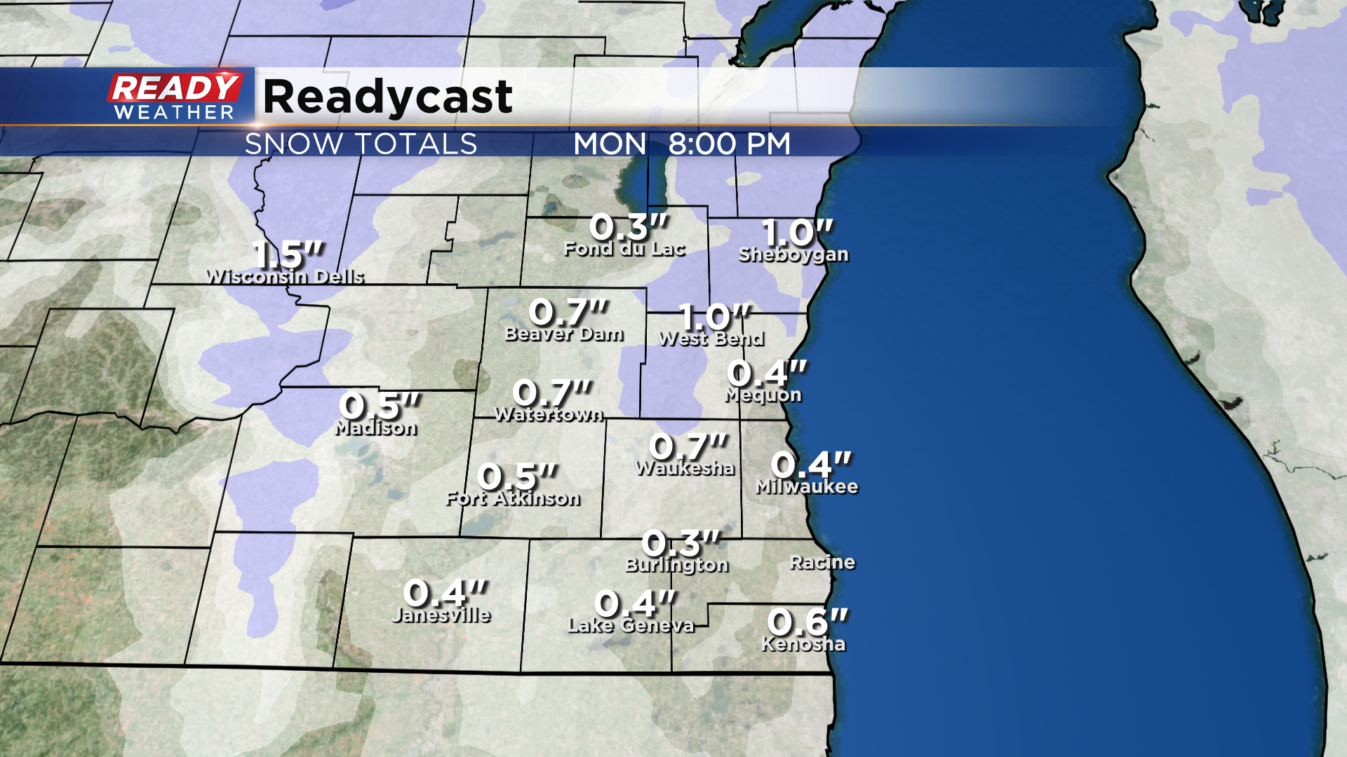
Dry weather is expected throughout Easter Sunday, but that'll change Sunday night as an area of wet snow pushes into southeast Wisconsin. This will continue into the Monday morning commute and could lead to lower visibility and wet/slushy roads.
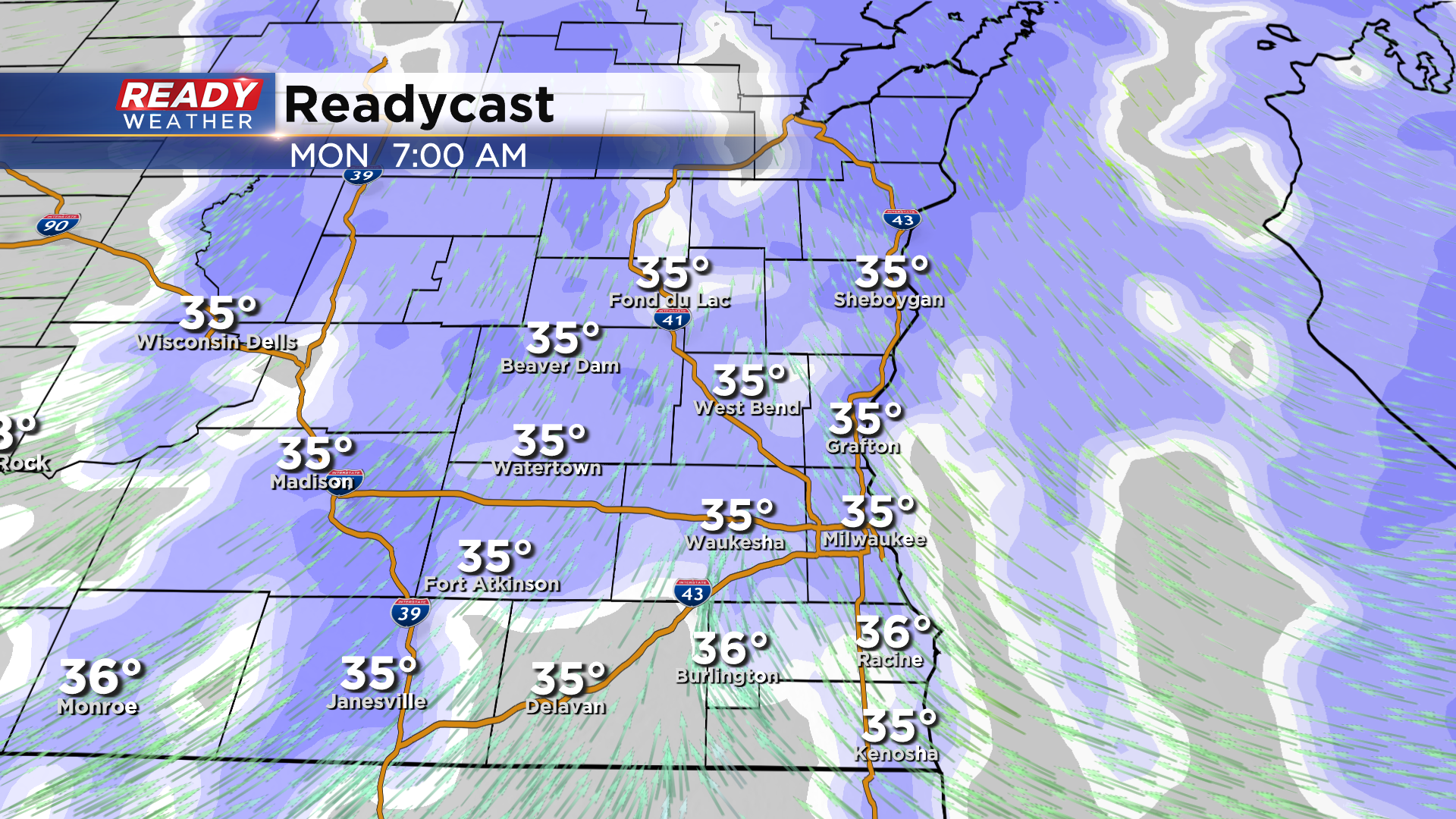
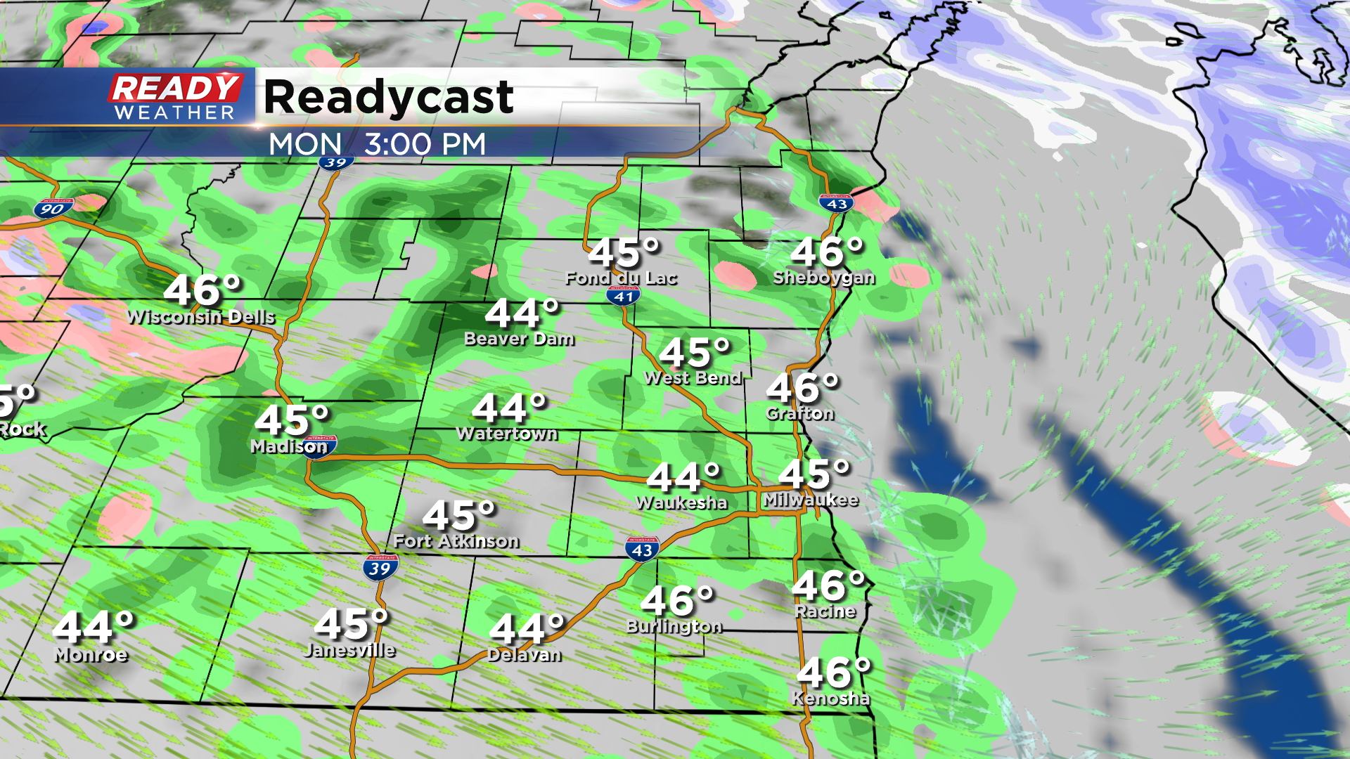
Temps will warm well above freezing during the day Monday, changing that early morning snow over to rain showers.
Since the ground isn't frozen anymore and air temps will be near or slightly above freezing while it's snowing, any accumulation will be on the grass. A coating of wet snow is possible before it changes over to rain.
Any snow will melt during the afternoon or by Tuesday as temps start going on a warming trend. By the end of the week, temps will be in the upper 50s to low 60s.
Download the CBS 58 Ready Weather App to see how warm we'll be by next weekend.