


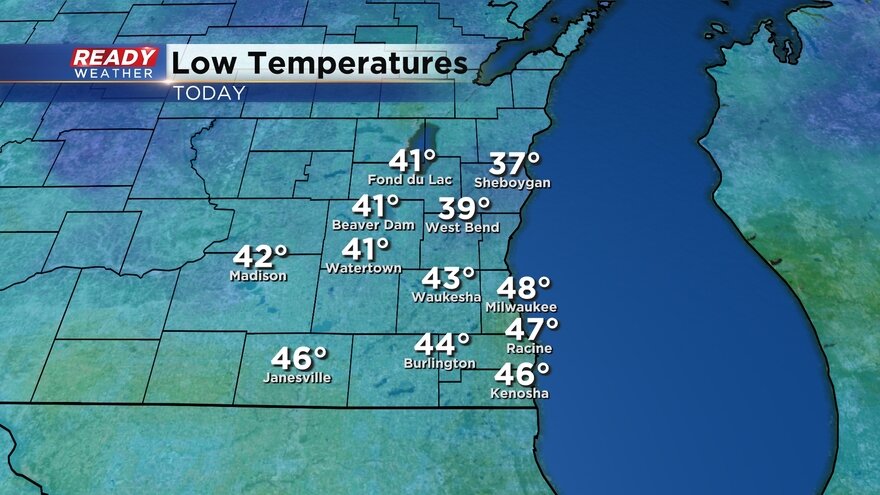
Our well advertised blast of cold air has arrived. The cold pushed in Monday night with lows reaching the teens to around 20° Tuesday morning.
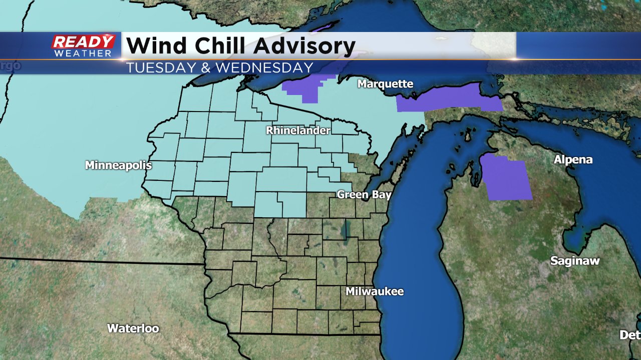
Temperatures stay cold all day Tuesday and Wednesday isn't much different. Wind chill values hang out in the single digits most of Tuesday with low wind chills Wednesday morning reaching -10°.

The cold is going to be worse to our north where wind chill advisories have been issued for northern Wisconsin and Minnesota. The wind chill there could get as cold as -20° to -30°.
The good news for you warm weather lovers is the cold blast is brief. By the end of the week temperatures rebound back above-average with 40° looking more likely for Friday.

We may cool back down into the upper 20s for the start of next week but for the most part temps are looking close to average for the third week of December. The Climate Prediction Center has put southeast Wisconsin in a 40% chance for above-average temps for the week leading up to Christmas. Average that time of year is around freezing so expect temps mainly in the middle 30s for highs.

Download the CBS 58 Ready Weather App to get an early look at the holiday week with the 10-day forecast.