


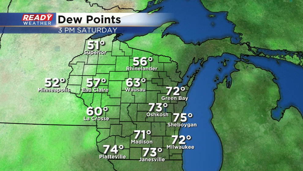
It's been another hot and sticky day across southeast Wisconsin with dew points in the low to mid 70s and temps in the mid top upper 80s. However, relief from the humidity is in sight! Dew points have dropped into the 50s and 60s across the NW half of the state behind a cold front.
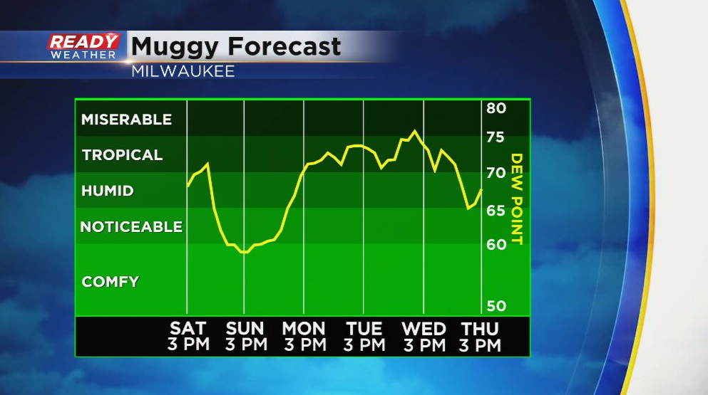
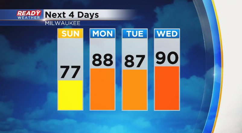
While the cold front moves through by early evening, the drop in humidity won't reach the Milwaukee Metro until closer to midnight. Humidity will be at comfortable levels throughout the day on Sunday, so get outside and take advantage of it because humidity moves back in on Monday and will be with us for a majority of the upcoming week.
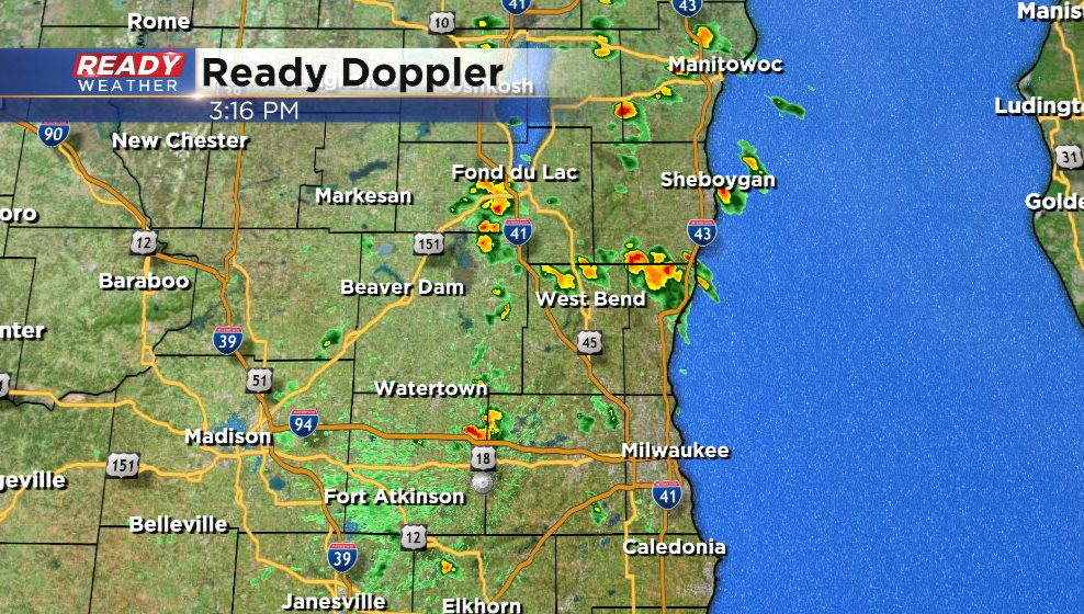
Before the cold front arrives this evening, we'll continue to see spotty pop up downpours with isolated thunder. Most of these have been concentrated along and north of I-94 so far this afternoon, but areas south of I-94 can expect a few of these through 8 pm.
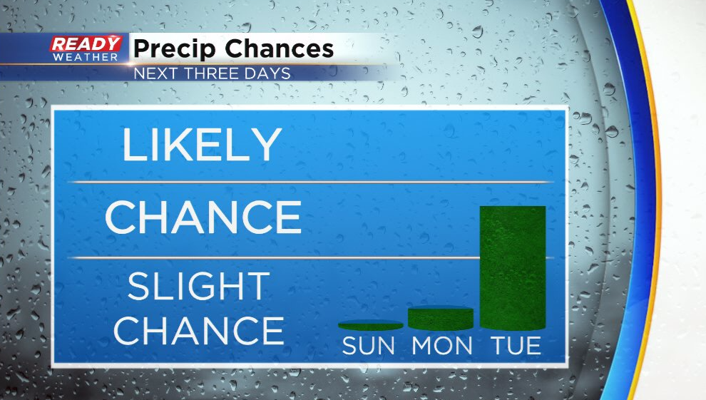
We'll see a break from the rain on Sunday, and most of the area will likely be dry on Monday. There just a small chance a dying shower sneaks into the area during the morning. A better chance for scattered showers and storms arrives on Tuesday.
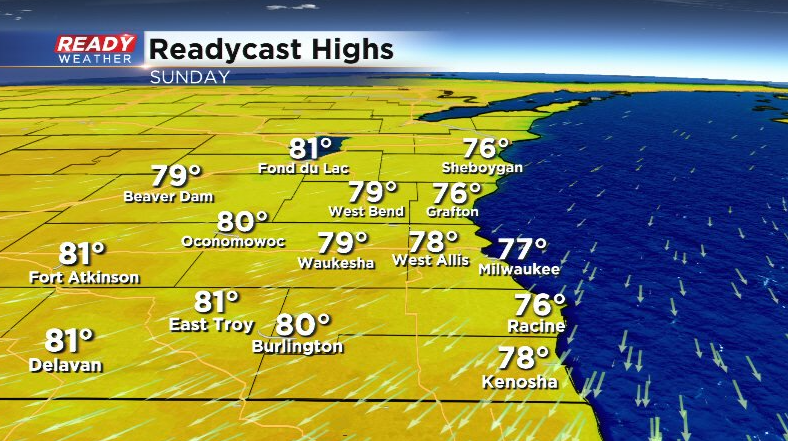
A north to northeast breeze will keep temps in check on Sunday with highs in the mid to upper 70s lakeside and a few 80s well inland.
Not only will the humidity return on Monday, but so will the heat. Temps will likely be in the mid to upper 80s through the first half of the week with some spots making a run at 90. Factor in the humidity and it'll feel more like the mid to upper 90s at times.
Our weather pattern will remain active through the second half of next week as well. Download the CBS 58 Ready Weather App to track any storms over the next week.