Below normal temps expected the rest of the week behind a series of cold fronts
A cold front pushed through southeast Wisconsin early this morning, and behind it is a batch of clouds producing a few stray flurries.
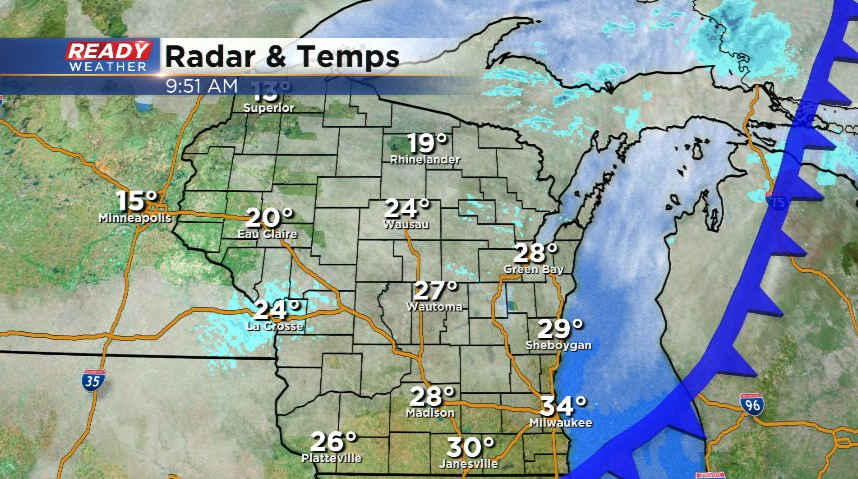
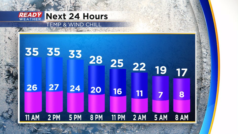
Winds have also turned a bit gusty behind the front and will continue to gust between 20-25 mph through sunset. While the wind dies down tonight, it'll still be around 5-10 mph. With temps falling into the teens, but it'll feel more like the single digits by Thursday morning once you factor in the wind.
Today's cold front looks to stall across the Ohio Valley and southern Illinois on Thursday, which will help keep most of the accumulating snow to our south Thursday night.
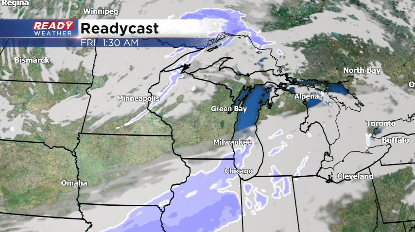
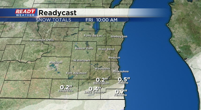
That being said, some light snow may clip far southeast Wisconsin. No more than a dusting is expected for folks south of I-94, but Kenosha may pick up a half inch or so before sunrise Friday.
A reinforcing cold front will move through during the day on Friday, which may trigger a few more flurries. That front will really bring in some unseasonably cold air to start the weekend with highs only in the 20s.
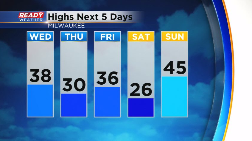
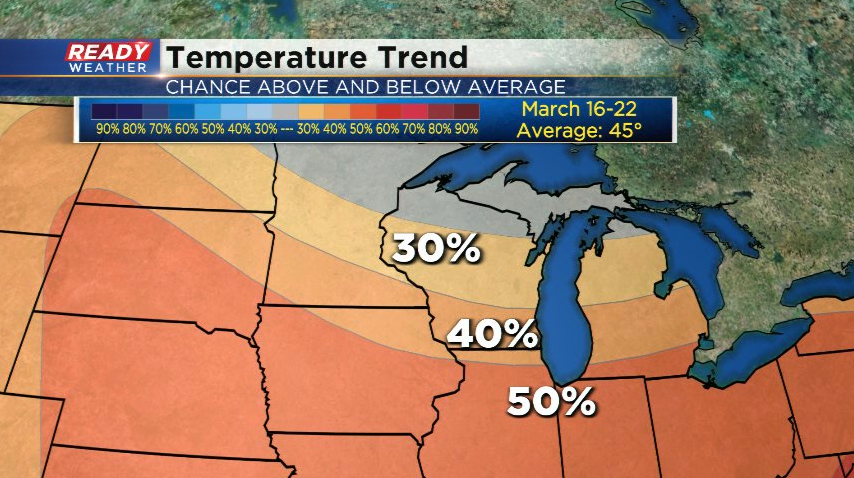
Thankfully this will be a short lived cold snap as temps rebound into the 40s on Sunday and continue to warm into next week. In fact, temps are favored to rise above normal around St. Patrick's Day and into next weekend! Normal highs by then are around 45°.
Download the CBS 58 Ready Weather App to track the small snow chance.
