Morning Update: Snow reports coming in as snow continues to fall
Updated: 8:31 a.m. Apr. 17. 2023
Snow is still flying across all of southeast Wisconsin. A number of crashes have happened with slick roadways reported especially on bridges and overpasses. The bulk of the accumulating snow is close to being over but light snow showers likely continue the rest of the day with 6 PM a good ending time.
Here's a radar image that will update with time:
Our first round of snow reports is in with a dusting to a few tenths of an inch reported in most communities but a few areas have picked up an inch or two of snow.
------
Updated: 4:54 a.m. Apr. 17, 2023
Snow has been falling most of the overnight hours but so far has been fairly light and off and on. Expect some ice on your windshield if you left your car outside overnight with the rain from Sunday freezing. A band of heavier snow is moving in from the west and may bring us our best chance of accumulation through mid-morning Monday. A couple inches of snow is possible in our western counties but probably only a dusting lakeside.
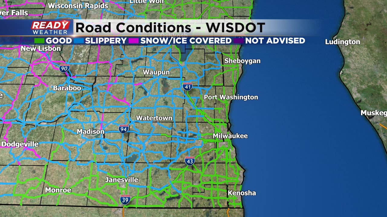
A majority of the snow accumulation will happen on grassy surfaces but some roads could get a bit slushy especially away from the Lake. As we get into the morning commute DOT is reporting just wet roads in lakeside counties but more slipper stretches the farther west you get.
Any snow that does accumulate on Monday melts quickly with sunshine and highs in the 50s returning as early as Tuesday.
------
Posted: 8:23 p.m. Apr. 16, 2023
After off and on rain showers most of Sunday, colder air is pushing into southeast Wisconsin and changing the rain over to snow. The changeover has occurred in counties west of Milwaukee as of 8:30pm and will change in lakeshore counties by 10 pm.
Wet snow will continue throughout the night into early Monday morning before becoming more patchy in nature. Snow will taper off mid to late afternoon as this stationary low pressure system finally pushes east.
Thankfully for us in southeast Wisconsin, temperatures have been in the 70s and 80s for the last week, so the ground is pretty warm. This should limit accumulation to grassy surfaces with mainly wet roads. Overall we're not expecting much snow, perhaps a couple of inches well west of the lake, but only a coating on the grass lakeside.
We're getting very lucky in southeast Wisconsin because the western part of the state will pick up 8-14" of snow from this system.
This is where Winter Storm Warnings have been issued. There are currently no winter weather alerts for southeast Wisconsin.
In addition to the snow, wind will be gusting between 30-40 mph on Monday. That combined with lower visibility from the snow will be the two biggest concerns during the morning commute. With relatively warm ground temperatures, we're expected the snow to melt on the roads, but can't rule out slushy spots on inland rural roads.
Always good to check the 511wi.gov websites for updated road conditions before you travel. We'll dry out on Tuesday, but rain chances return nearly every day for the rest of the week. Download the CBS 58 Ready Weather App to keep tabs on the snow.


