Arctic cold front dropping temps into the teens for the weekend


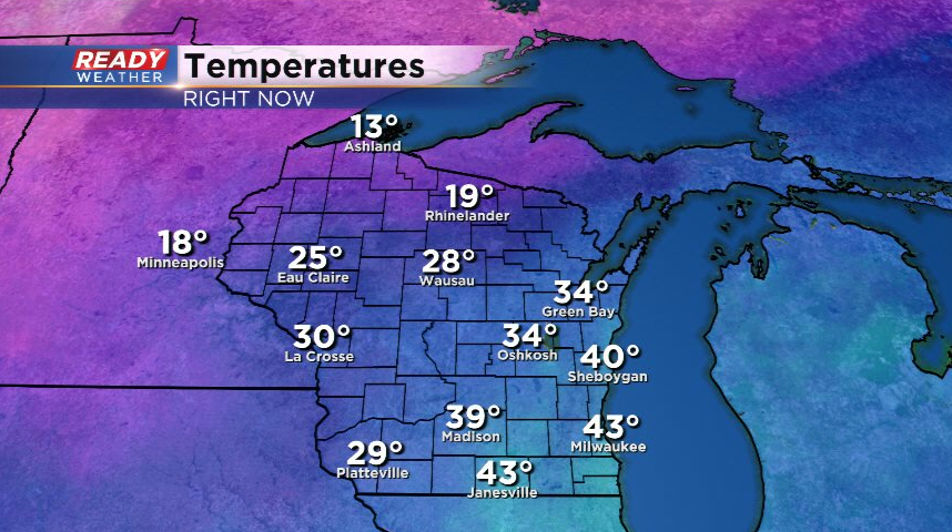
It's been a mild day across southeast Wisconsin with temps currently in the upper 30s to low 40s. However an arctic cold front is pushing through the state with teens and 20s not far away!
The cold front is triggering a batch of rain/snow/sleet showers that will push through southeast Wisconsin into early evening. Lower visibility and up to a half inch of snow is possible in spots, but roads will initially be wet as these push through thanks to our warmer temps.
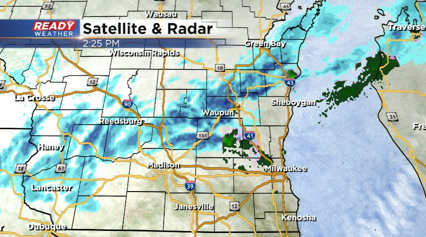
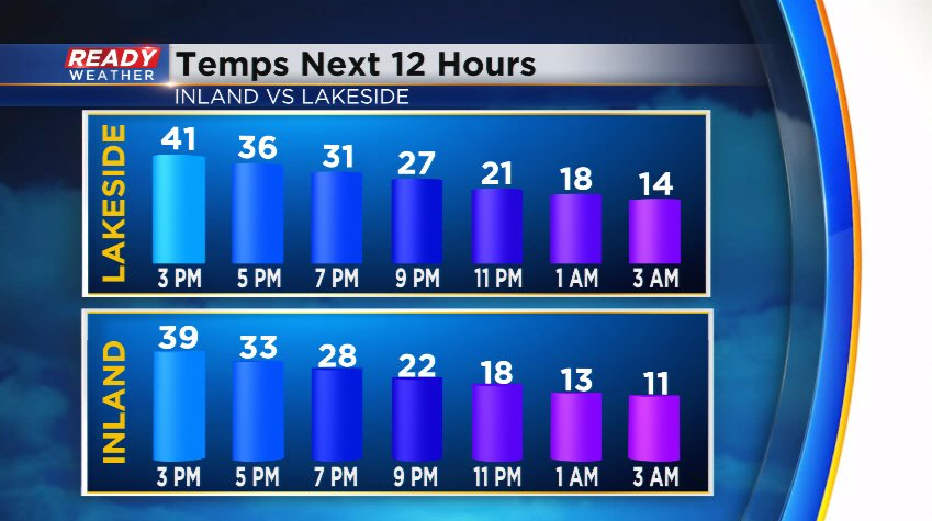
However, temps will plummet into the teens and 20s behind the front this evening which may cause a flash freeze, turning wet roads icy. Travel with caution later tonight!
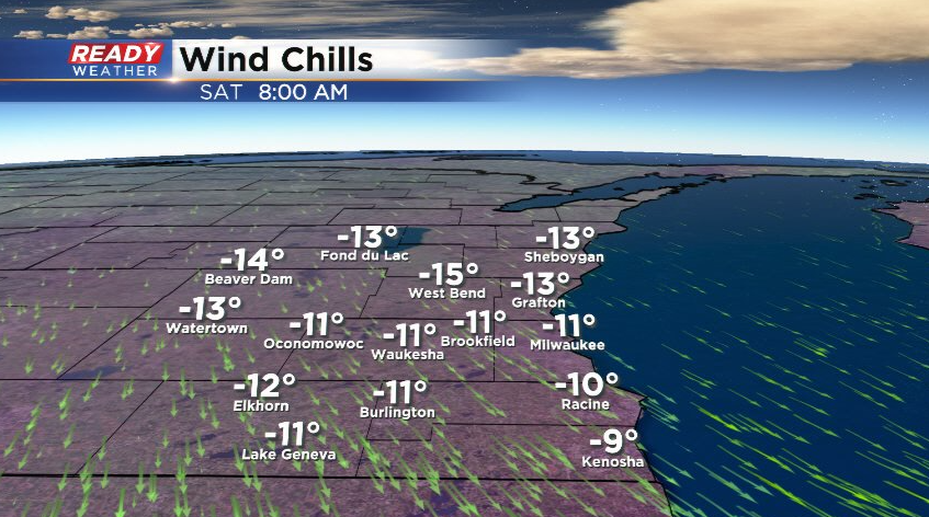
By Saturday morning, actual air temperatures will be in the single digits to around 10°, feeling more like -10° to -15° once you factor in the wind.
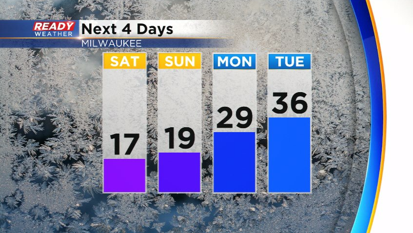
Chilly weather sticks around all weekend, but we'll be mainly dry besides a stray flurry or two on Sunday. After spending the weekend in the teens, temps rebound back above freezing by Tuesday and will be even warmer by the middle of the week.
Download the CBS 58 Ready Weather App to track the fluctuating temperatures.