


We saw another round of wet weather Sunday evening through Monday morning. Most of the precipitation stayed just rain with only a little slushy snow around Fond du Lac, Sheboygan, West Bend and Port Washington. As of 7 AM the bulk of the rain and mix has wrapped up with just some lingering isolated showers possible through mid-morning. Another soaking 0.25-0.50" of rain fell in southeast Wisconsin.

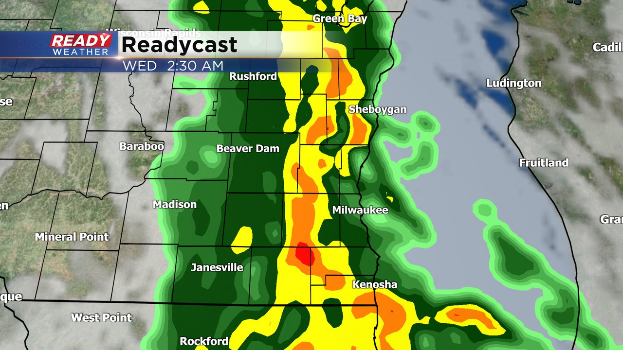
The majority of the rest of Monday and most of Tuesday will stay dry with another round of rain looking likely for Tuesday evening into Wednesday morning.
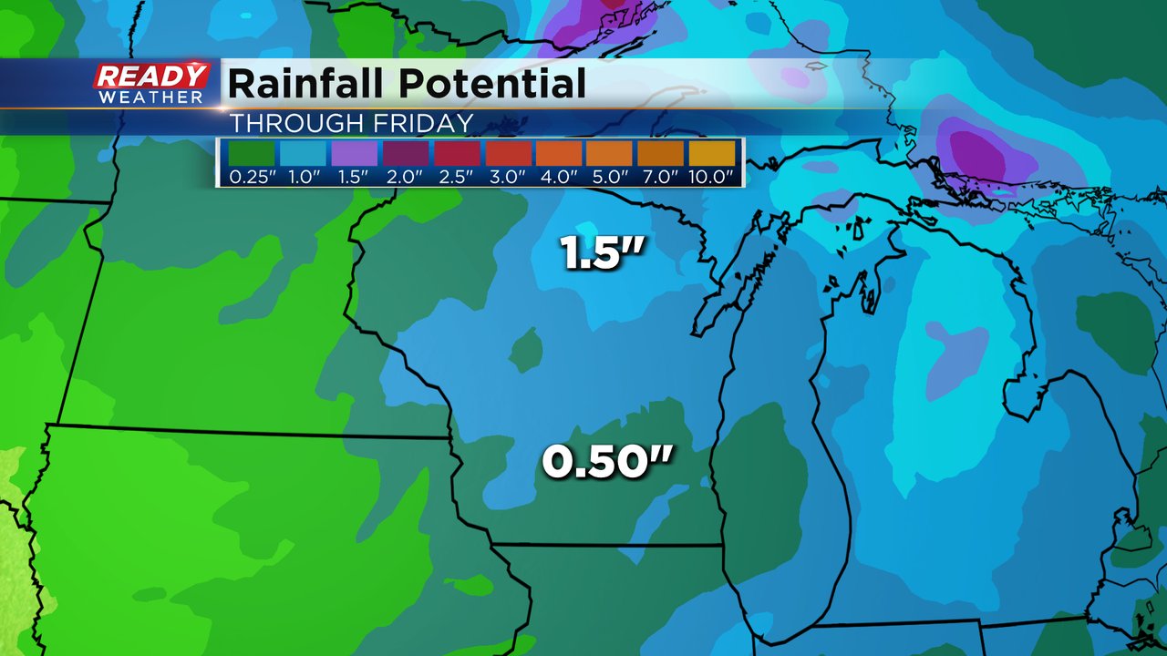
At least part of every day this week has a chance for either rain or mix. After drying out for midday Wednesday another round of rain looks likely Wednesday evening into Thursday morning then lingering through Thursday when it mixes with some snow. Light and scattered mix showers will still be possible Friday before we dry out for the weekend. By the end of the work week we could see an additional 0.50-1.50" of rain throughout the state continuing our soggy stretch of weather.
Download the CBS 58 Ready Weather app to track the wet weather.