Another round of rain tonight before some accumulating snow Monday night


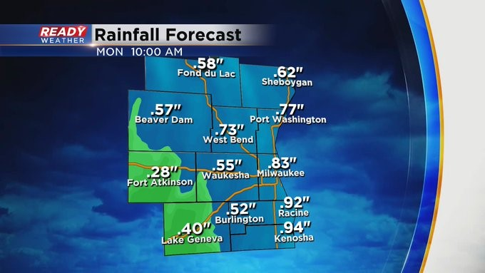
After a break during most of the day today, another round of moderate rain is on the way for tonight. An additional .50 – 1” of rain is expected with the highest totals near the lake.
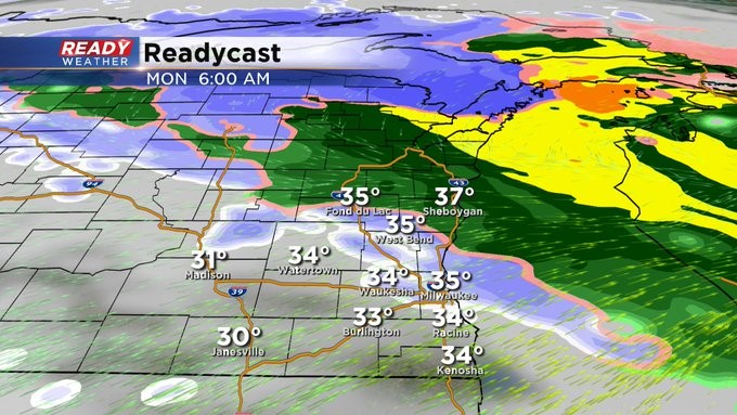
Some wet snow may mix in with the rain between 4-7 a.m., but shouldn’t have too much of an impact on the morning commute besides reduced visibilities and slushy spots on roads.
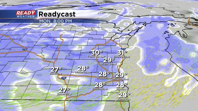
Most of the area will generally see a break from the rain/snow during the day Monday (possibly a short break in Fond du Lac county), but an area of light snow will move back in from the northwest after sunset Monday and continue through Monday night before tapering off Tuesday morning.
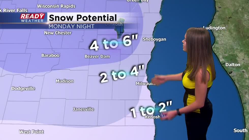
The heaviest snow totals of 4-6 inches will fall around Fond du Lac and western Sheboygan counties where a Winter Weather Advisory will be in effect from Noon Monday through 6 a.m. Tuesday.

1 to 2 inches is expected along the lakeshore, and 2 to 4 inches is expected inland. Expect slippery and snow covered roads Monday evening into the Tuesday morning commute. The accumulating snow should come to an end around 7 a.m. Tuesday.