


It's been a beautiful, but chilly end to the weekend with abundant sunshine and temps in the mid 30s to low 40s. The gusty wind has made it feel like the 20s most of the day, but the wind will calm down tonight. Clouds will increase overnight ahead of another quick moving low pressure system. After a dry start to the day, a band of wet snow is expected to push into the area between 9-11 am.
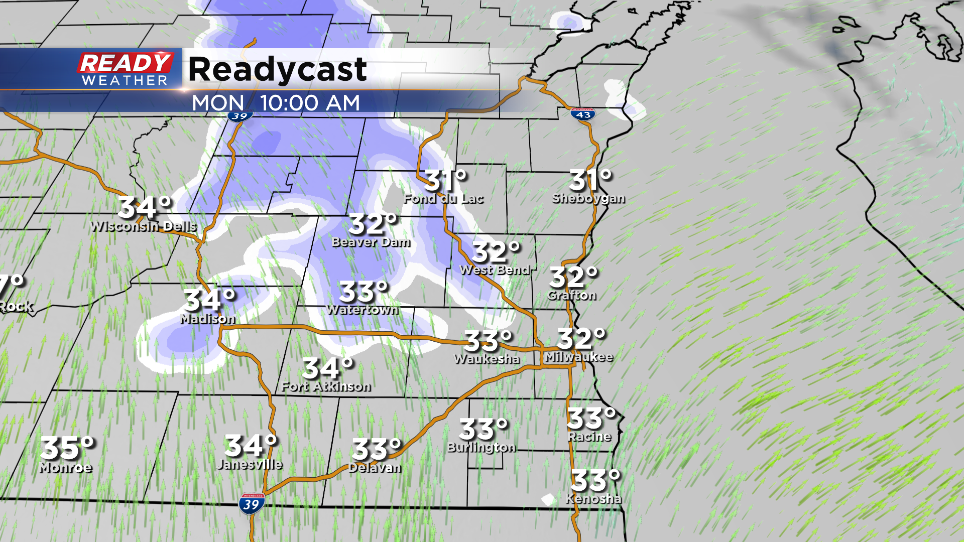
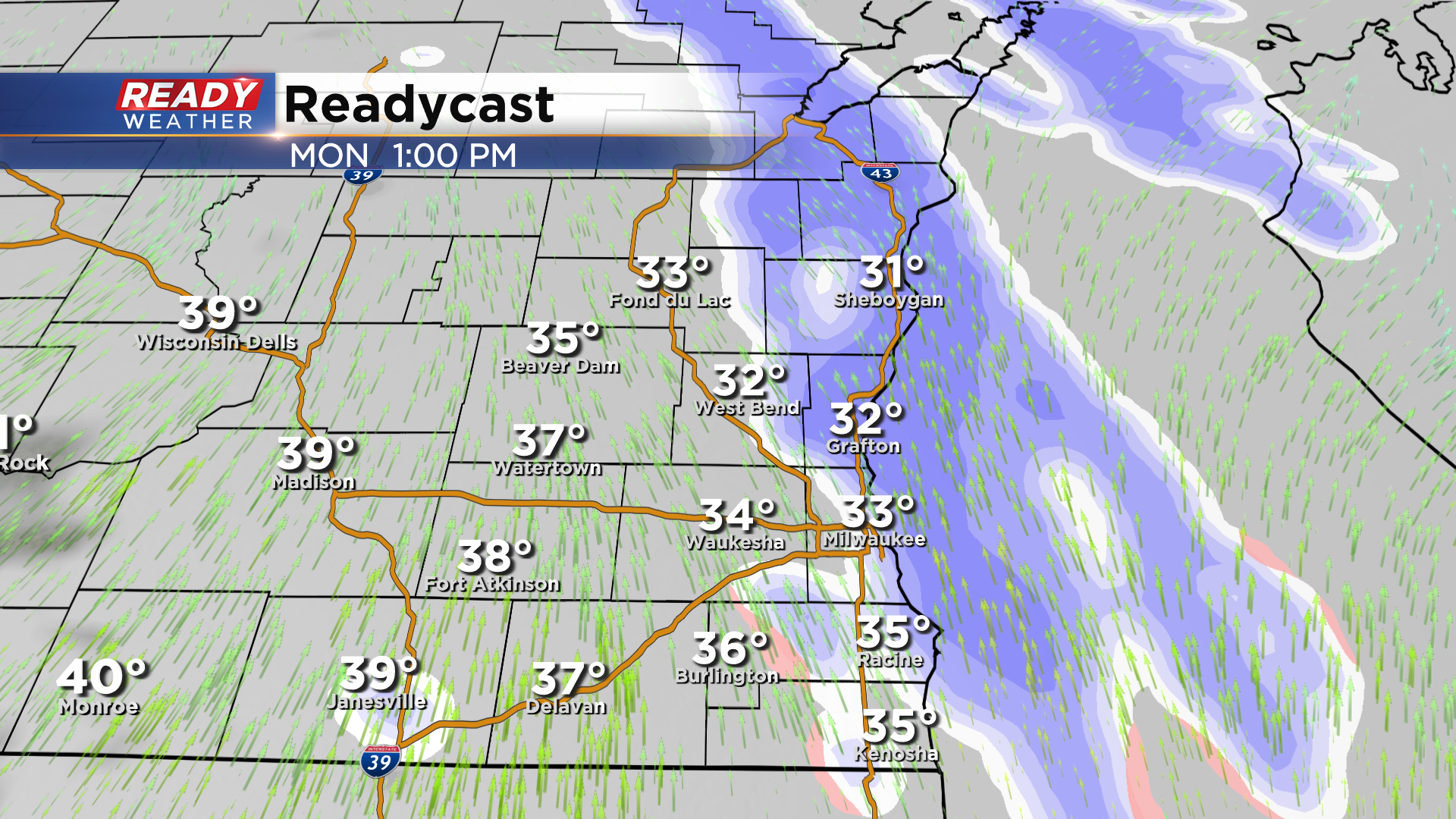
This will be a quick moving band of snow that looks to exit between 1-2 pm. Some rain may mix in closer to the WI/IL border.
Temperatures will be in the mid 30s as the snow moves through, which will limit accumulation to a dusting for folks NW of Milwaukee and a couple tenths of an inch near Fond du Lac and Sheboygan. Accumulation will primarily be on the grass.
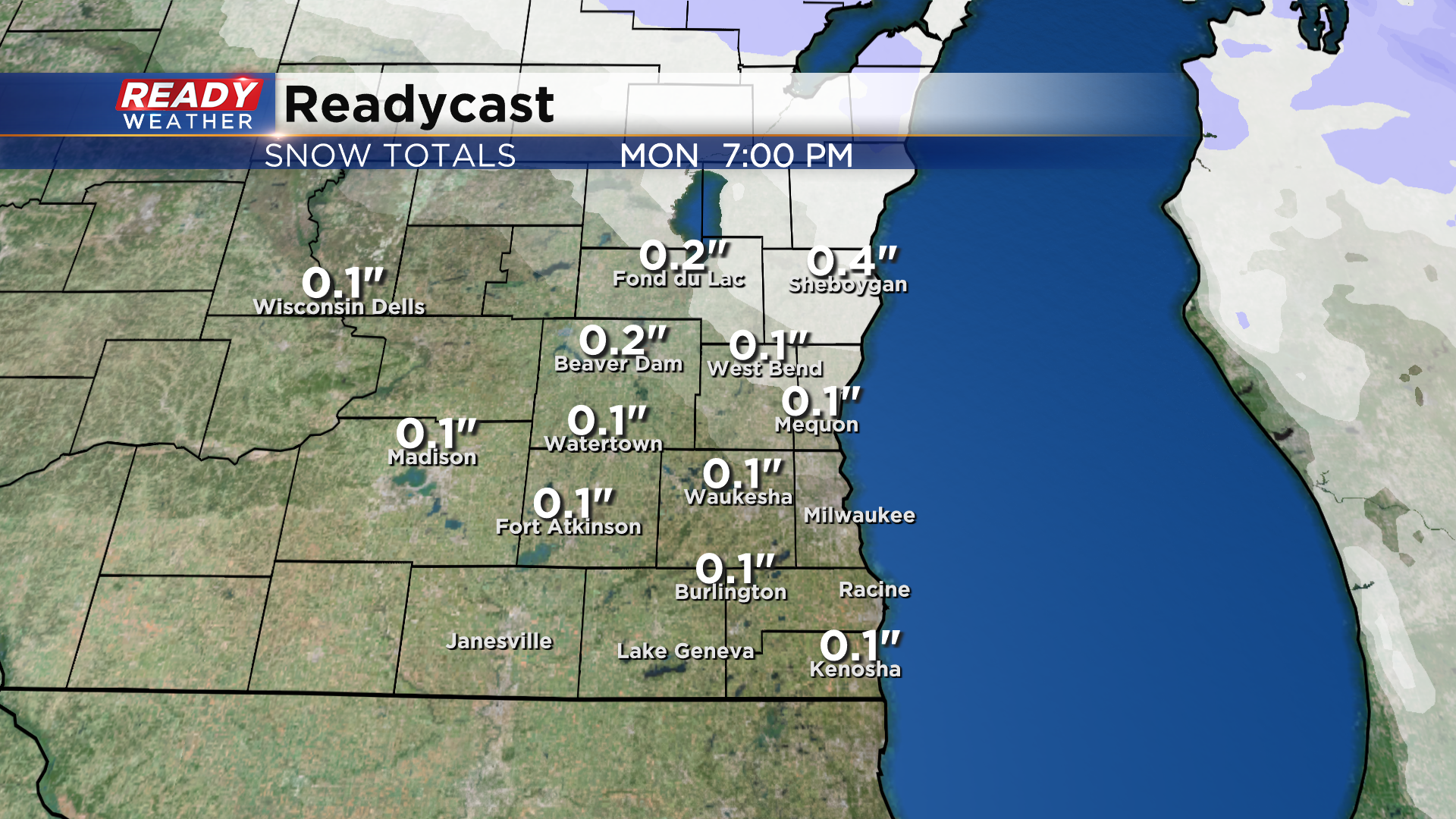
Biggest impact will be reduced visibility with roads primarily wet. There could be some slushy spots on roads in far northern areas away from the lake, but with temps continuing to warm it should melt pretty quickly.
Depending on if we see some sunshine, temps could warm close to 40 Monday afternoon. Mid to even upper 40s are then expected for the middle of the work week.
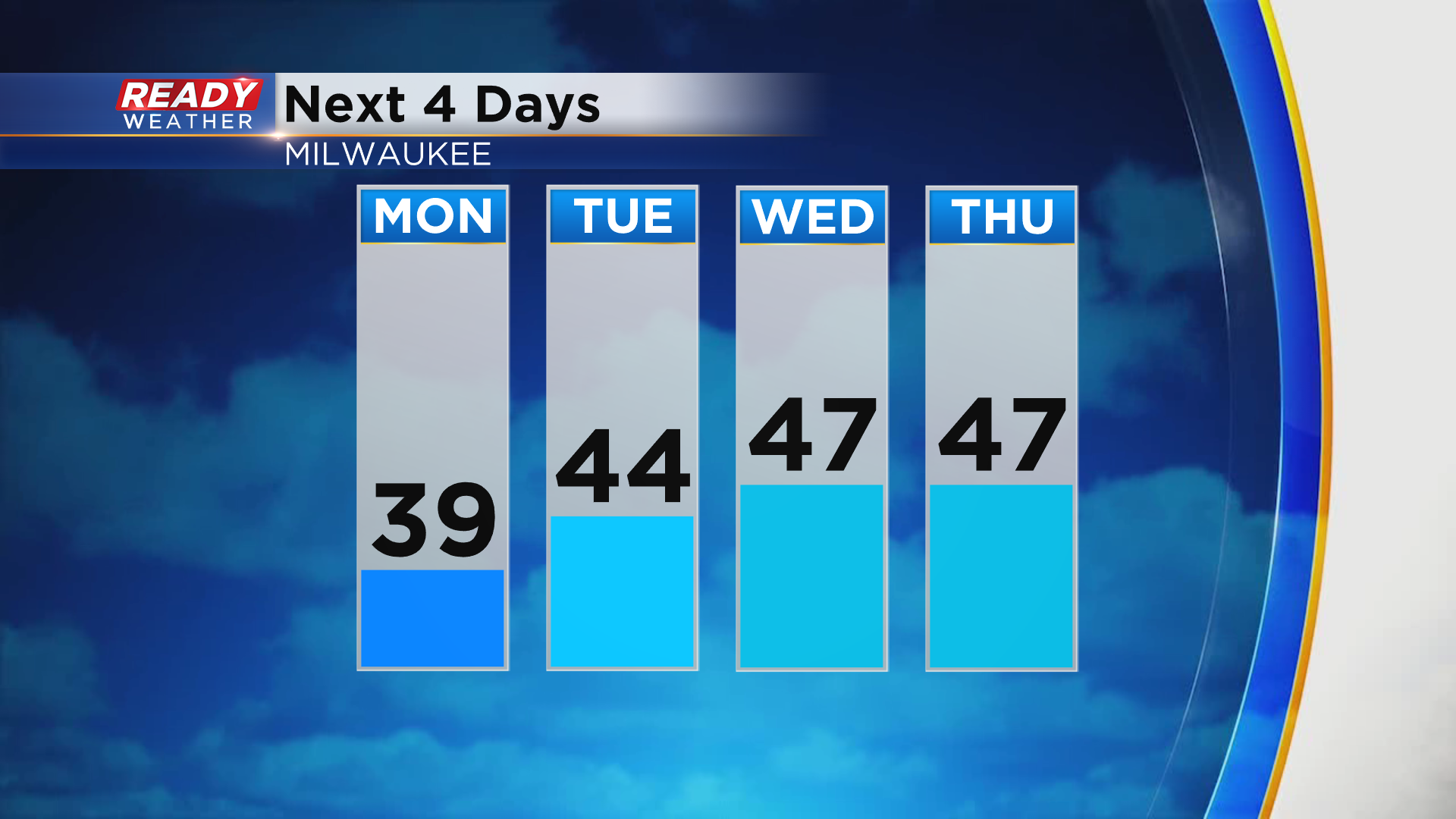
Another chance for rain and snow showers arrives on Wednesday. Download the CBS 58 Ready Weather App to track the Monday snow showers.