A touch of light snow possible near Illinois border Thursday evening


A larger storm system moving across the central US has continued to trend farther and farther south. Winter storm warnings and winter weather advisories have been posted across some of the Plains states where they could see 2-8" of snow.
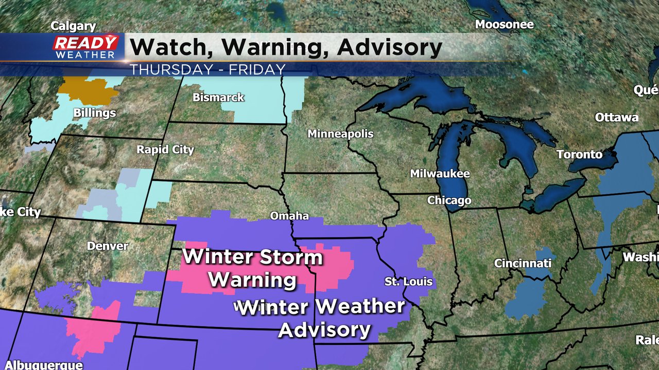
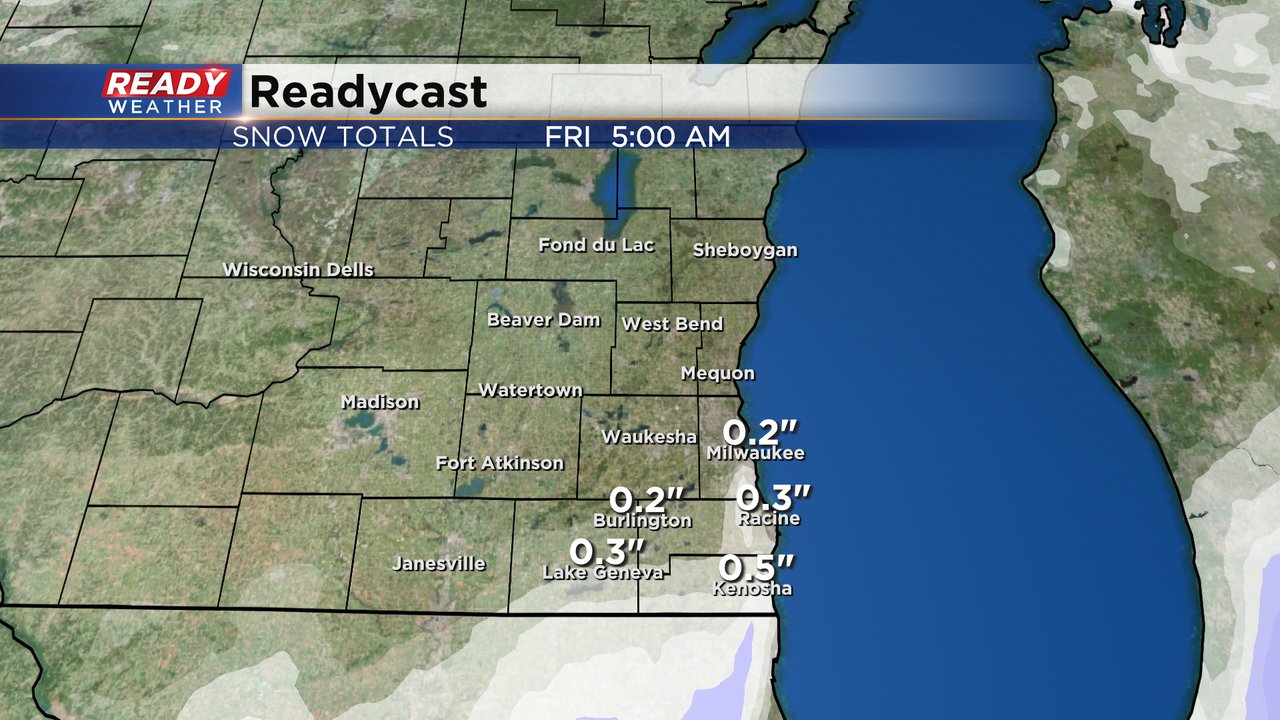
Chicagoland could get a fresh 1-3" but most of southeast Wisconsin will miss out. Any snow that does fall locally won't arrive until Thursday evening lingering through just after midnight. No concerns are expected for the Thursday evening or Friday morning commutes. Walworth, Racine, Kenosha and southern Milwaukee Counties are the only areas that could get some snow.
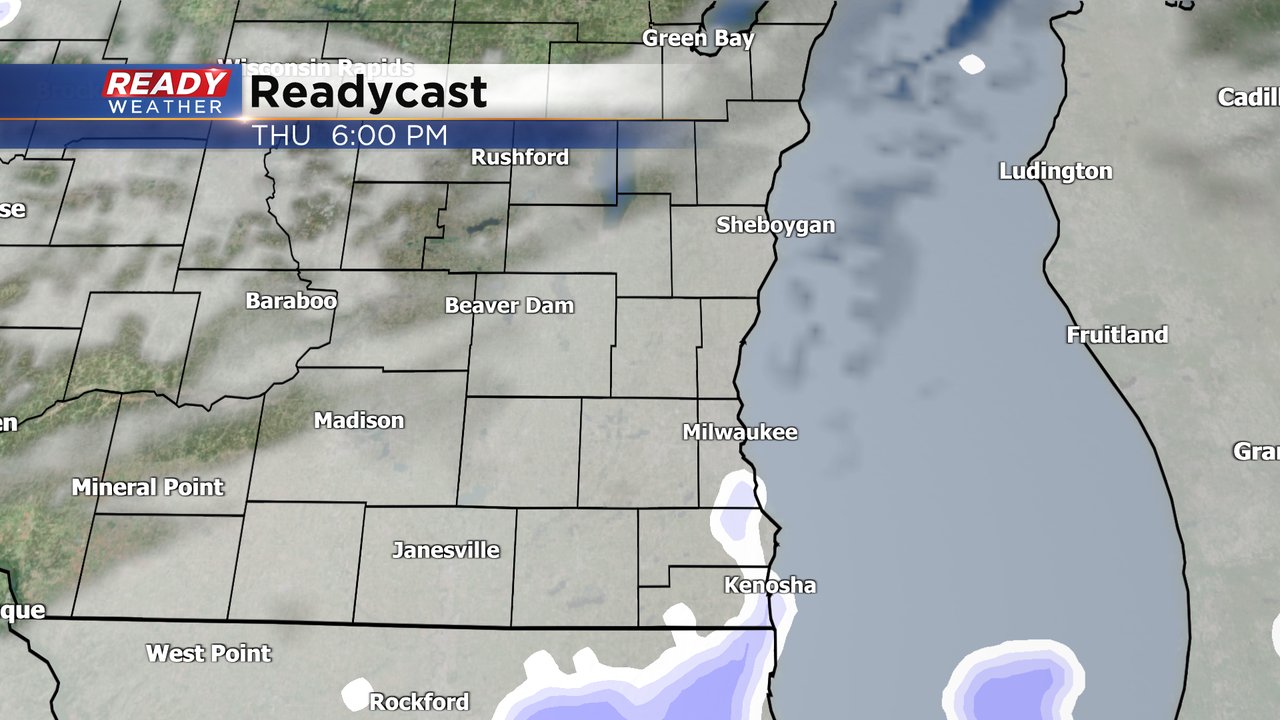
Any snow that does fall in these communities won't amount to much with a dusting or few tenths of an inch possible.
A few flurries may also be possible during the day on Friday that could drop a quick dusting as a front pushes across the state.
Download the CBS 58 Ready Weather app to track any snow with the interactive radar.