


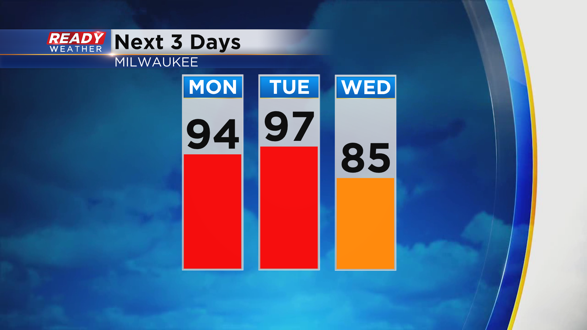
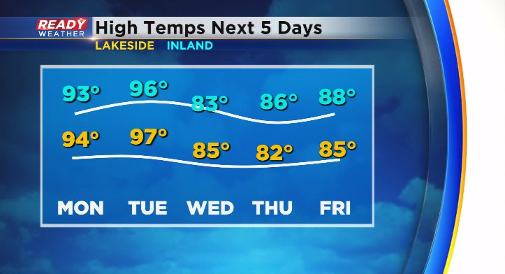
It's been a fantastic Juneteenth/Father's Day across southeast Wisconsin with plenty of sunshine, low humidity, and temps in the 70s to low 80s. Hopefully you took advantage of the lower temps and humidity over the last few days because you'll need the AC as we move into the work week. Highs return to the low to mid 90s on Monday and warm back into the mid to upper 90s on Tuesday!
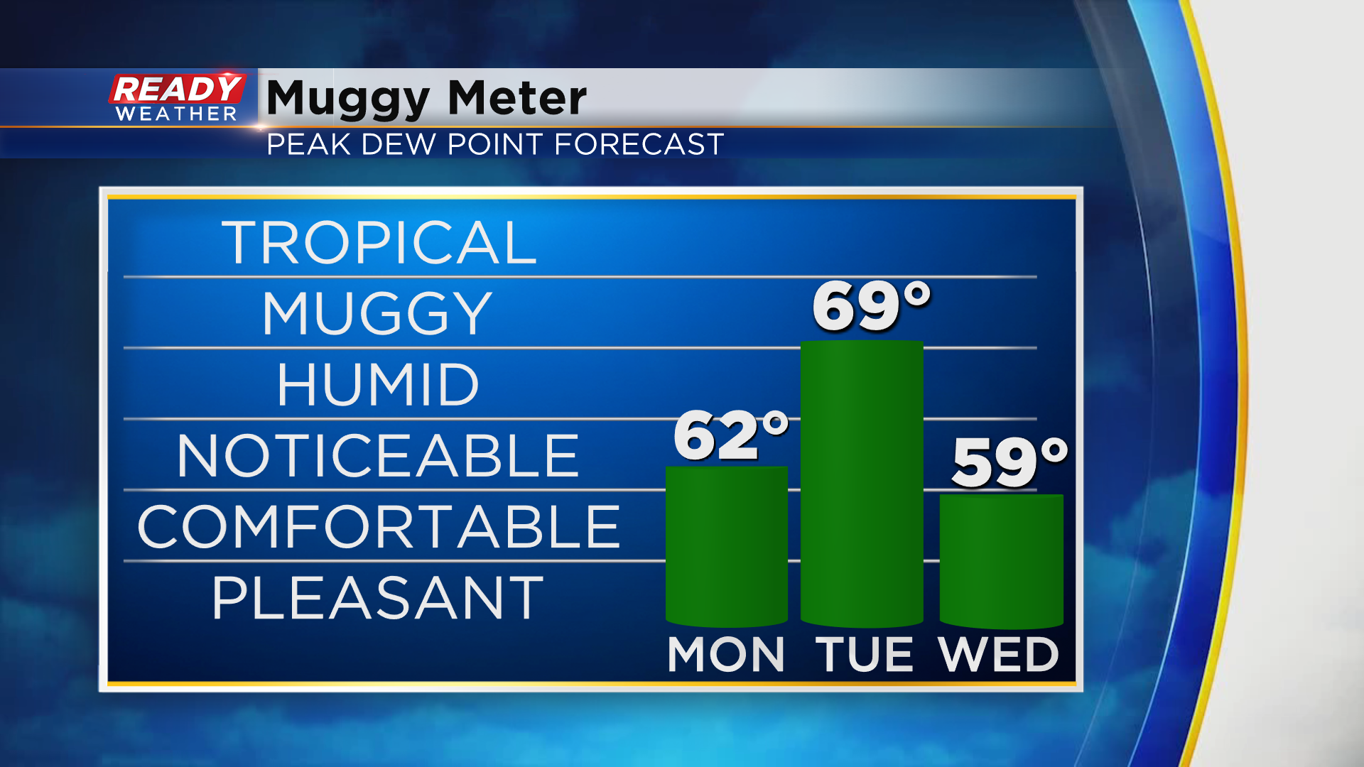
You'll notice the humidity a bit more on Monday, but it won't be too bad. Dew points climb back into the upper 60s to low 70s on Tuesday, making it the most humid day of the week.
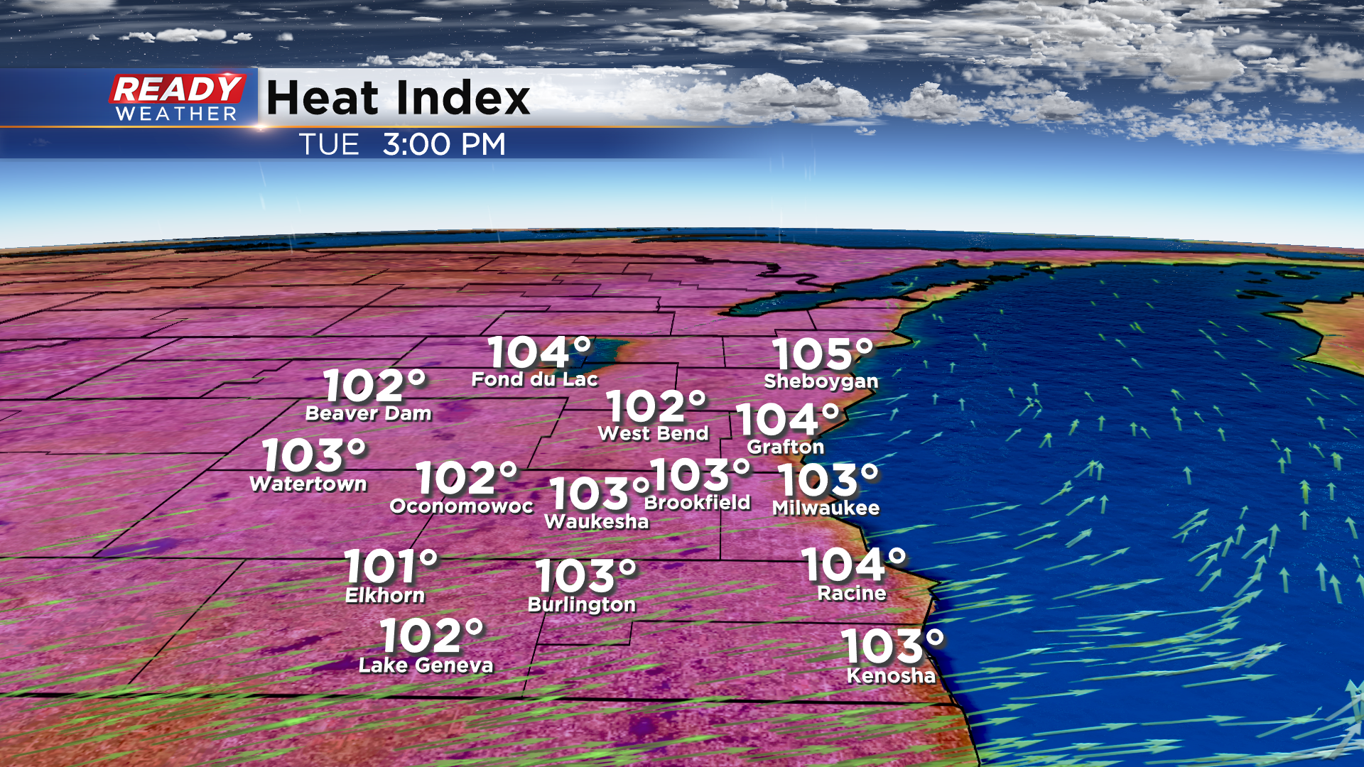
Once you factor in the humidity on Tuesday, it'll likely feel like the 100s area-wide. A Heat Advisory looks likely on Tuesday.
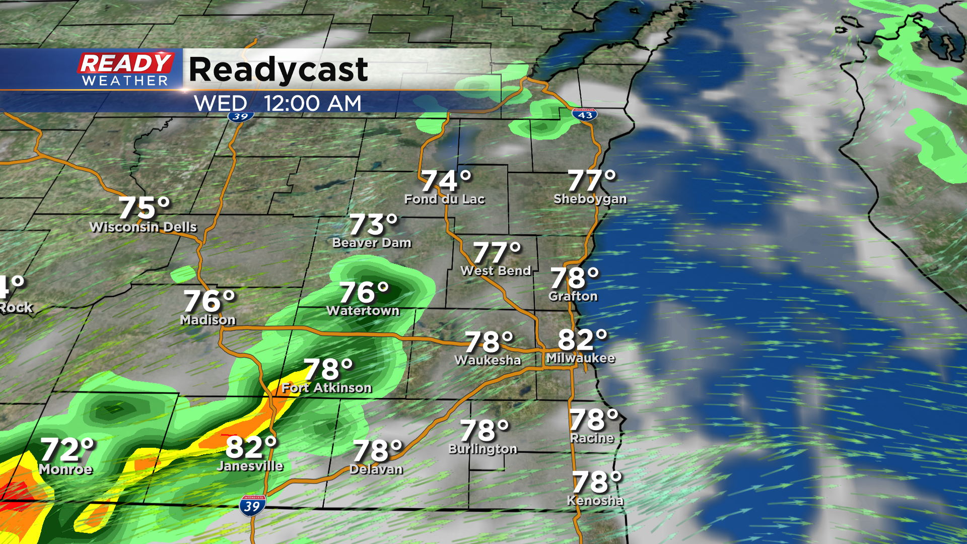
Thankfully the 90s and humidity won't be around for long. A weak cold front moves through Tuesday night and will knock dew points back into the upper 50s on Wednesday. There could be a couple isolated showers or storms along the front Tuesday night, but it currently doesn't look widespread.
Temps will drop into the 80s for the second half of the work week with cooler temps expected lakeside Thursday and Friday thanks to a lake breeze.
Showers and storms return by the end of the week and continue into the weekend. Download the CBS 58 Ready Weather App to get any heat alerts sent to your phone.