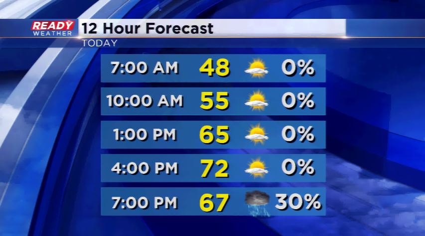
Today will be the warmest day of the year with a mild start in the upper 40s and sunshine. The west to southwest wind will be a big player Monday propelling those temperatures back into the 70s for the first time since early October last year. A cold front passes later today touching off scattered showers or storms around the region.
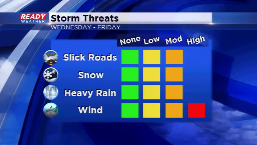
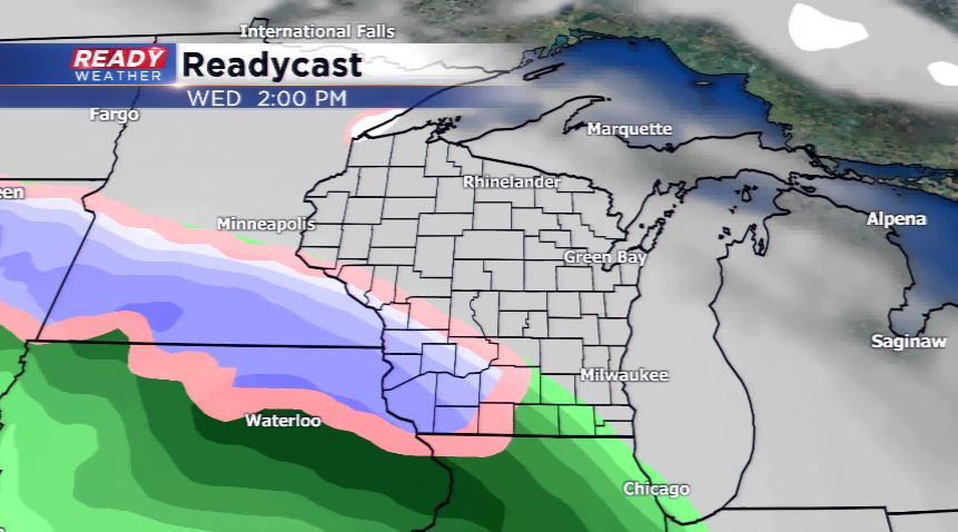
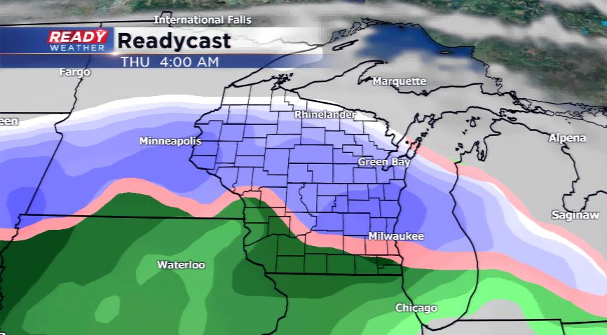
All eyes will be on the middle of the week with a strong storm system which will eventually turn into a major late season winter storm. This storm will bring all forms of weather including thunderstorms, heavy rain, strong winds, and snow. Timing on this system looks to be as early as Wednesday and running into Friday. Initially there will snow, then with warmer temperatures swirling around the low, it will turn to rain. The heaviest snowfall looks to take place from central and northern Wisconsin extending west toward parts of Minnesota and the Dakotas. In those sections blizzard conditions are expected.
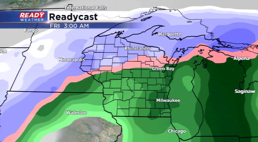
Bottom line, plan ahead for weather-related issues and the likelihood of changing weather conditions. The forecast remains uncertain of who exactly will see the heaviest snowfall and how much, so keep an eye on future updates.