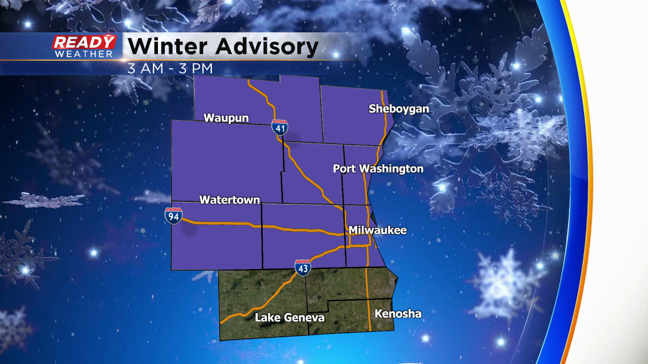
Winter weather advisory issued for parts of the area; snow arrives overnight with accumulation


All is quiet and cold this afternoon across southeastern Wisconsin. More clouds will roll in later tonight ahead of our next clipper system. This next snow maker won't be as wet as the last one; however, we are expecting accumulation and some slick roads during the morning commute.
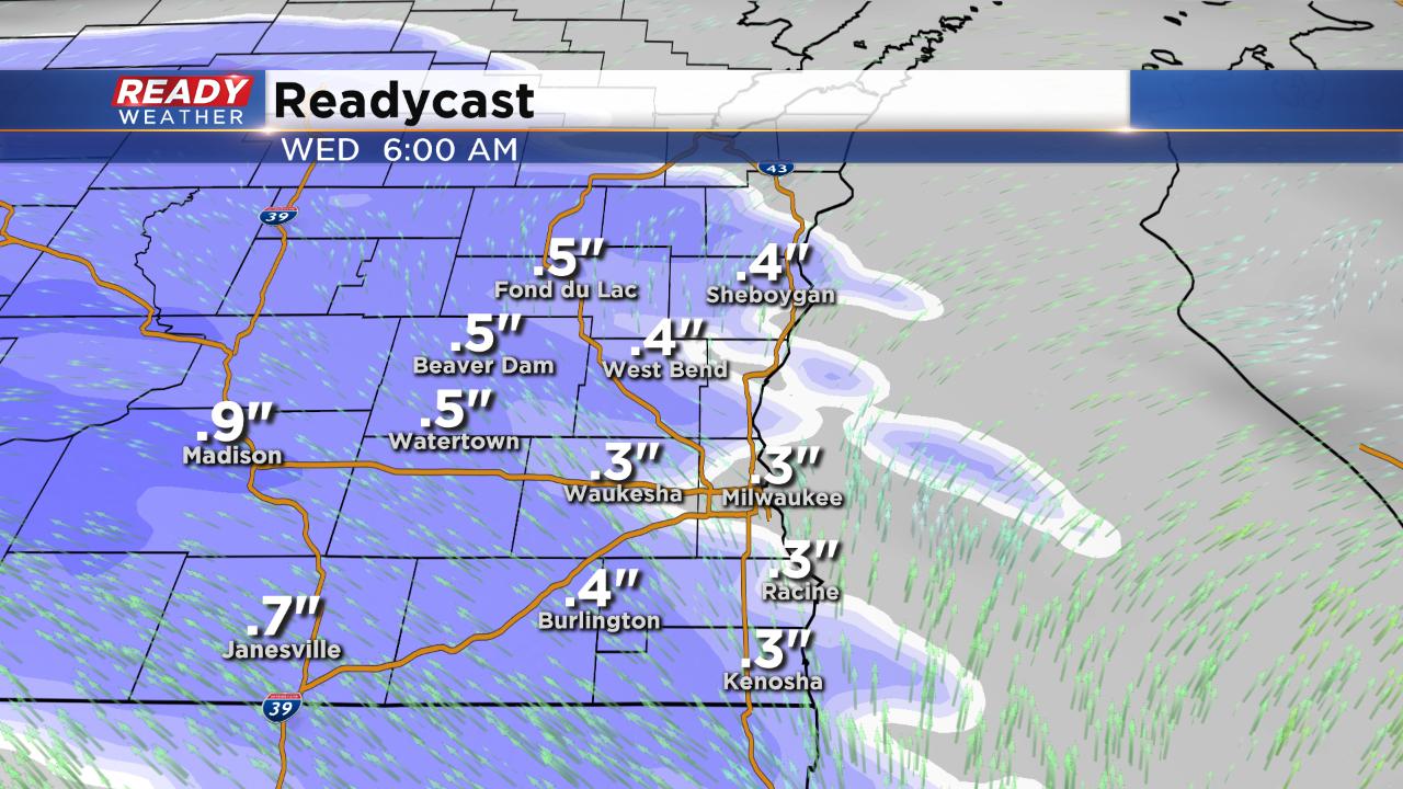
Snow looks to begin between 3 AM and 5 AM from west to east. Temperatures might drop a few degrees with evaporative cooling with the onset of snow, so slick roads are possible once the snow starts to fall more consistently.
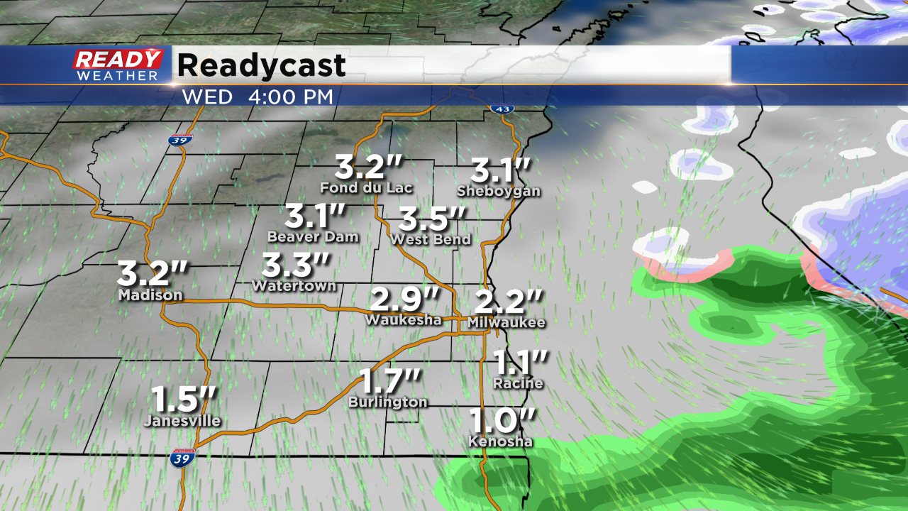
Snow is expected to linger through the morning and early afternoon. Most areas within the advisory will pick up 2" to 4" of snow with slightly lower totals across our southern counties. .
Watch out for some slick morning travel. We should have improvement through the afternoon with a better evening commute expected. If snow lingers during the late afternoon that could create some issues. That will need to be watched.