


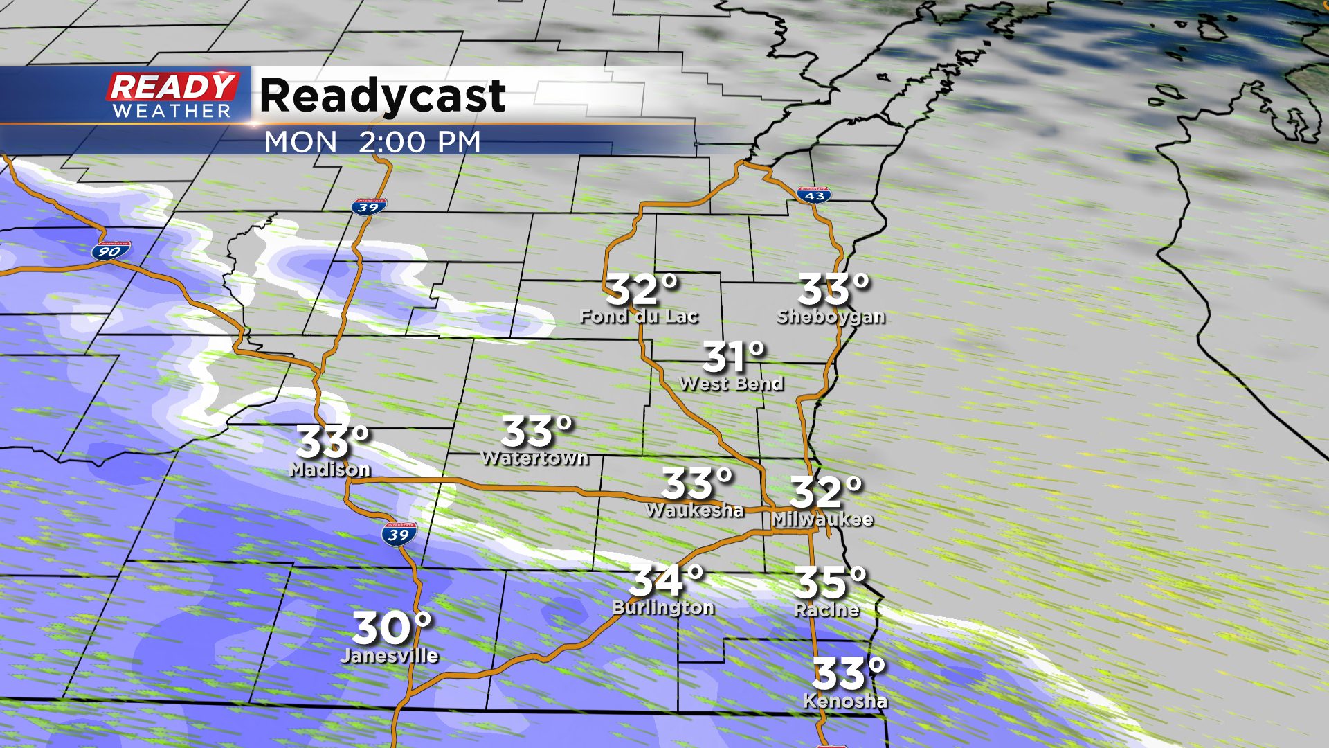
It's been a chilly and blustery day with filtered sunshine across southeast Wisconsin. Thin clouds will continue to stream into the state tonight ahead of a low pressure system that'll bring us our first batch of measurable precipitation in 3 weeks. Clouds thicken up Monday morning, but with very dry air in place we're expected dry conditions through midday. A band of wet snow will then move in from southwest to northeast during the afternoon.
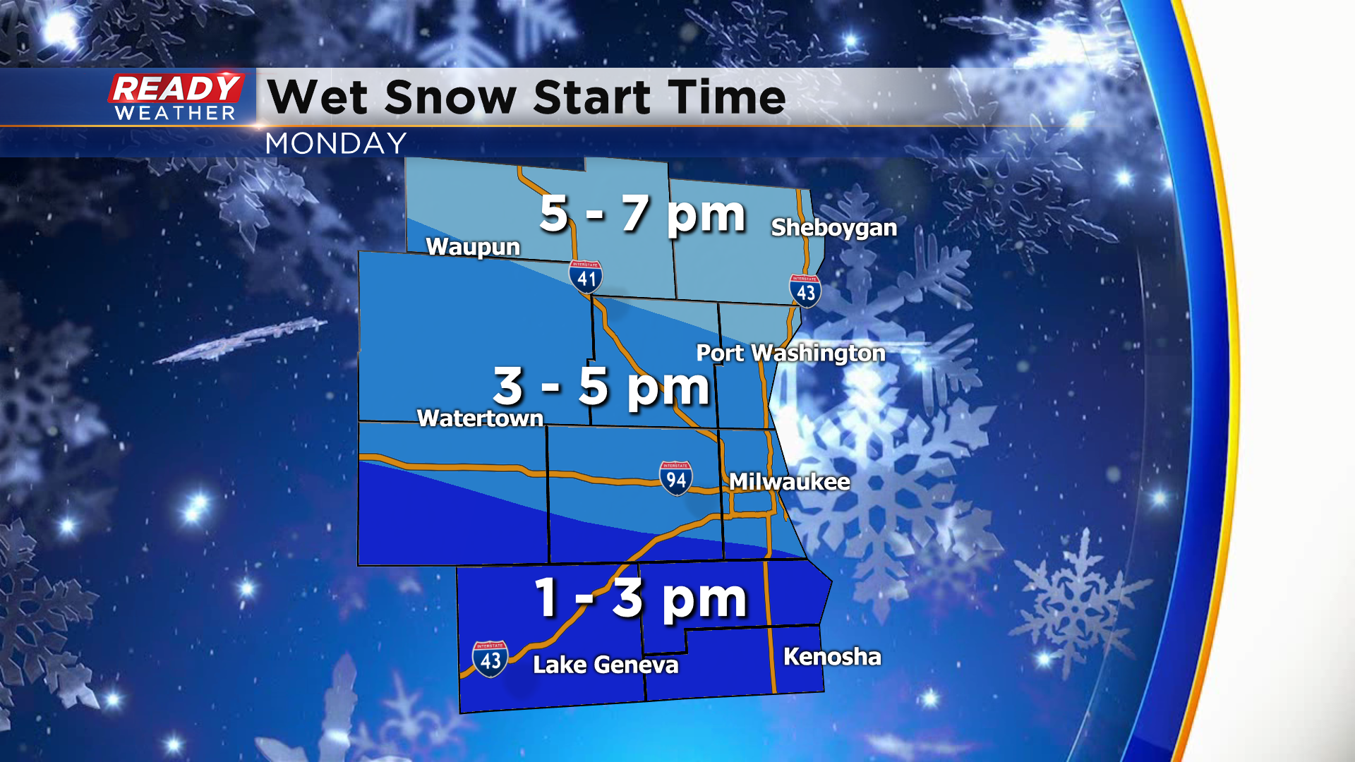
Snow overcomes the dry air between 1-3 pm in spots like Racine, Kenosha, and Lake Geneva, between 3-5 pm in Milwaukee, Waukesha, and West Bend, and will reach the Sheboygan area between 5-7pm.
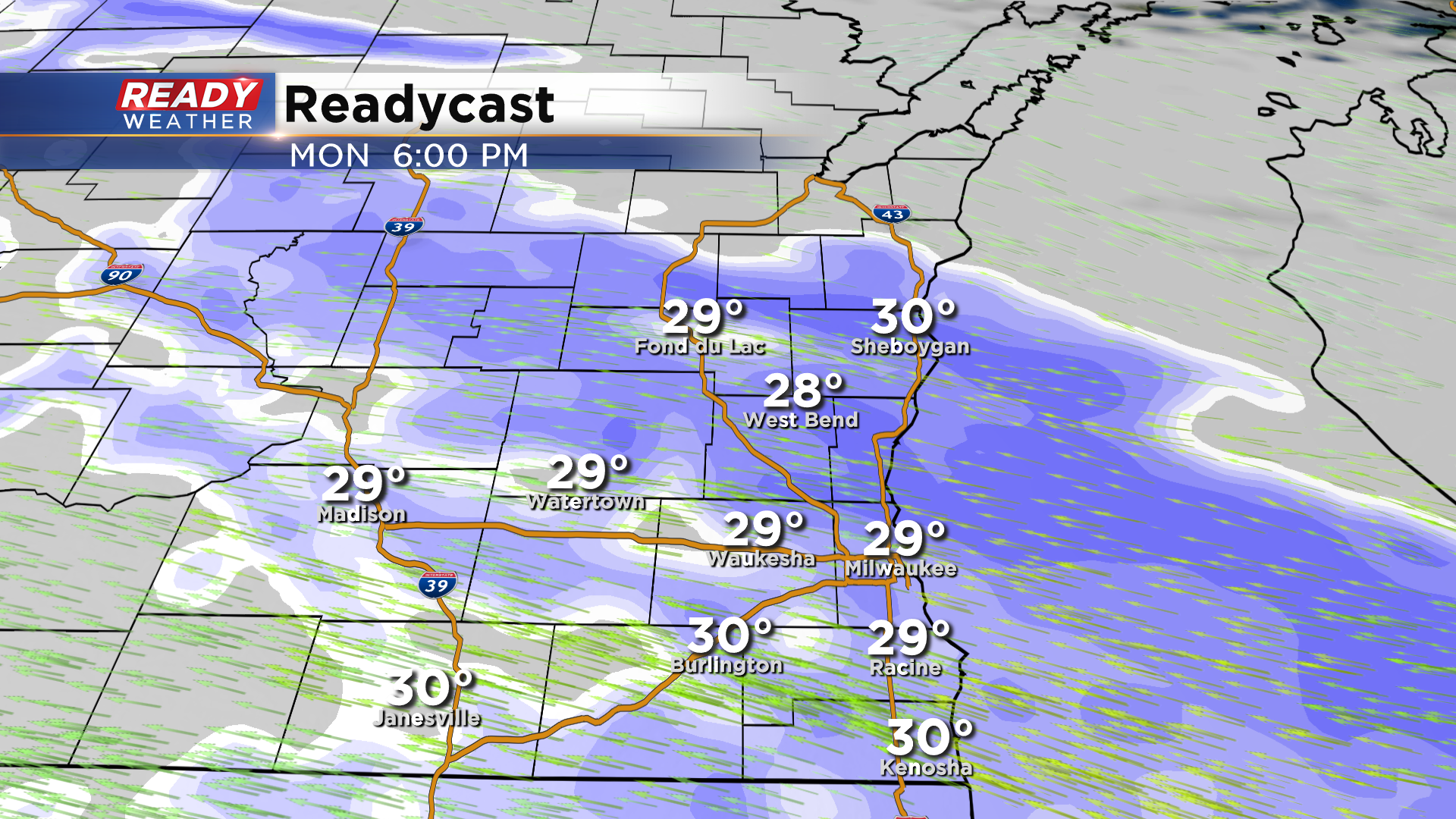
The wet snow may fall at a moderate to heavy rate as it begins, which will cause reduced visibility and slushy/slick roads for the PM commute.
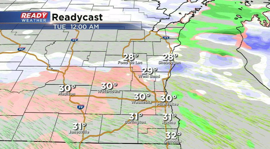
The snow looks to taper off after 9-10 pm, but we may have a period of freezing drizzle into the overnight hours. This is expected to be light, but it could create a glaze of ice on cold surfaces and cause slick spots to linger into the Tuesday morning commute.
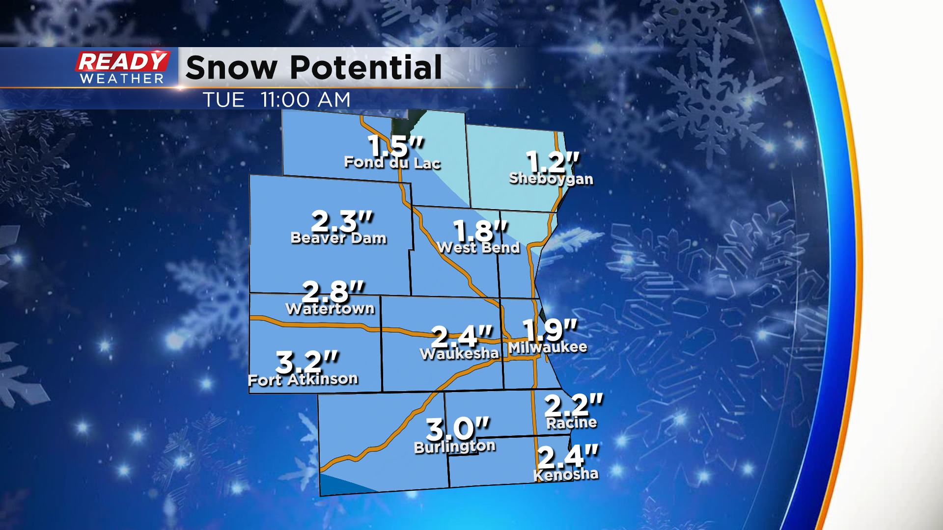
In general, 1 to 3" of wet snow is expected across southeast Wisconsin Monday afternoon - evening, with up to 4" possible in south central Wisconsin where a Winter Weather Advisory is in place.
While the snow will come down at a decent rate at times Monday afternoon, we're expecting snow to initially melt on contact with roads due to how warm we've been over the last 2 weeks. Accumulations will initially be on grassy and elevated surfaces, but roads are expected to deteriorate during the PM commute, especially in spots that see some of the heavier bursts.
Plan on slower travel Monday evening with the potential for lingering slick spots Tuesday morning. Thankfully the snow won't stick around for long as temps will warm into the 40s for highs most of this week. Download the CBS 58 Ready Weather App to track the incoming wet snow and to be alerted if any advisories are issued.