
-
1:22

Juneau boys’ basketball team heads to WIAA Division 4 State...
-
2:17

Family grieves as Milwaukee Police search for double shooting...
-
1:57

From Wisconsin to the Big Dance: Grant Leonard leads Queens...
-
1:02

Evers says he’ll sign bill banning purchase of candy, soda...
-
2:21

Milwaukee VA Medical Center opens new Women’s Health Clinic...
-
2:21

Lake Country School District faces possible dissolution ahead...
-
0:53

’It makes me very sad’: Suspect arrested after vandalism...
-
1:47

Brewers unveil plans for new outdoor plaza at American Family...
-
2:15

’This was 7 years overdue’: Evers signs bill extending postpartum...
-
3:31

Milwaukee Bucks Foundation’s Sixth Man Soirée returns to Fiserv...
-
2:12

Proposal to name part of Washington County highway after Charlie...
-
0:50

Milwaukee County leaders announce 2026 Traveling Beer Garden...

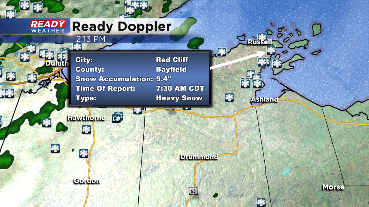
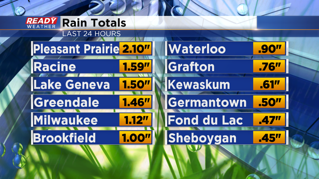
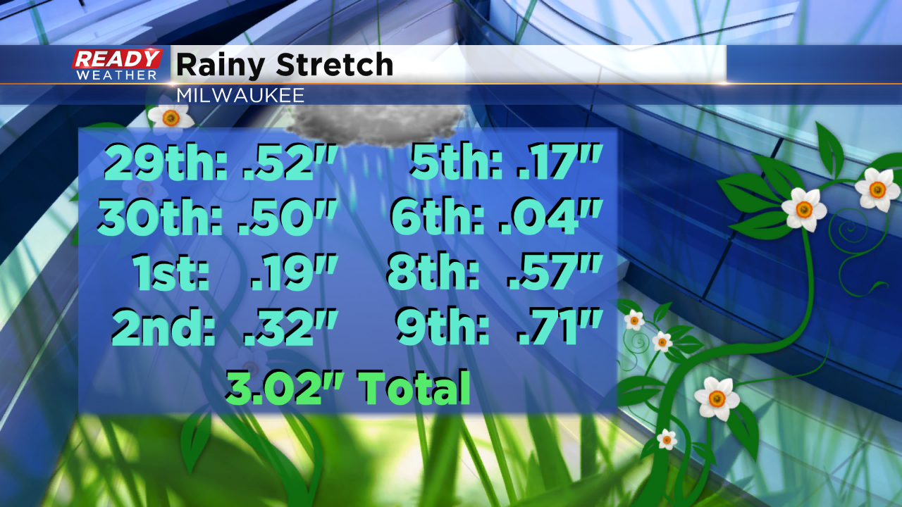
We were bracing for the rain again last night. By 9pm a solid batch of rain closed in on the area. At that same time, heavy wet snow was pounding the far northwest part of the state. Check out this total:
Sign up for the CBS 58 Newsletter