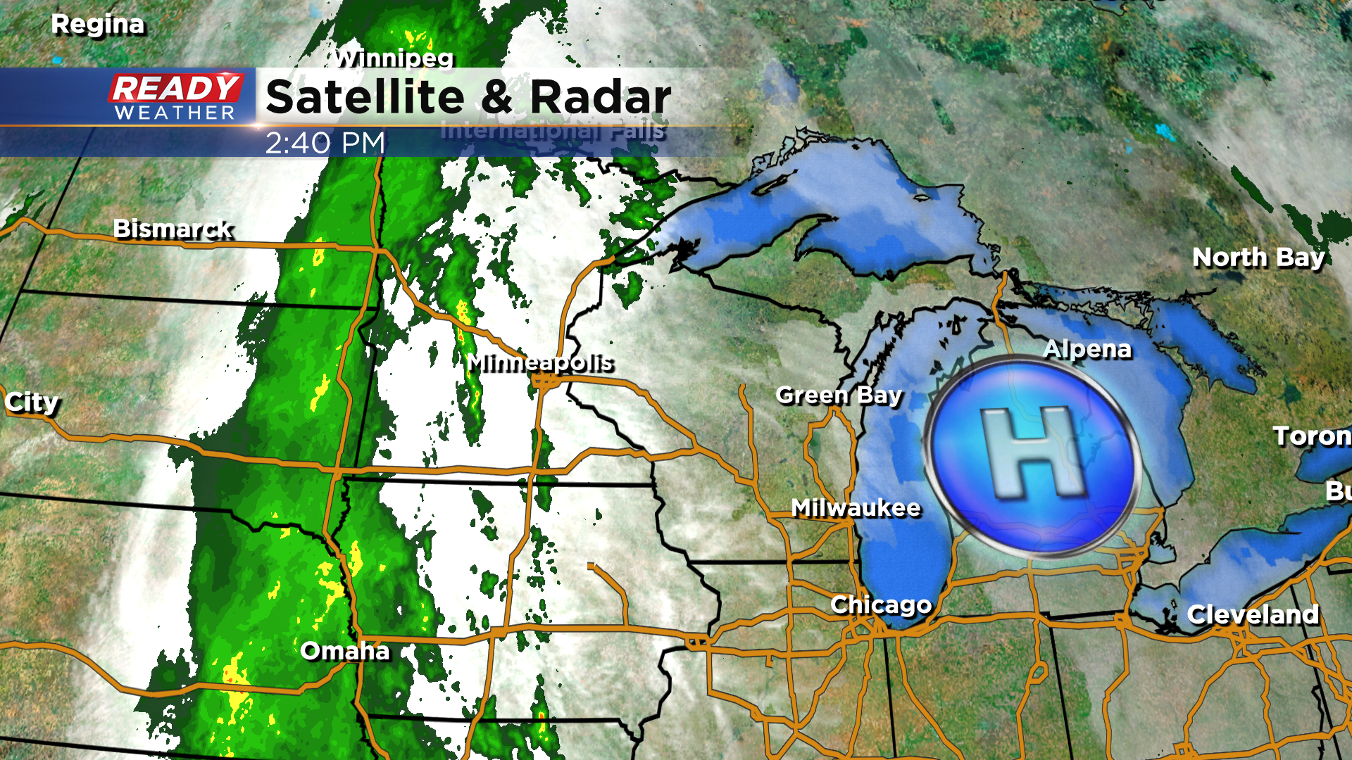
It's been a rather pleasant Wednesday with a mix of sun and clouds and temps in the mid to upper 50s. High pressure has been keeping us dry today, but it'll push off to the east tonight and allow for wet weather to return on Thursday.
Clouds will increase through the night tonight with some patchy drizzle possible lakeside.
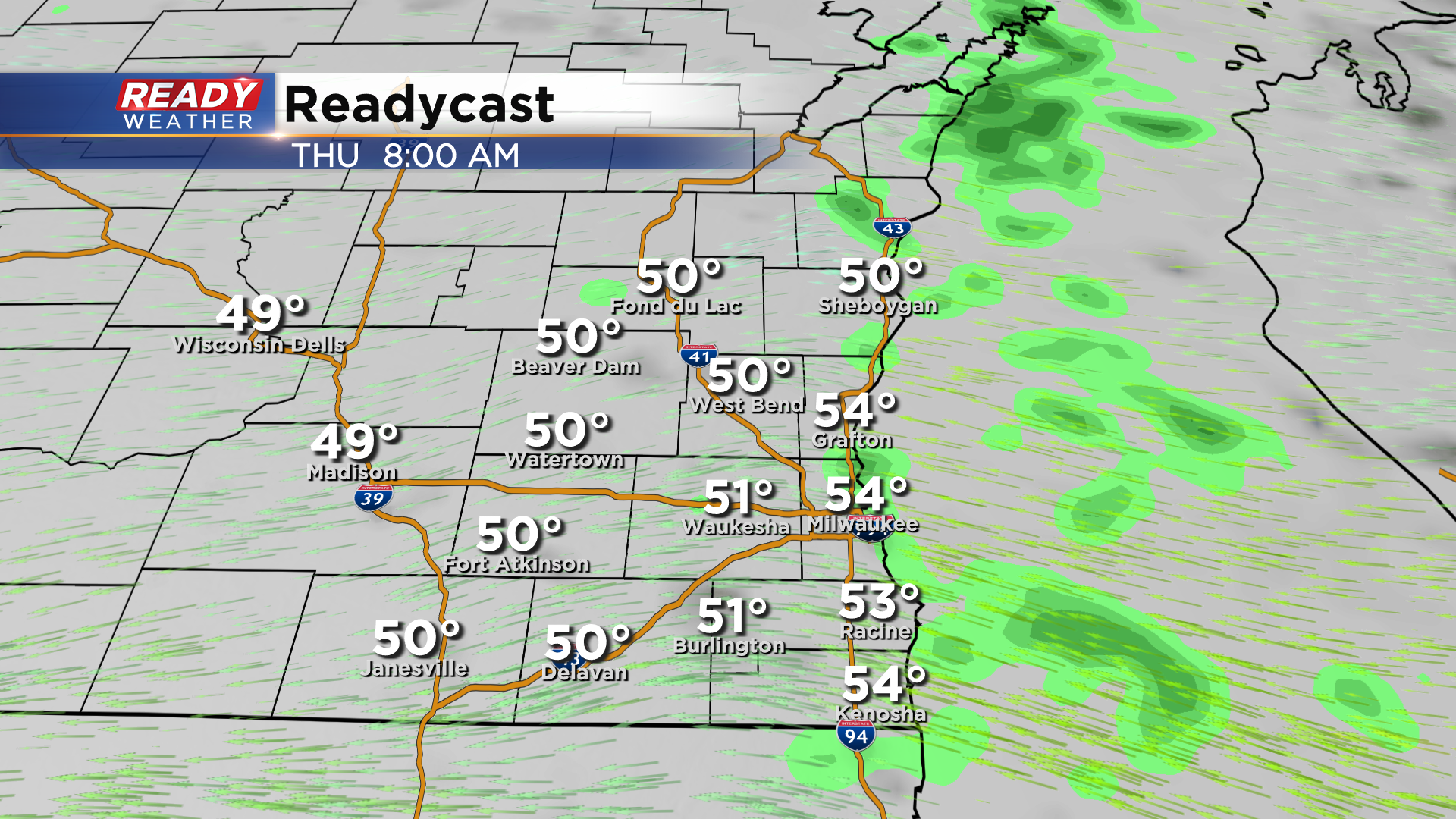
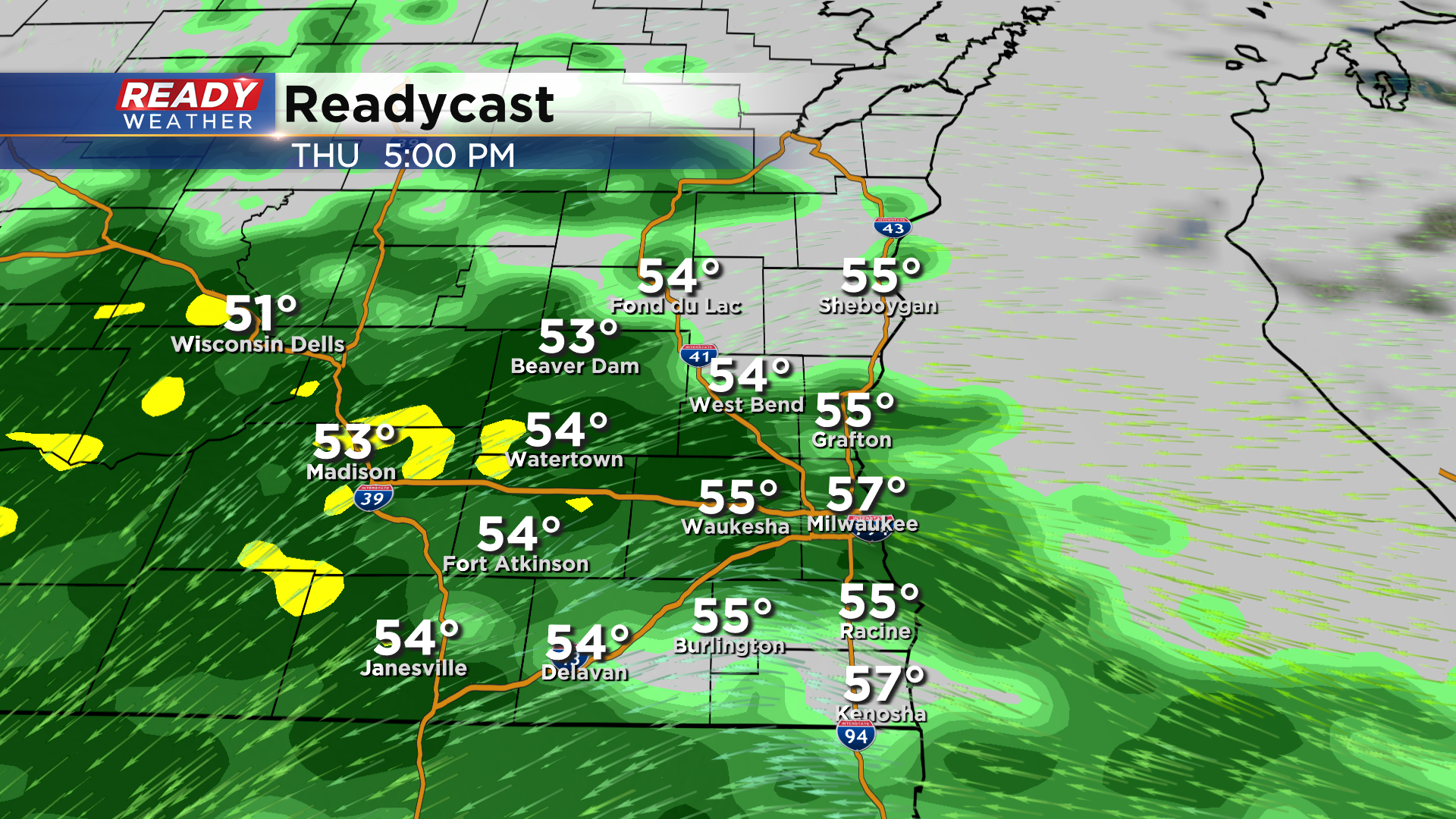
This drizzle will continue Thursday morning for lakeside communities, but the real showers will hold off until early afternoon. Rain will become steadier and more widespread late afternoon and evening and continue through Thursday night.
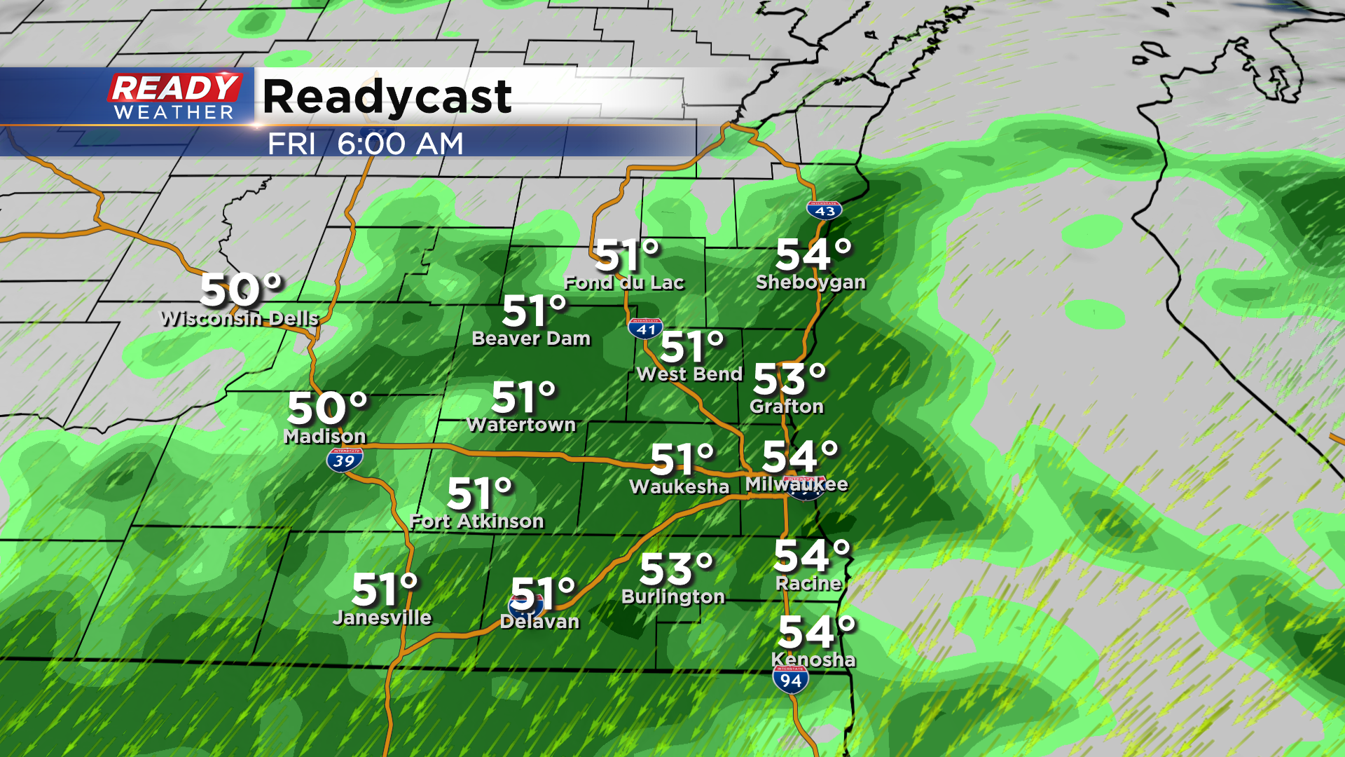
Steady rain will likely impact early morning commuters on Friday, but the steady rain looks to taper off by mid morning.
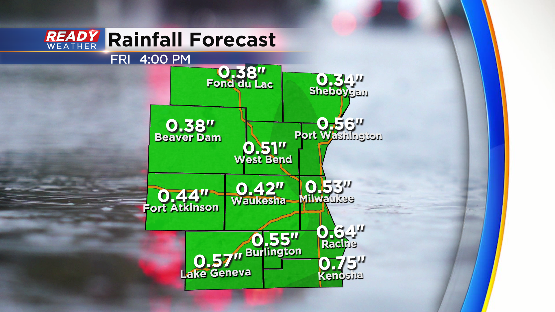
Similar to early this week, lingering lake effect showers will be possible Friday afternoon before ending around sunset. We're not expecting as much rain as earlier this week, but most of southeast Wisconsin will likely pick up .35-.75" of rain with the highest totals in far southeast WI.
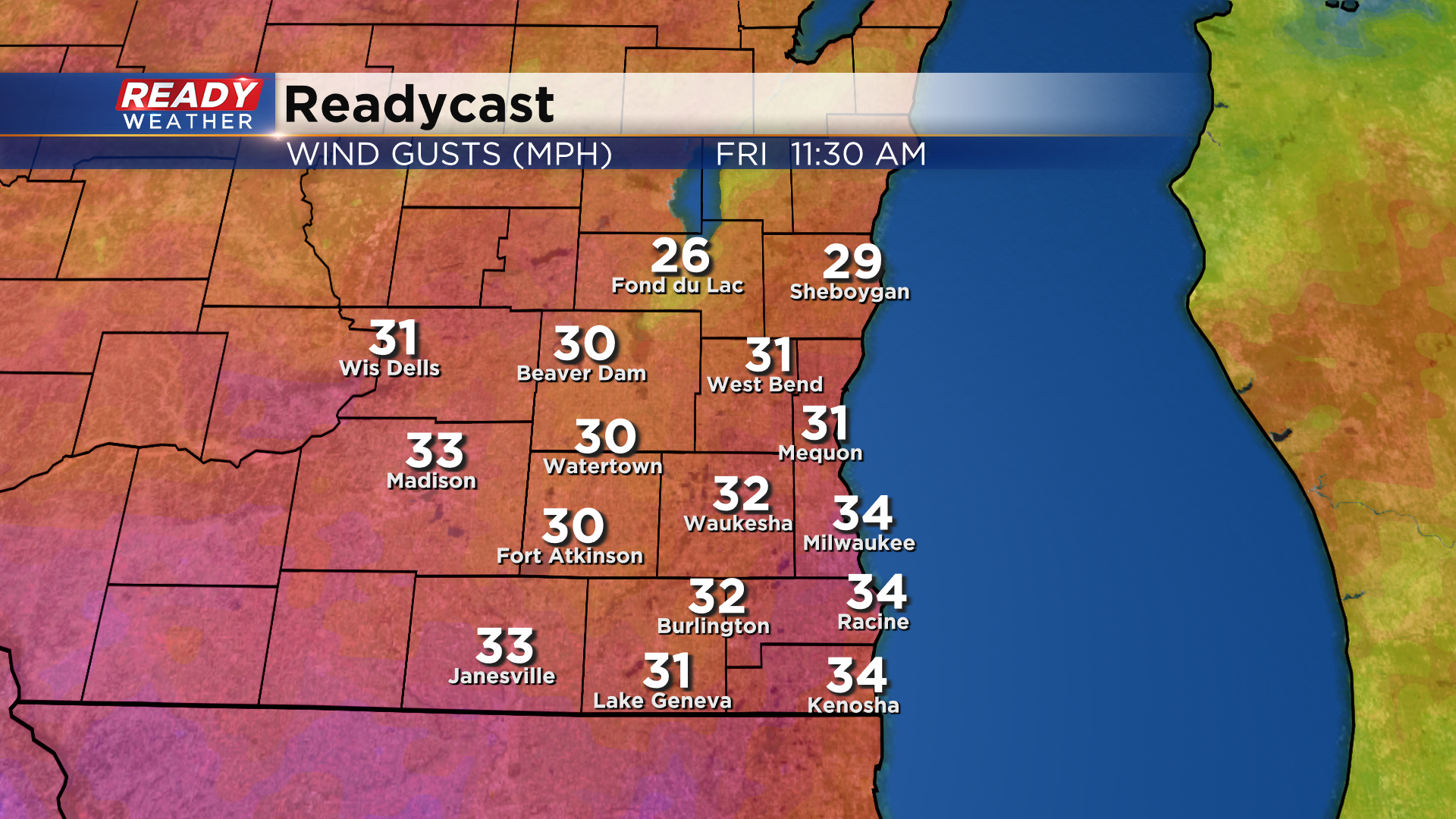
The gusty onshore winds will also return on Thursday, gusting from the east at 20-25 mph. NE winds will increase to 30-35 mph throughout Friday.
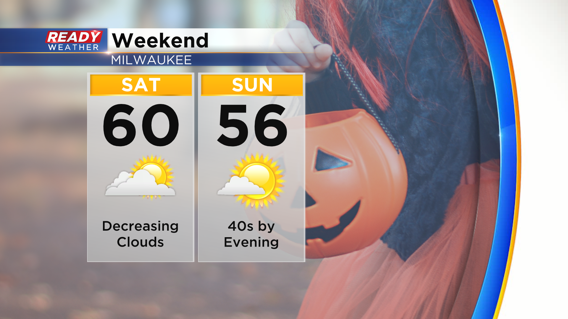
Thankfully all of this rain and wind will get out of here before Halloween weekend!
Download the CBS 58 Ready Weather app to see the full 7 day forecast.
