Weekend Winter Weather Update
There is a lot going on with the forecast as we head into the weekend, so I want to clarify the latest model thinking for snow on Saturday. Over the last 24 hours the models have been up and down with precipitation forecasts, but it appears that the track for the next storm has been established, and that is giving us more confidence in a snowfall forecast.
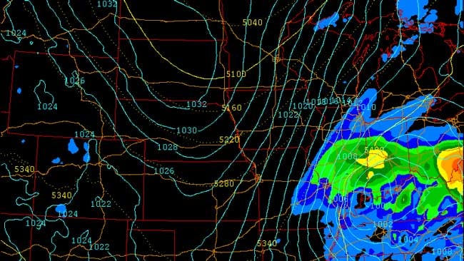
Take a look at the picture above. This is a map of expected precipitation and surface level pressure. Notice the inner circle of pressure over southern Indiana. That's the area of low pressure that will provide us a chance for winter weather Saturday night into early Sunday evening.
The track is a little more east compared to earlier runs, and that has cut down on the overall snowfall accumulation. While the track varies some between models, there is decent consistency between them. It appears the light snow will hold off until after 6 pm Saturday and wrap up as flurries around 7 am Sunday.
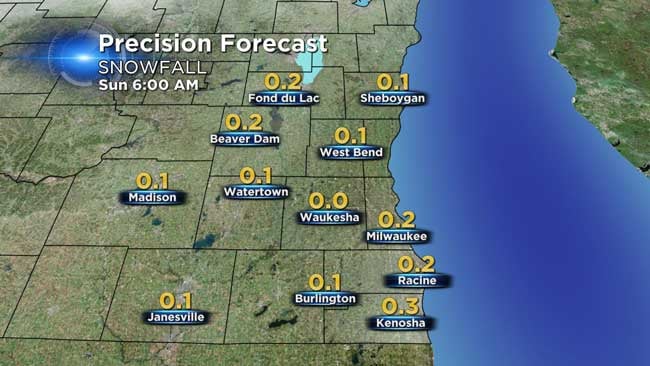
Overall it appears that an inch or less will occur by early Sunday morning. If the track shifts to the northwest, the totals could dramatically go up. We will continue to watch this for you as we head into the weekend. Check back on the blog for the latest updates!
