We go from sun to soggy in less than a day as a new work week begins


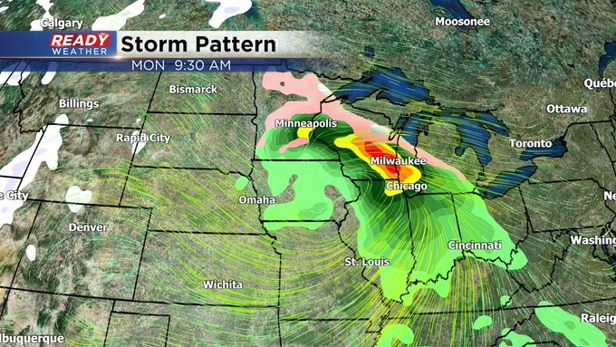
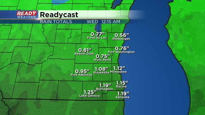
MILWAUKEE (CBS 58)--Our weather will become manic very quickly over the next 24 hours as another area of low pressure comes our way from the Plains. This system will draw up warmer air, giving us mainly a rain event. It can be heavy at times, especially the first part of the day. An inch to an inch and a half at least can be expected. Meantime, highs today will be near 40 featuring sunny skies. Our next weather maker will be a wind maker as well. Expect wind gusts from the southeast around 30 to 40 mph on Monday. With the heavy rain potential, there is the threat for some minor flooding. So make sure your storm drains are cleared and keep an eye on water levels.
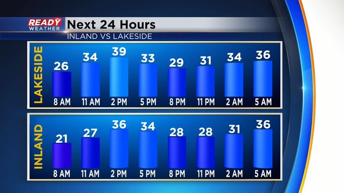
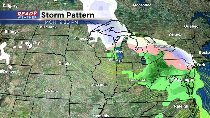
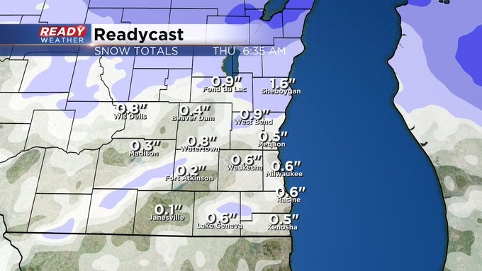
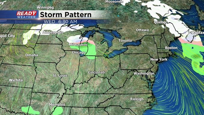
There is another system behind this one, but it's much weaker and a little colder. So count on a wintry mix by Wednesday and then it cools off to seasonable, if not seasonably cool weather, for the end of the week with highs in the 30s.