


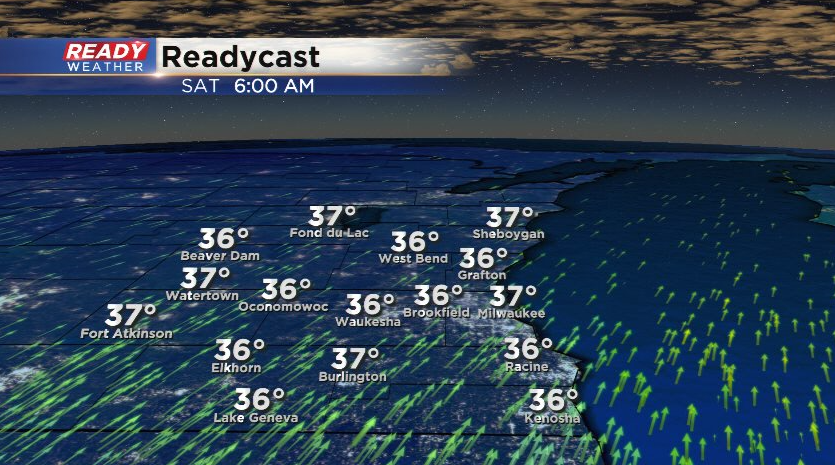
Temps remained on the cool side today with highs in the mid to upper 30s for most. Temps will only drop into the low 30s tonight thanks to mostly cloudy skies and a breezy southerly wind gusting 20-25 mph.
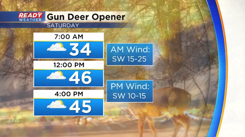
Clouds will hang around for most of Saturday, but the breezy southwest wind will boost temps into the upper 40s area-wide. Wind gusts will be strongest in the morning before tapering off in the afternoon. Folks hunting in the morning should prepare for wind chills in the 20s, but a nice afternoon.
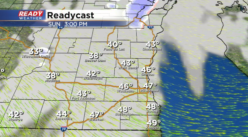
A system passing to the south late Saturday night into early Sunday morning may bring a shower or two into far southeast Wisconsin, but most of the area looks dry. A stronger cold front moves through Sunday afternoon, which could trigger a few snow showers well north of Milwaukee by evening. No accumulation is expected, but winds will turn strong behind the front, which will likely cause a bigger impact.
The strong northerly wind will bring much colder air into the state to start next week. Download the CBS 58 Ready Weather App for the full forecast.