


After seeing our first day with a high temperature in the 50s since May 31st, a light southeast wind has returned for today, which should help push our temperatures to the mid-60s today, and stay above average through this afternoon. Temperatures should continue to climb heading into the weekend, with highs returning into the low to mid 70s as more of a southwest wind develops.
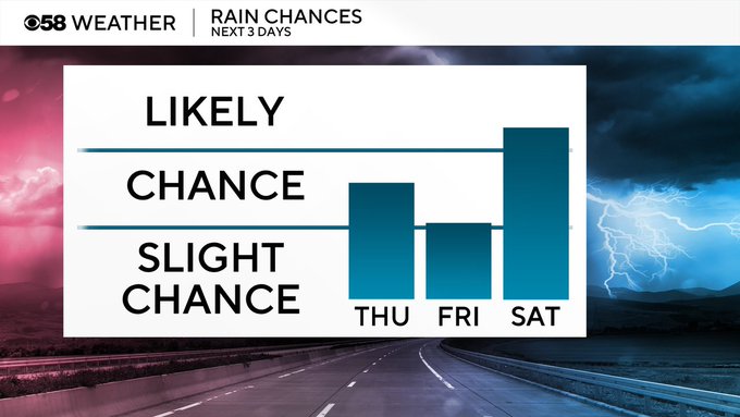
After more sunshine this morning then what we have seen since the start of the weekend, a chance for an isolated shower is possible this afternoon and evening. Isolated shower chances will hold through Friday, with the best chances in the morning and then again into the evening.
Friday evening's chance will linger into the start of the weekend, with an even better chance for rain now pushing in for Sunday. Neither day is a complete washout.
Behind this system, a northerly wind returns, and we cool off back into the upper 50s and low 60s to round out the weekend and begin our new work week.