Warm Weather... Updated
Unseasonably warm weather continues today as highs warm into the low 70s once again. Blue sky and southwest winds will help boost temps well above our normal high of 53°. Today's record high of 74° will likely stand, but only because winds will shift as a lake breeze works inland. As this southeast wind develops temps will cool back through the 60s near Lake Michigan during the early afternoon.
The surface map below shows the weather pattern leading to our warm up. With the main storm track to our north a large dome of high pressure is remaining stationary over the Ohio Valley. The clockwise air-flow around this feature is tapping warm air from the deep south and sending it northward.
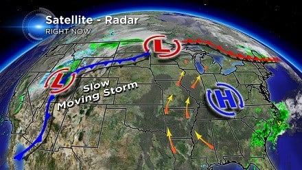
Meanwhile, a strong storm is developing over the Rockies. With a large dip in the jet stream cold air is plunging south in this region and producing a lot of snow in high elevations. It's a slow moving system for now, but once it kicks east the storm is expected to race toward Wisconsin bringing rain and much cooler weather by the weekend. The rain should arrive Thursday night and is forecast to end Friday morning.
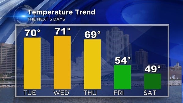
The graph below shows our five-day temperature trend... as you can see, the warm weather comes to an end by Friday morning. It's a big cool down, but in reality, upper 40s to low 50s is normal for the first full weekend of November.