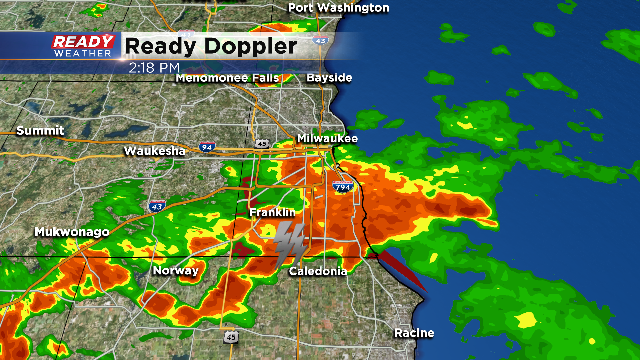
Very Heavy Rainfall Today....Flash Flooding
Hot and very humid conditions fueled showers and storms ahead of a cold front this afternoon. Dewpoints in the upper 60s made the downpours more tropical in nature. Couple the moisture with slow moving steering winds aloft, and you had a recipe for flooding rainfall in a short amount of time.

Milwaukee county was particularly hit hard with a blowup of storms that produced heavy rainfall from 1:30 pm till 2:30 pm. In that hour alone there were many spots that picked up 1 to 3 inches of rainfall. Keep in mind the normal rainfall for August in Milwaukee is 3.97". The heaviest rain of the summer was on June 15th where the airport picked up 1.03" of rain.

Look at some of these reports across Milwaukee county! Way too much rain for the storm drains to keep up with. The summer as a whole has been abnormally dry across the county, but these recent rains will actually put us close to normal for the month of August. Unfortunately you don't want to pick it all up at once!

A cold front comes in later tonight sweeping away the humidity and drops temperatures into the 60s and 70s toward the middle of the week.

