


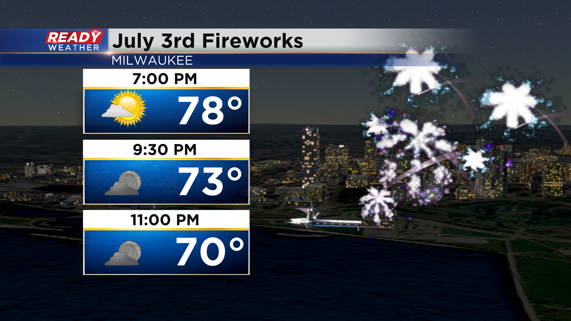
Mother Nature got the memo that Milwaukee was having their first fireworks show since 2019 tonight and delivered perfect weather! Dry and comfortable conditions will be in place through the evening.
Dry weather will continue overnight through Monday morning, but Mother Nature looks to create her own fireworks during the second half of the day, potentially in the form of two rounds of storms. The first round of scattered rain and storms looks to move into southeast Wisconsin during the afternoon. While the exact timing is still uncertain, the later their arrival, the better chance they have at being strong to severe.
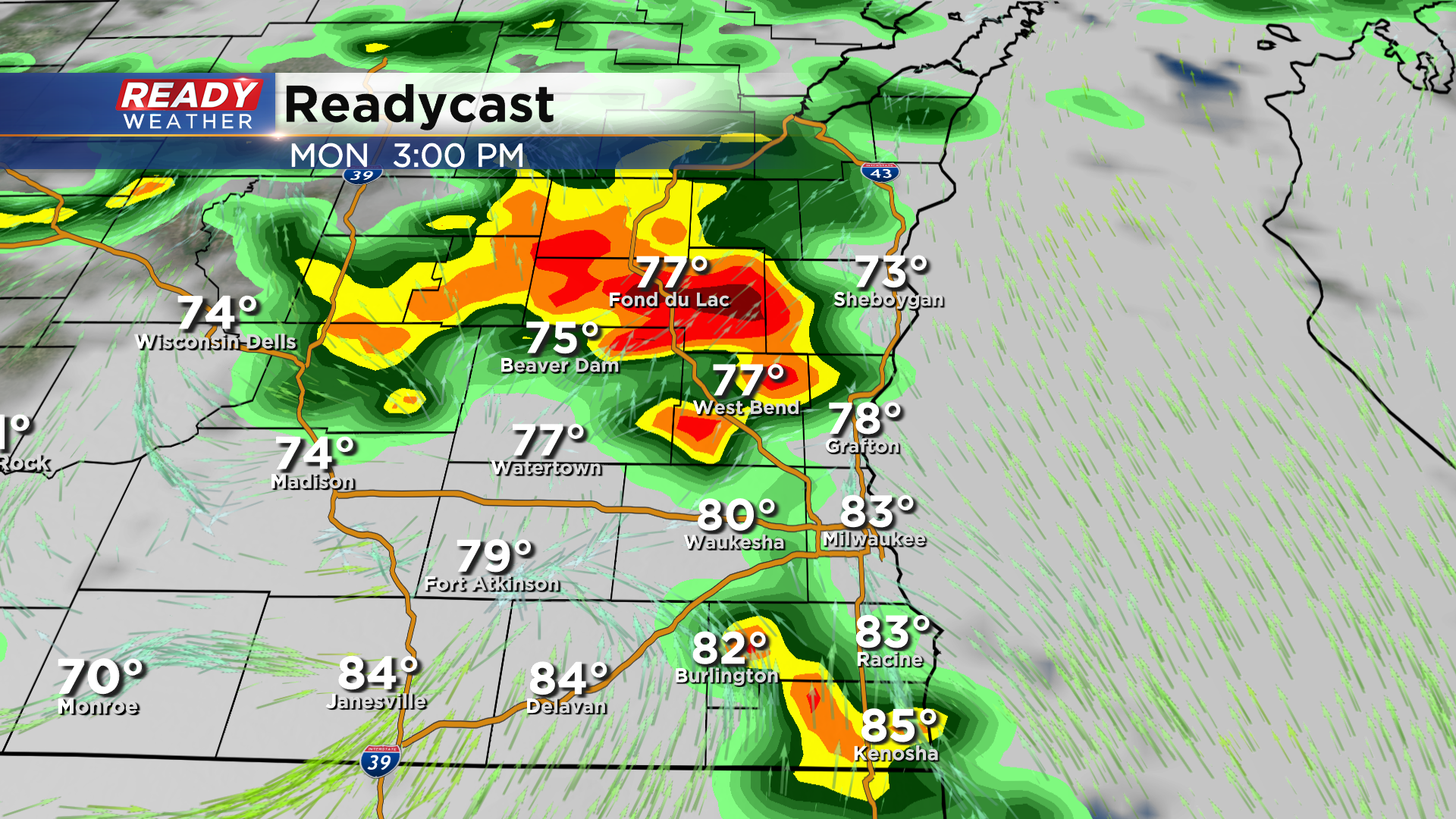
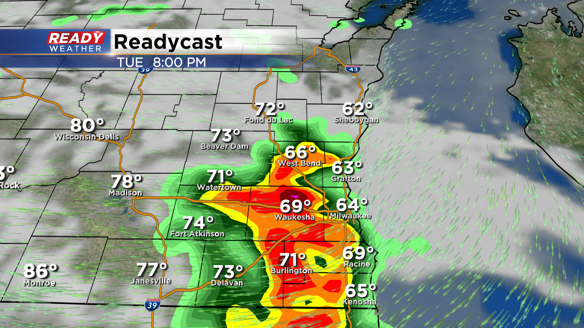
There may be a lull in the action early in the evening, but we'll be watching for a second round of more intense storms to develop mid to late evening. Where exactly this line fires is still uncertain, but it'll develop as a west to east oriented band which will produce heavy rainfall, strong winds, and hail.
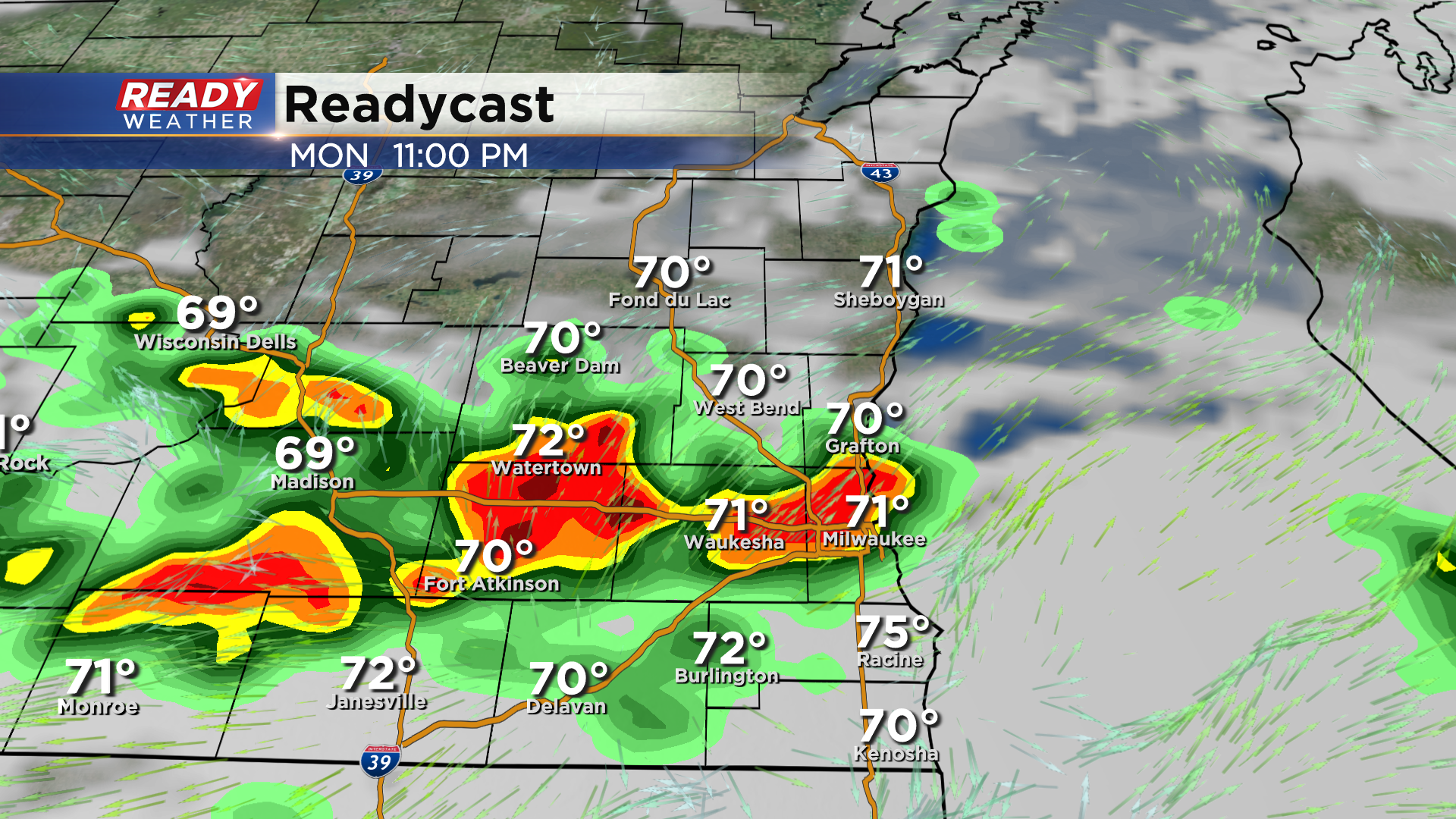
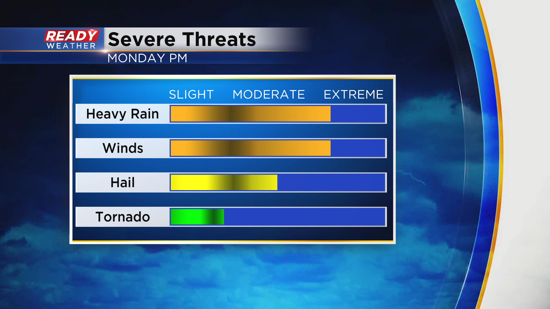
There's a good chance this impacts some local fireworks displays Monday evening. A good portion of southern Wisconsin is under a level 2, Slight Risk, for severe storms on the 4th of July. The rest of the state is under a level 1, Marginal Risk.
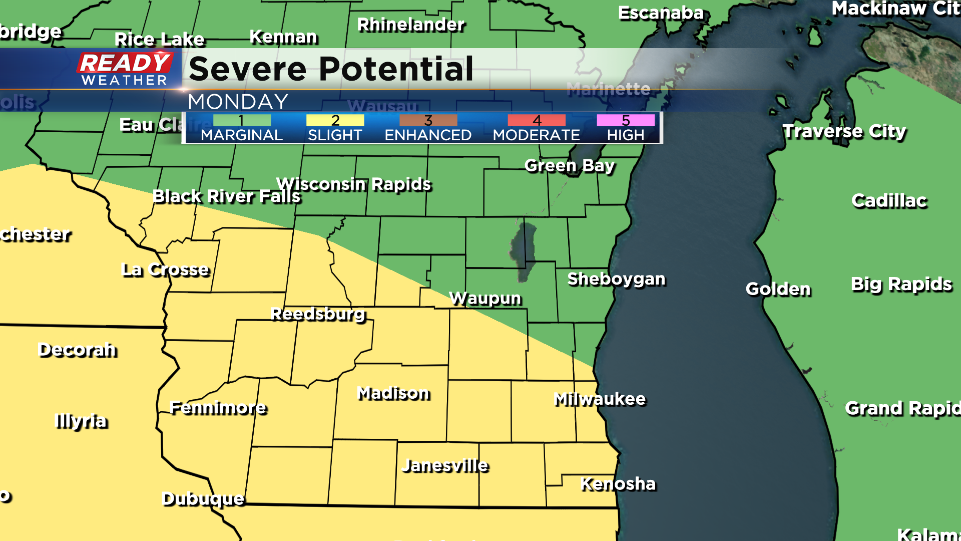
Damaging winds, heavy rainfall leading to flash flooding, and hail are the main threats. The tornado threat is pretty low.
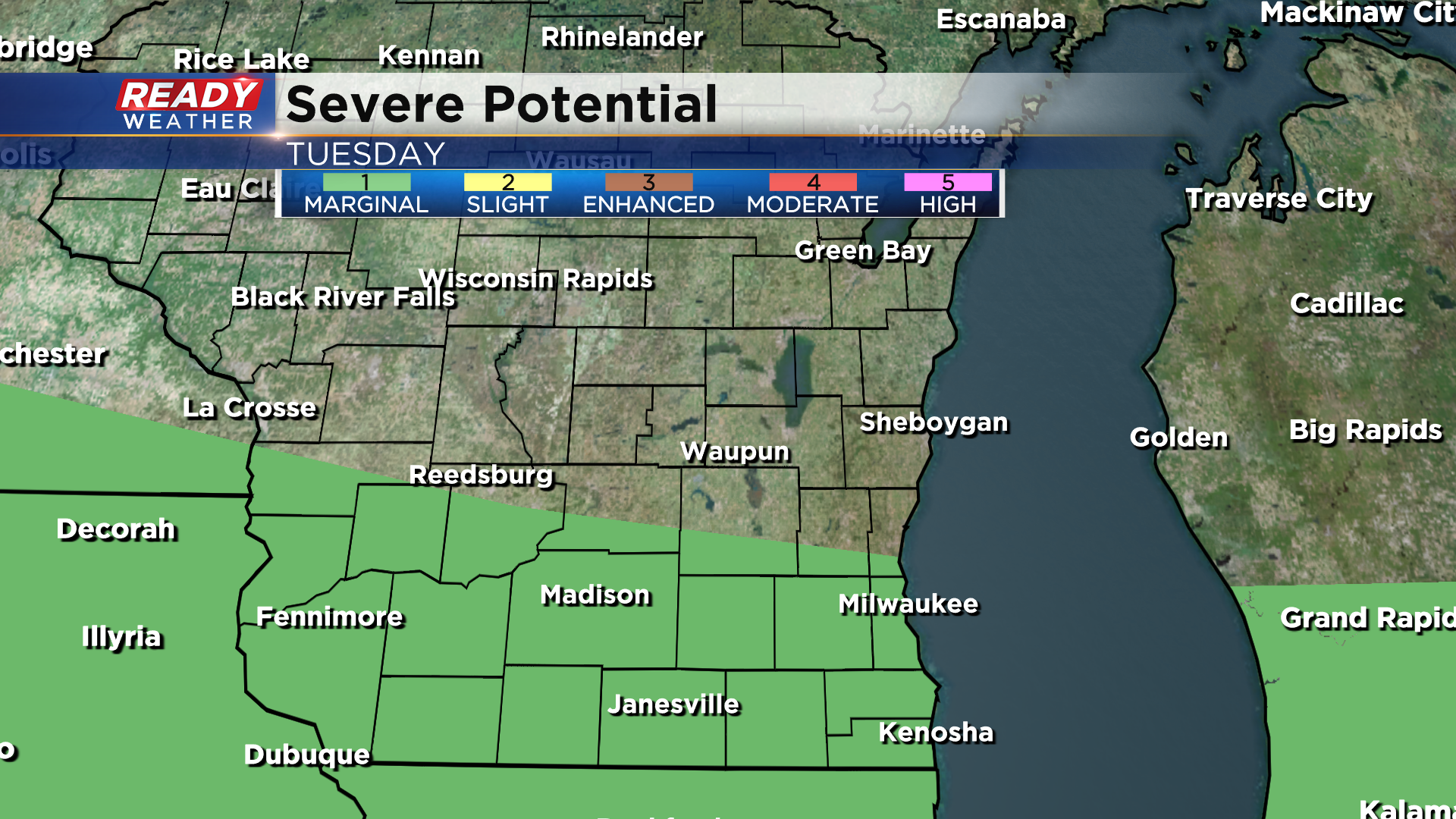
We'll have a break in the action for a good chunk of Tuesday, but we'll be watching for another potential round of storms in the evening or at night.
With a very warm and humid airmass in place, these storms could be strong to severe as well. Areas closer to the Illinois border have the best chance at storms on Tuesday, where a level 1, Marginal Risk, is in place.
This active weather pattern will continue through Friday, so download the CBS 58 Ready Weather App to keep up with the changing forecast and to get any watches and warnings sent to your phone if you'll be out and about on the 4th of July!