
-
2:12

Schlesinger’s Saturday Showcase (5/30)...Lots of plant sales,...
-
3:10

Finishing off May on a quiet and cool note before another warmup...
-
2:49

Francesca Hong stands by comments about having “vision“ for...
-
2:42

Beer garden expected to open in Milwaukee’s Red Arrow Park...
-
1:00

Milwaukee named the best city for creatives, report says
-
0:37

Big Bay Beach closed down due to high levels of E. coli
-
4:20

Poll shows depression, loneliness remain at record high post-pandemic;...
-
1:42

Teens from Milwaukee High School of the Arts win national student...
-
2:06

Milwaukee County treatment court graduates celebrate new beginnings...
-
0:49

Wauwatosa senior living residents enjoy Bridgerton-inspired tea...
-
0:55

Cyclists take part in 4-mile community ride through Milwaukee’s...
-
2:32

Milwaukee’s Downtown Dining Week officially underway

Just when you think we have turned the corner for Spring, winter weather remains possible across the area. Late tonight a disturbance will create a mix of rain and snow across southeastern Wisconsin.
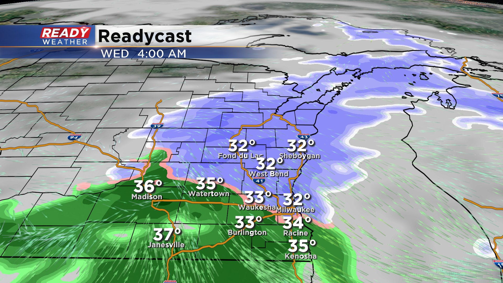
The winter weather should hold off until after midnight. Expect more of a mix of rain and snow along and south of I-94. The further north you are from Milwaukee the better chances for that mix being more snow.
Thankfully road temperatures and ground temperatures are relatively mild, so accumulation will be mostly confined to grassy areas. This will be a wet slushy snow that should melt by Wednesday afternoon. Plan on the mix to be wrapping up by 10 am.
Accumulation should be an inch or less, with the highest totals across Sheboygan and Fond du Lac counties.