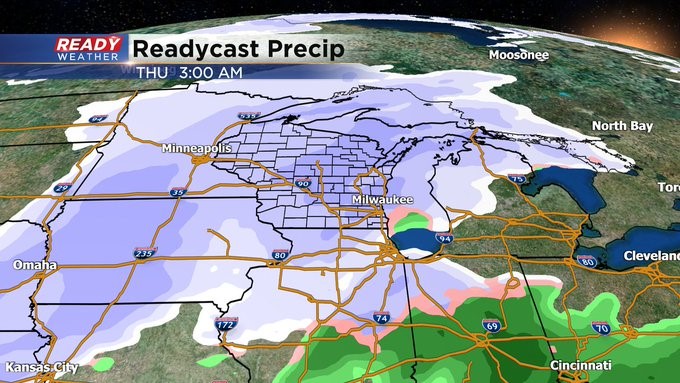
The start of winter looks to be rather impactful with snow, wind into the holiday weekend


MILWAUKEE (CBS 58)--All eyes are on a developing winter storm set to impact our area late Wednesday night and go into Friday. We're talking snow and wind. It's too soon to talk about snow amounts but rest assured the CBS 58 Ready Weather team is on top of the latest developments and will keep you updated.
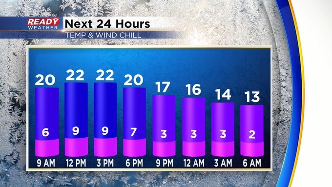
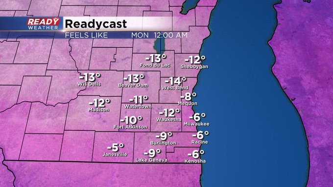
In the meantime, if we're lucky, we could see a few breaks in the clouds later this afternoon. Otherwise look for chilly conditions with highs in the low 20s. Any wind will make it feel colder.
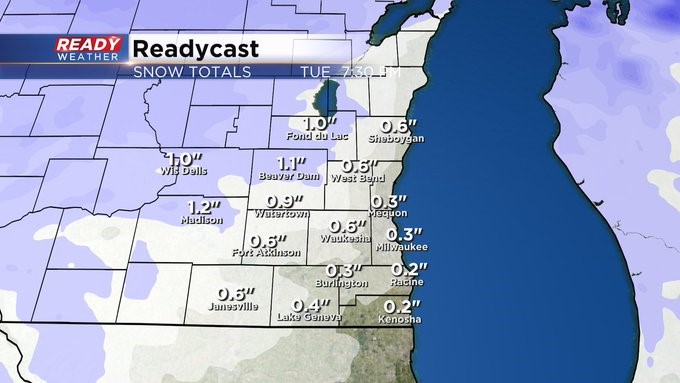
Monday clouds develop ahead of our next minor system giving us a bit of snow Monday night into early Tuesday. Perhaps an inch in spots, creating some slick travel.
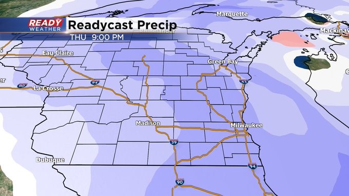
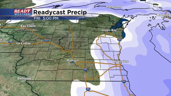
Again, the big talker looks to be for the second half of this week. By the way, temperatures behind the system for the end of the week will drop into the single digits and lower teens for the holiday weekend, giving us some of the coldest weather we've seen during Christmas in some 40 years!