


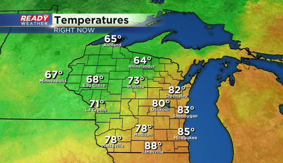
It's been a warm Friday so far with temps in the 80s for most of southeast Wisconsin, but a cold front is working its way through the state.
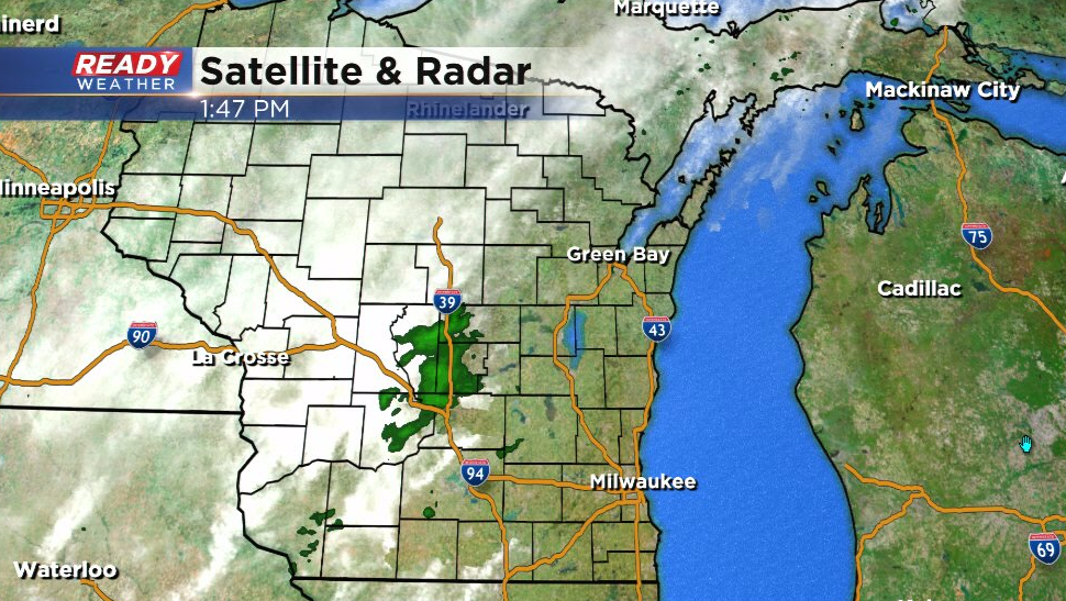
That cold front has been touching off a few isolated, very light showers, but they've been battling some lingering dry air. A few isolated showers or a storm will be possible between 4pm - 8pm as the front moves through, but a majority of southeast Wisconsin will likely stay dry.
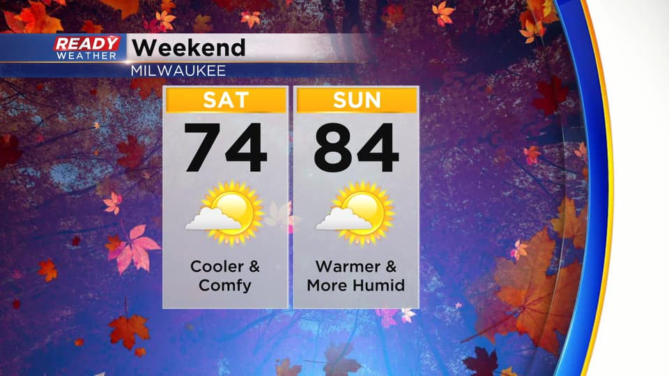
Cooler air will filter in behind the front overnight with a much more fall-like day expected on Saturday. A northeast breeze will hold temps in the low to mid 70s with coolest temps lakeside. Winds turn more to the southeast on Sunday, which will allow for a bit warmer and more humid air to move back in.
Rain will hold off through the weekend, but a few isolated showers or storms look to work their way back into the area on Monday. A better chance for rain will arrive Tuesday with the cold front. It'll feel a LOT more like fall behind Tuesday's cold front. Download the CBS 58 Ready Weather App to see how far temps will fall.