Sunshine and above normal temps return for the first day of spring


Showers and drizzle lingered for most of the day on Saturday, keeping temps in check in the upper 30s to low 40s. These will exit by sunset with gradually decreasing clouds through the evening. With clear skies and light winds overnight, areas of fog will develop and could be locally dense.
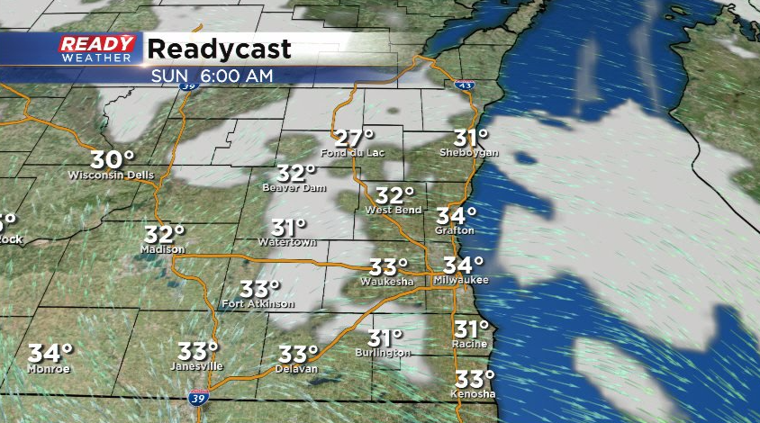
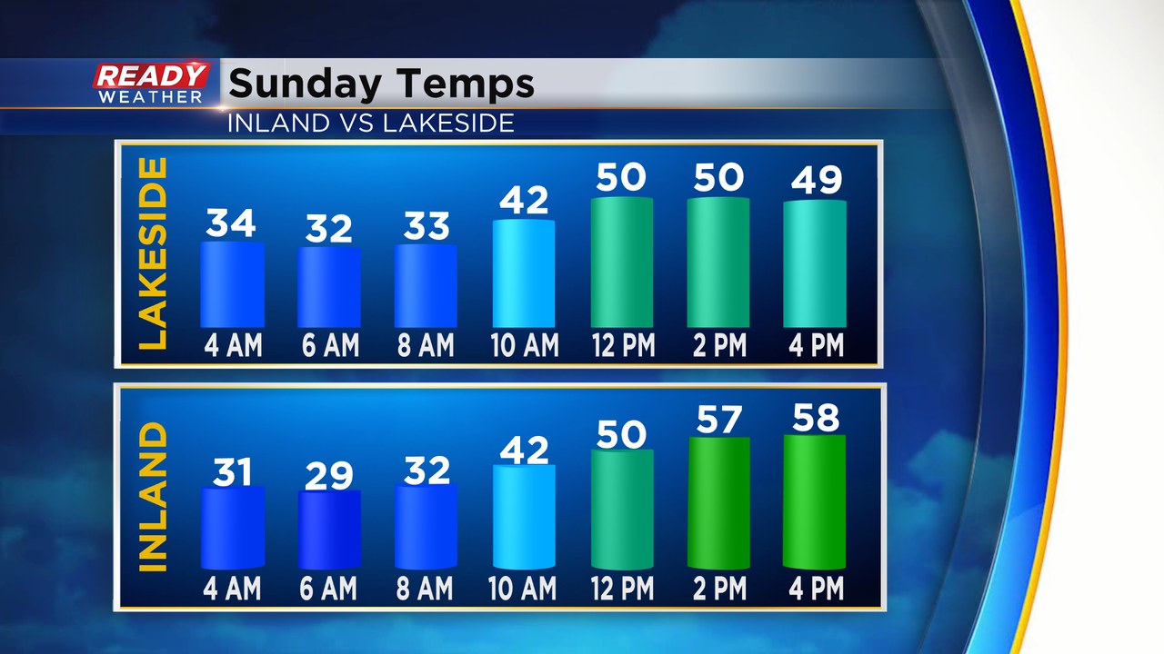
The fog will lift by 9-10am with mostly sunny skies expected for the rest of Sunday. Temps will quickly warm into the 50s under the March sunshine, but a chilly lake breeze will kick in for the afternoon and keep lakeside temps in the upper 40s to around 50. Inland spots warm into the upper 50s.
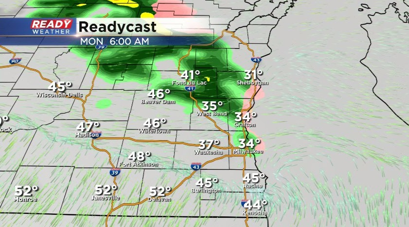
Monday will also be cooler near the lake as a warm front nudges into southern WI, but temps cool back to normal for the middle of the week with highs in the mid 40s.
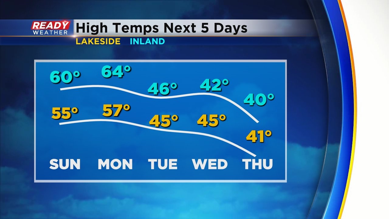
A few isolated showers are possible north of Milwaukee early Monday morning as the warm front approaches, but the rest of Monday looks dry.
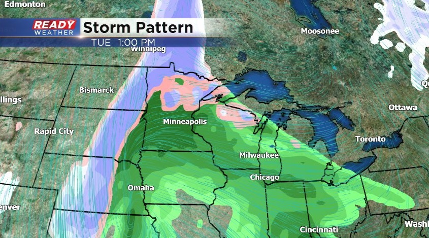
Showers will become widespread on Tuesday and become heavier Tuesday night into Wednesday. Some sleet or wet snow may mix in northwest of Milwaukee on Wednesday.
Download the CBS 58 Ready Weather App to keep up on the latest details.