Evening Update: Isolated storms remain possible


Updated: 6:30 p.m. June 13, 2022
As of now the severe storms are over with. But a swath of hail reports is found in its wake.
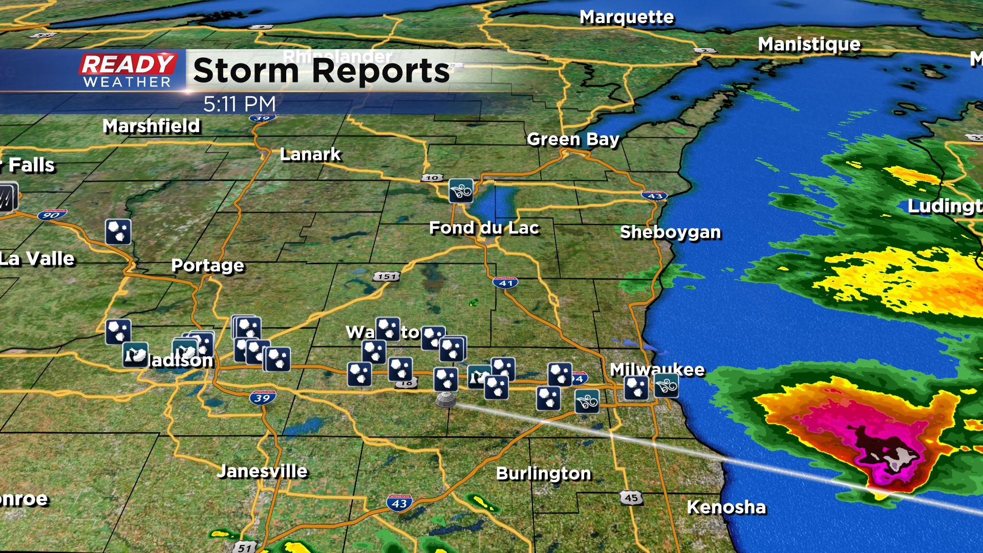
Any storm chance would be isolated!
______________________________________________________________________________________________________________
Updated: 4:45 p.m. June 13, 2022
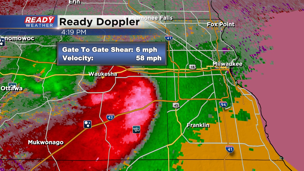
One large complex of storms is moving over Milwaukee county. The warning is out until 4:45 pm. Quarter hail and winds well over 60 mph are expected! This complex produced 2" hail in Jefferson and western Waukesha counties.
Heavy flooding rainfall is also likely in the county with very heavy rainfall.
The SPC has issued a new severe thunderstorm watch for the area until 9 pm. Strong to severe storms are expected to develop over the next several hours. Damaging winds and hail are the biggest threats; however, an isolated tornado can't be ruled out either.
______________________________________________________________________________________________________________
Updated: 1:30 p.m. June 13, 2022
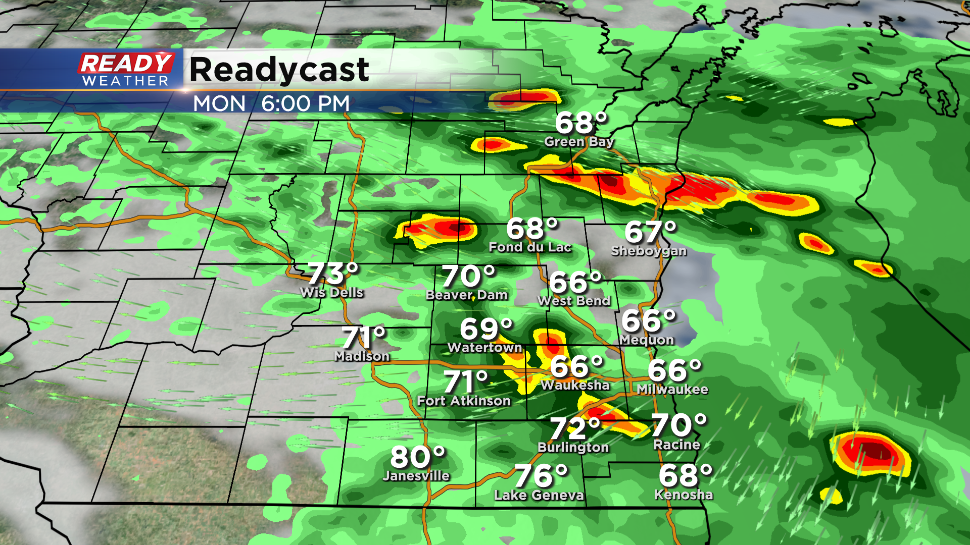
No changes from the SPC regarding the enhanced risk; however, there are many uncertainties that exist for strong to severe storms across our area tonight. Right now a decent shield of rain and some embedded storms are moving through the area. Other than some small hail, this looks to remain below severe limits.
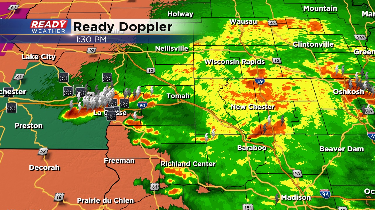
We are watching a new complex of storms forming across the western part of the state. There's potential that this will grow as it moves east. Where it goes and the strength remain in question. Later this evening there's a chance that more storms fire. That remains in question.
______________________________________________________________________________________________________________
Updated: 12:55 p.m. June 13, 2022
So far storms are still below severe limits, but they are now pushing across parts of the area.
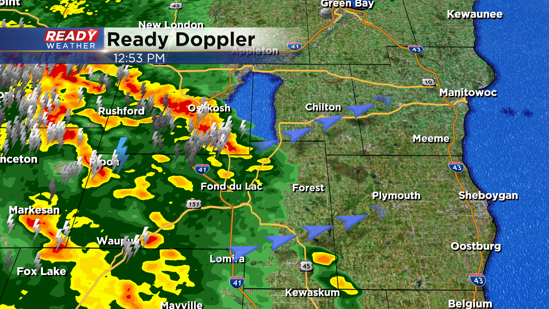
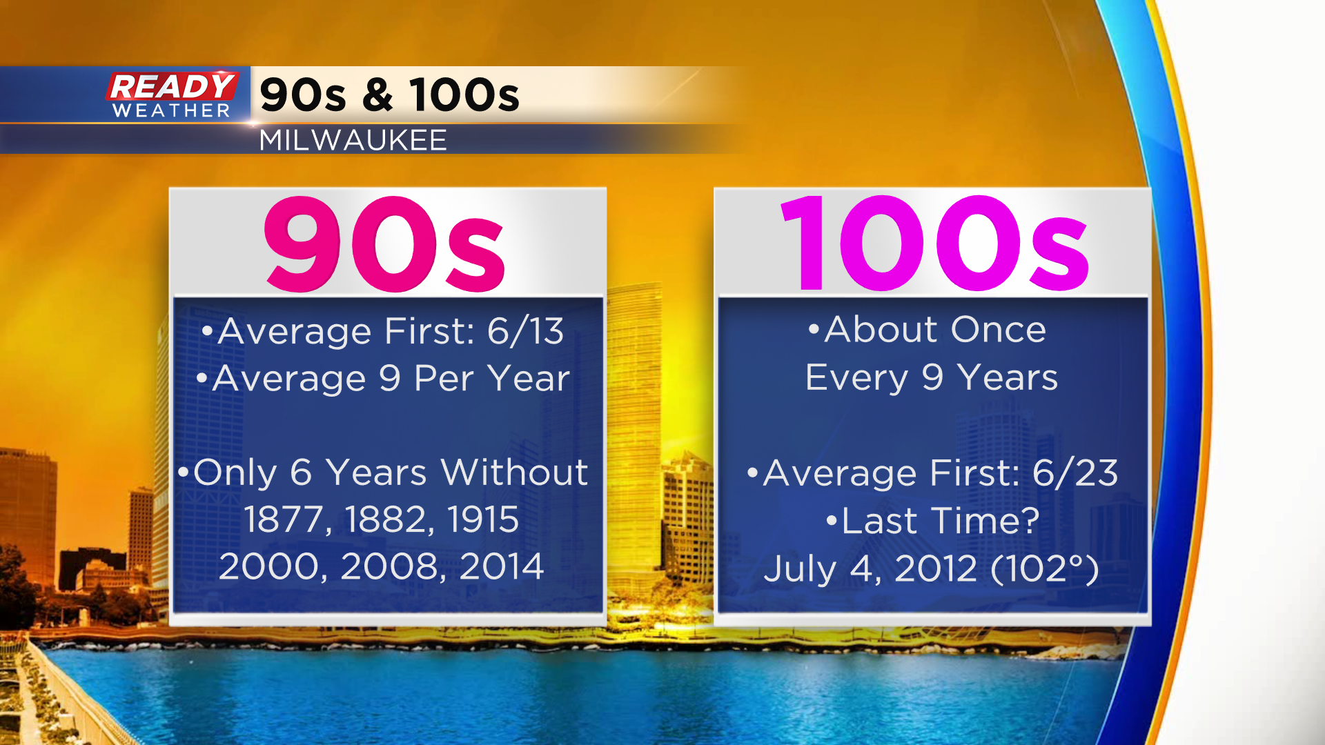
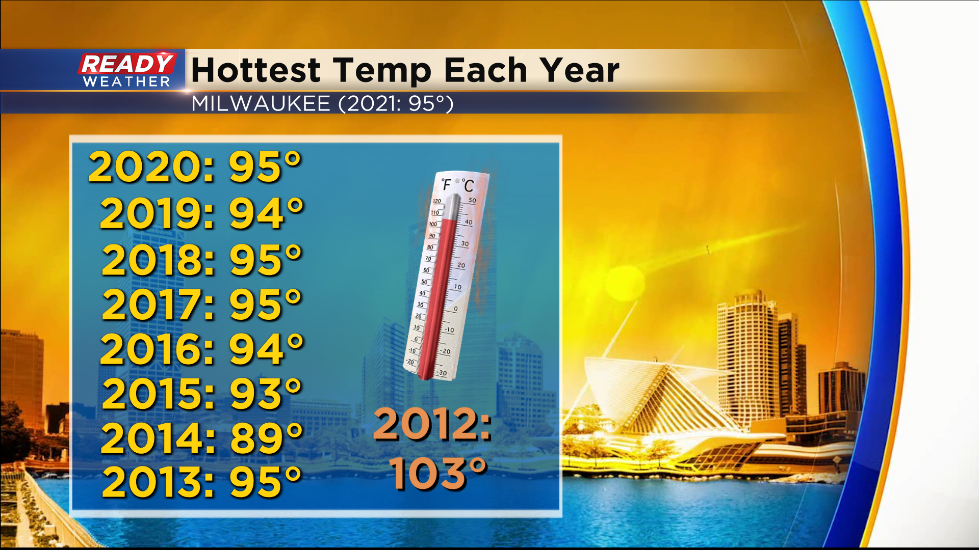
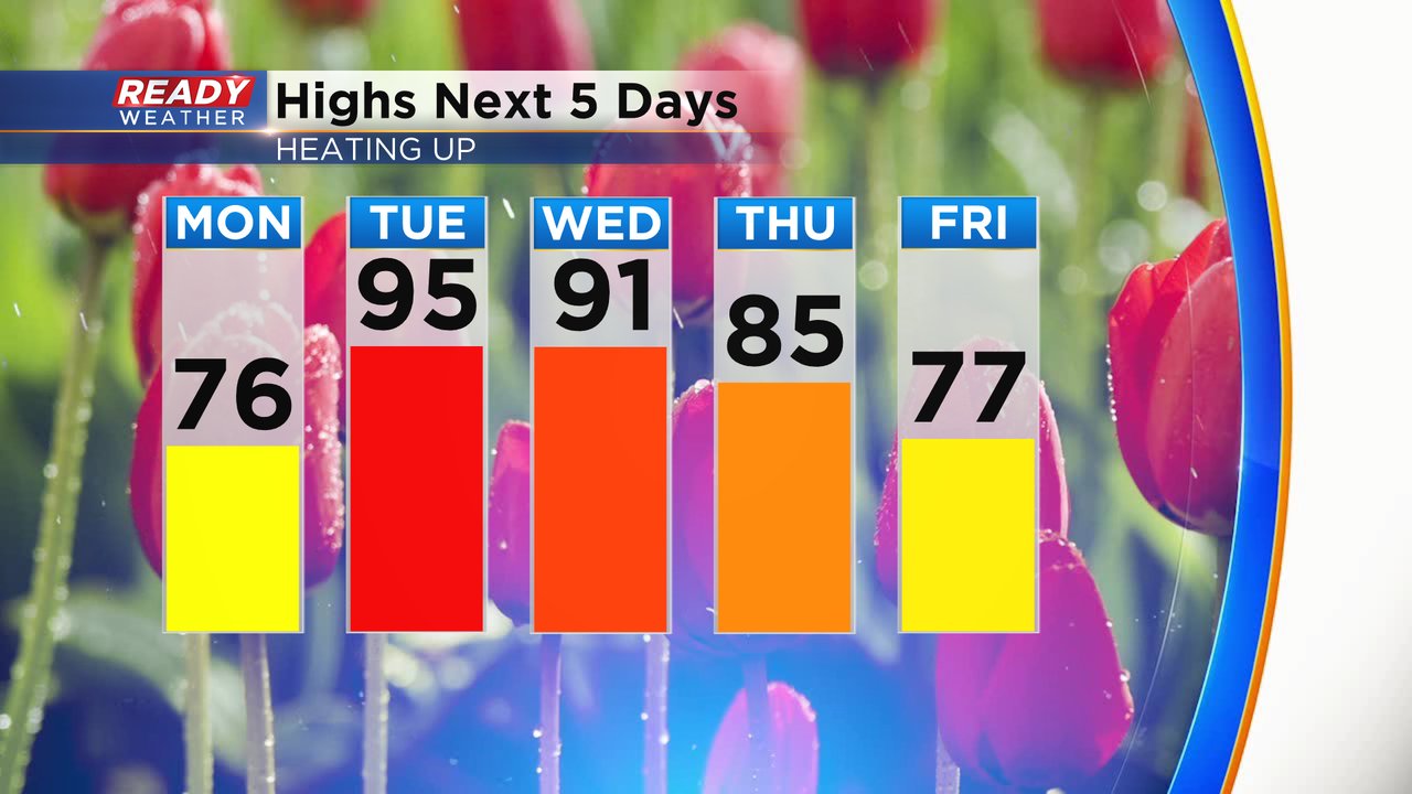
On a quick side note we're also watching a warm front slowly inch our way for tonight into tomorrow. Behind this boundary we are bracing for heat we have not felt in potentially a decade. Check out a few of these stats:
Updated: 9:26 a.m. June 13, 2022
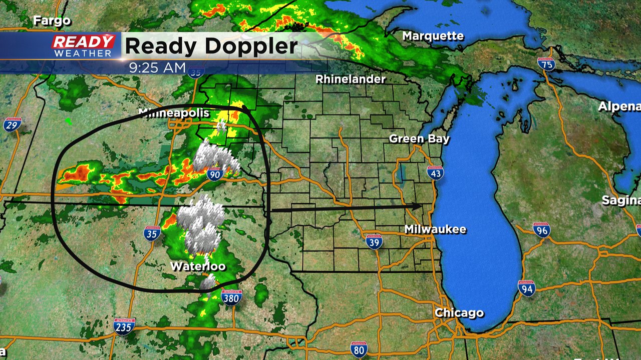
Strong to severe thunderstorms with a lot of lightning are currently ongoing in Minnesota and Iowa. These storms are starting to form a cluster that will likely enter Wisconsin within the next few hours and arrive in southeast Wisconsin later this afternoon. The timing potential for storms locally has shifted a little later to the 1-6 PM timeframe.
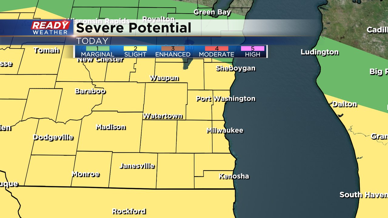
Parts of southeast Wisconsin, especially southern counties, have been added to the Level 3 Enhanced Risk for severe weather. Damaging wind is still the primary threat with gusts over 30 mph possible. A few tornadoes are possible as the warm front lifts into southeast Wisconsin.

Make sure you have a way to get warnings. And if your kids are home alone on summer break make sure they know what to do in case of tornado warnings.
------
Updated: 7:05 a.m. June 13, 2022
Storms are still going in Minnesota and Iowa. There are a few severe thunderstorm warnings currently in southern Minnesota with those storms. We have not seen the storms form a line or cluster yet but that is expected as they move into western Wisconsin.
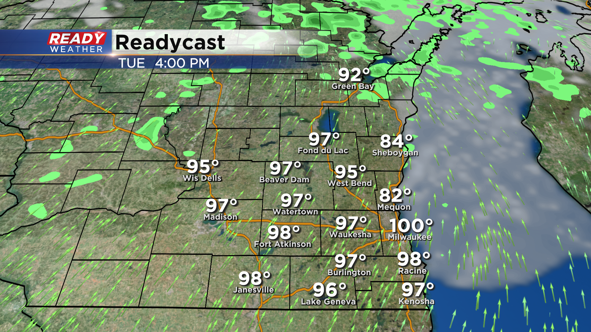
In addition to the storms today we have some intense heat on the way for Tuesday and Wednesday. High temperatures both days will reach into the low to middle 90s. We have not seen a temperature warmer than 95* since 2012!
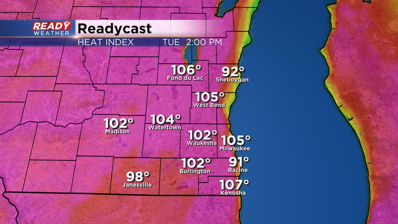
Not only is it going to be hot the next few days but the humidity will be insane! Dew points on Tuesday and Wednesday will get as high as the middle 70s putting us well into the tropical level humidity and borderline miserable conditions.

The heat combined with the humidity will push feels like temps well into the 100s all across southeast Wisconsin.
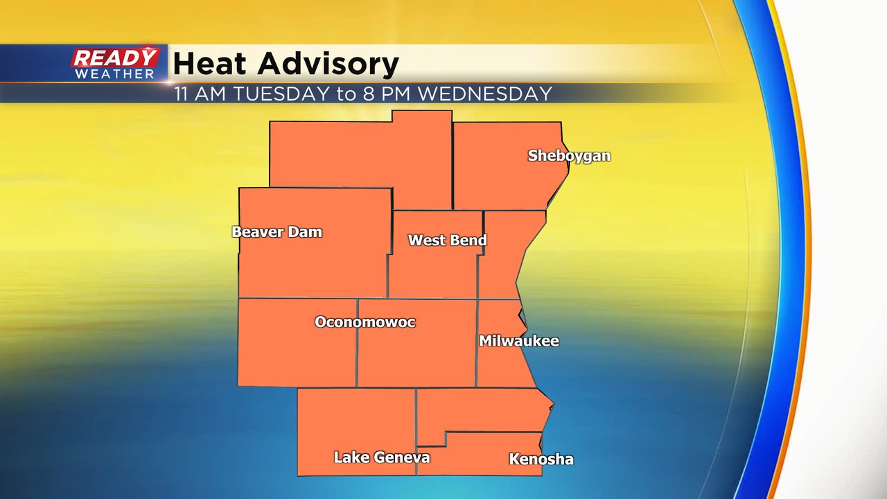
A heat advisory has been issued for all of southeast Wisconsin. The advisory starts at 11 AM on Tuesday and lasts until 8 PM on Wednesday. Wednesday night a cold front will role through with a chance for storms. Depending on when that front arrives, those storms could also be strong to severe.
------
Posted: 5:34 a.m. June 13, 2022
After a mostly dry weekend the chance for storms and severe weather will ramp up going into a new work week. Right now we are watching thunderstorms in southwest Minnesota and parts of Iowa that are moving east. Right now those storms are sub-severe but as they move into Wisconsin there's a good chance they become at least strong and gain strength as they move east. Those storms are expected to arrive in our local area from 11 AM to 6 PM.

All of southeast Wisconsin is in the Level 2 Slight Risk for severe weather. There is some uncertainty surrounding the storms. A few weather models don't have the activity becoming severe until after they move east of our local area. Other models keep the warm front where storms will form down to our south. So there is the possibility that some of us stay dry all day long Monday.
If storms do become severe, damaging wind will be the main threat. Wind gusts over 75 mph are possible. There is also a tornado threat mainly south of I-94. Some hail and heavy rain is possible. Make sure to take down the patio umbrellas and any plastic or light weight furniture.

Download the CBS 58 Ready Weather app to track the storms and get alerts if watches or warnings are issued.