Strong storms could produce hail overnight


The storm prediction center has taken away the slight risk for the northern part of our area. A marginal risk remains in place. The timing for the strong storms will be from Midnight until 4 am.
The greatest chance for a strong or an isolated severe storm will be across Sheboygan, Fond du Lac, Dodge, northern Washington, and northern Ozaukee counties. The main threat within the slight risk will be hail. Strong gusty winds will also accompany the strongest storms.
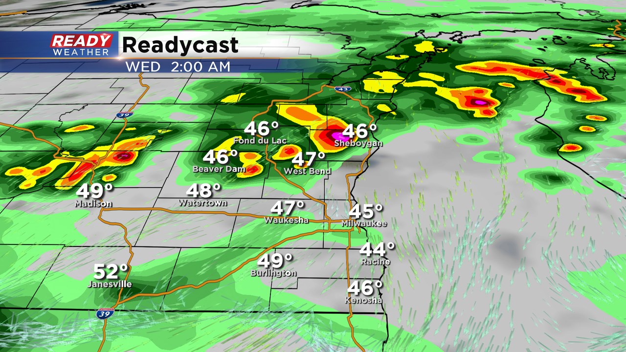
These storms will be elevated in nature, so the chance for a tornado is very low. Elevated storms near warm fronts tend to produce hail. Even tough the surface temps will be cool, hail aloft is still very possible.
The line of storms will push south overnight with a minimal chance for a strong to severe storm near the Milwaukee area overnight.