


There's a chance for a few storms after midnight tonight; however, we aren't expecting a severe weather risk.
Temperatures are expected to warm up quickly on Tuesday, especially away from the lakefront. Low to middle 80s will be common across the area, and that will help fuel strong to severe storms for Tuesday night. Lakeside areas can expect the 70s on Tuesday. In addition to the warmth, dewpoints will surge well into the 60s, which is ample for strong to severe storms.
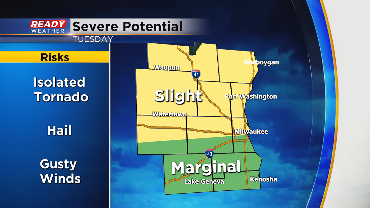
The SPC has the northern half of our viewing area under a slight risk for strong to severe storms. Large hail, damaging winds, and even an isolated tornado are possible.
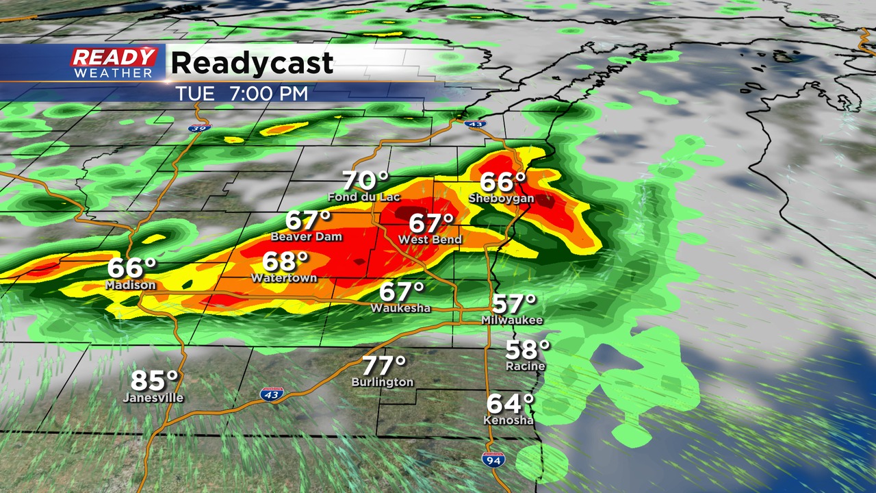
Storms are expected to initiate between 3 pm and 5 pm just northwest our area. Those storms will explode and move southeast during the evening time. Storms that quickly fire will have the chance to rotate and possibly produce an isolated tornado.
Once the storms come together they will have more of a damaging wind threat.
Storms are expected to be south of the area by midnight.