Strong Thunderstorms to Snow.....Wild Week Ahead
The end of February into March is going to be an absolute wild ride; talk about roaring in like a Lion! We are expecting showers and some stronger thunderstorms to turn over to accumulating snow all within a 24 hour period.
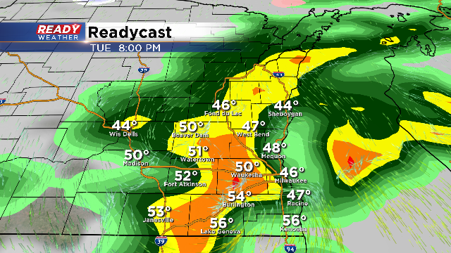
Some rain will develop overnight tonight, but thankfully temperatures will remain above freezing, so no winter weather is expected. Showers and storms are expected to develop by Tuesday evening. There will be enough instability to produce some locally heavy rain and stronger storms with hail. Hail should remain below severe limits; however, some dime to nickel size hail can't be ruled out.
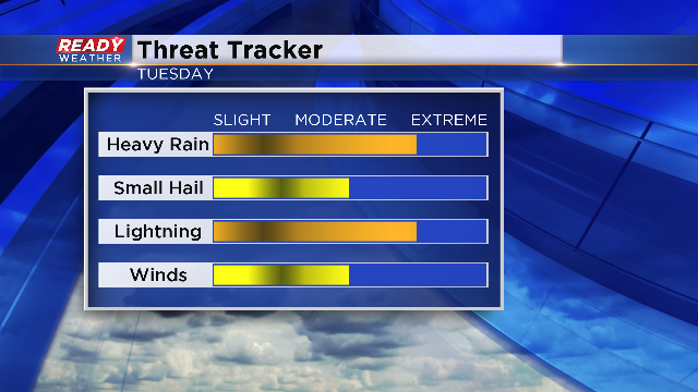
Locally heavy rainfall could total over an inch in many places, especially with thunderstorms. Obviously, lightning will be an issue with storms, but some gusty winds to 40 mph could accompany the stronger cells. A severe thunderstorm watch is not anticipated with this event.
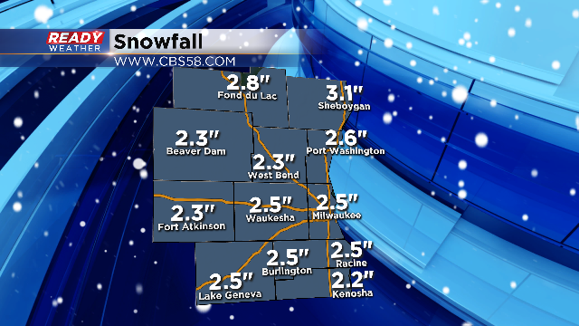
The first day of March will be the ultimate transition back to winter. Rain showers in the morning will turn over to snow showers during the afternoon and evening. Most of the computer models show 2" to 3" of snow on Wednesday! Roads could become slick during the Wednesday evening commute as temperatures fall into the lower 30s.
Another quick batch of snow is possible on Thursday as a disturbance moves through. Look on the bright side, we are 20 days away from the start of Spring!
