A very complex weather pattern will unfold across southeastern Wisconsin over the next 24 to 36 hours. Temperatures will hold steady overnight and start to rise by late Thursday afternoon as a warm front arrives from the southwest.
This warm front will be the focus for showers and storms on Thursday. The SPC has now upgraded portions of our area into a slight risk for strong to severe storms for Thursday evening. The greatest chance for severe storms will be along the border of IL/WI where instability will be maximized.
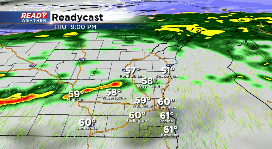
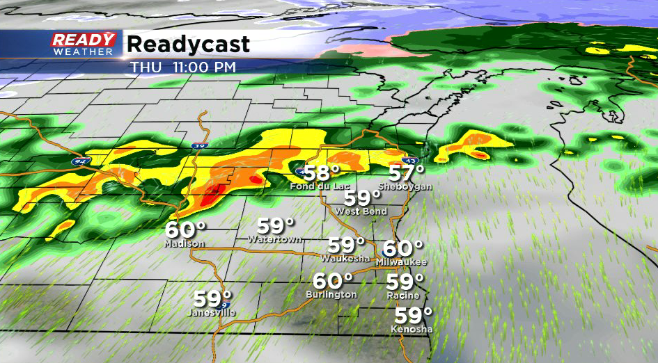
Temperatures tomorrow will spike by the late evening with a southerly wind. The best chance for storms will be from 7 pm through 11 pm. Even though we won't have peak heating, there will be enough instability to pop storms with cold air aloft.
Hail and damaging winds are the main threat; however, there's a ton of shear, so an isolated tornado can't be ruled out. We will continue to watch the latest model runs and update folks accordingly.
