


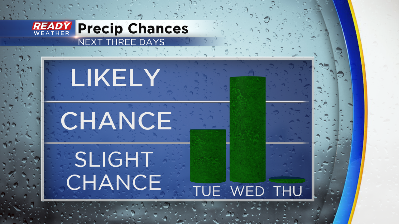
Tuesday is our change day as our weather pattern moves from the comfy and cooler weather we had Sunday and Monday back to the warmth, humidity and eventually storm chances. There is a chance for rain Tuesday evening but better chances for rain arrive Wednesday, especially in the evening. Thursday kicks off a brief dry stretch.
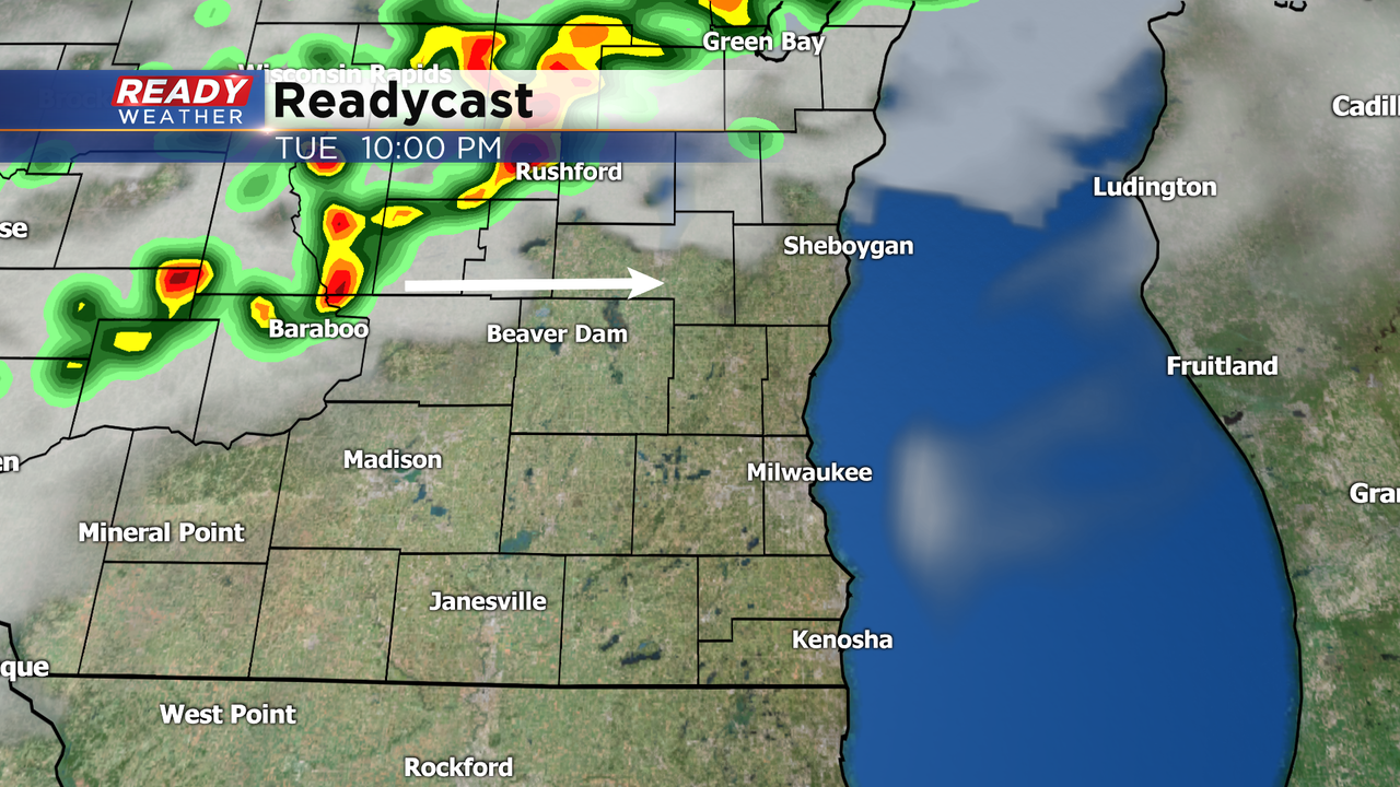
Storms stay just west and north of our local area Tuesday afternoon and evening. Our northern counties like Fond du Lac and Sheboygan have the best chance to see some storms Tuesday evening and if it happens they could be on the stronger or low severe side.
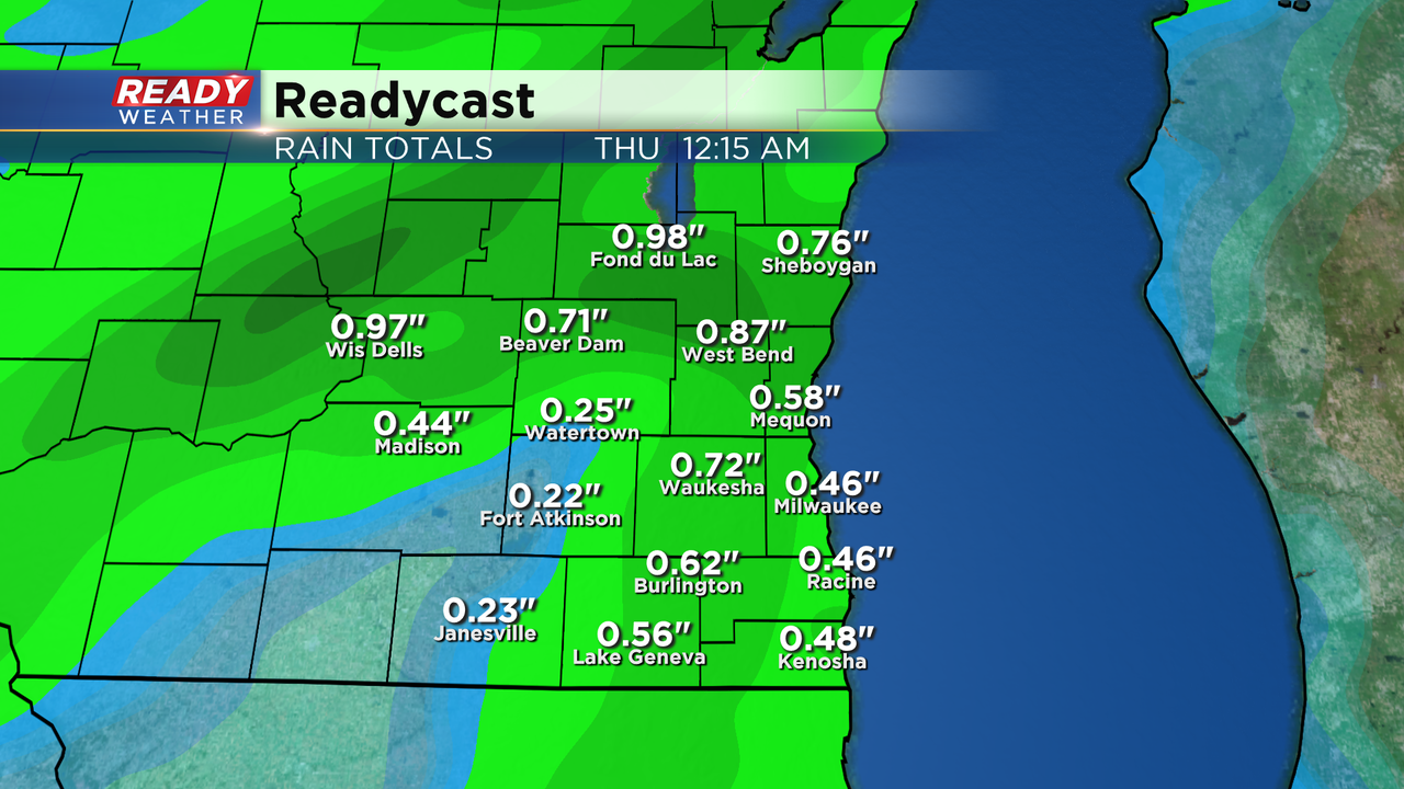
A few isolated showers or storms can't be ruled out Tuesday morning or early afternoon but better chances will arrive in the evening. Despite some staying dry until Wednesday evening there is still a possibility for a soaking rain with over a half inch for most and those that see thunderstorms getting well over one inch.
Download the CBS 58 Ready Weather app to use the interactive radar to track the rain and storms the next 48 hours.