


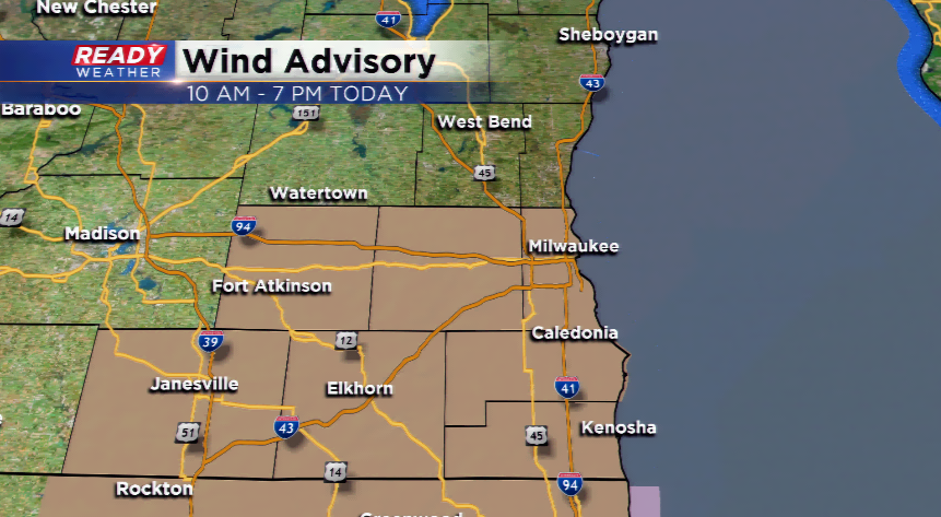
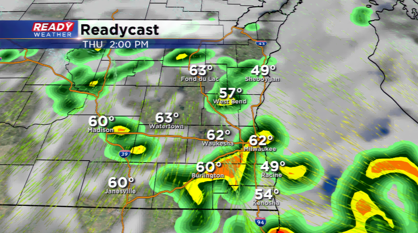
A record-setting low pressure system is ushering in periods of rain, but also clearing the way for the warmest temperatures in the viewing area since the day before Halloween. There will be intervals of showers during your Thursday and then a little clearing at times with temps warming quickly due to the mild morning and strong southwesterly winds. The record high is 78 degrees, which will not be touched. Those winds we speak of could exceed 45 mph. That’s why the NWS has posted a Wind Advisory for the metro from 10 am today until 7 pm this evening.
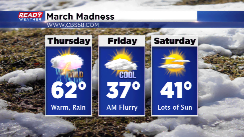
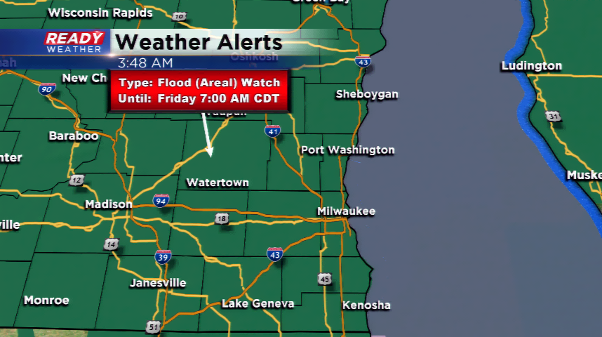
The showers will become more widespread by this afternoon and evening. Rain will begin to turn to a wintry mix and taper off by the morning; accumulation is not expected for snow. It will remain breezy for tomorrow, as well. The Flood Watch will stay in effect until 7 am tomorrow due to the melting snow and waves of rain.
If there’s any positive news to this forecast, even though we will drop in temperatures by week’s end, the region will stay quiet for the weekend with highs around 40 and lots of sun.