


We've had rain chances in the forecast for the last five days but most of the showers and storms have been very isolated with only some seeing any accumulating rain. That changes Thursday with some widespread scattered showers and storms with some heavy rain. A few light showers will be possible in the early morning but rain really gets going in western counties by late morning and for all of southeast Wisconsin during the afternoon and evening.
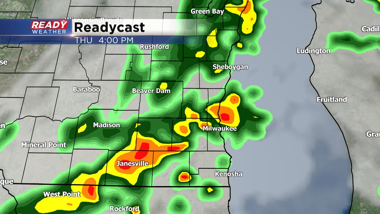
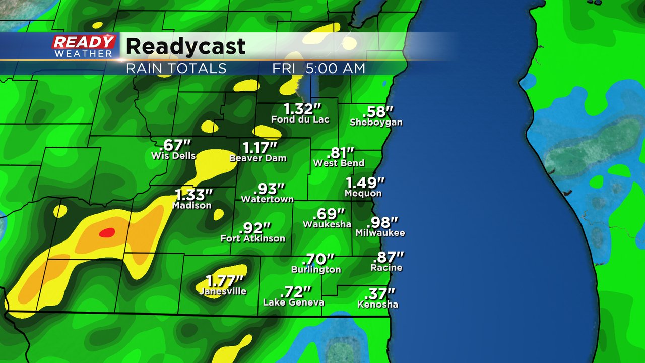
No severe weather is expected Thursday but some heavy downpours are likely. Rain totals in most communities will reach around a half to full inch of water. None of our area rivers are in flood stage but if we see over 1" of rain we could see some minor flooding.
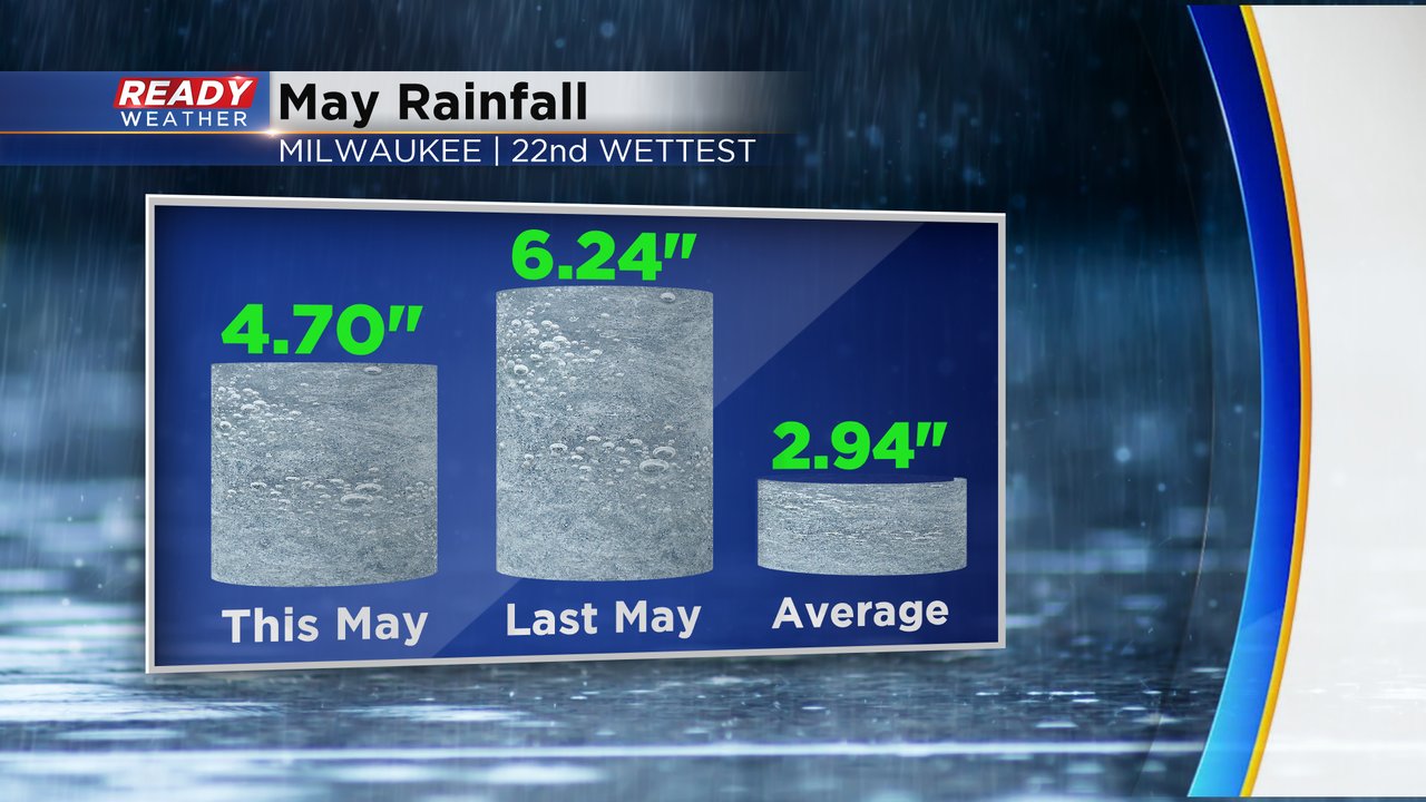
May has overall been a wet month especially after record rains two weeks ago. As of Thursday morning Milwaukee has picked up 4.70" of rainfall which is enough for it to be the 22nd wettest May on record. It's still about an inch and a half below last years very wet May but well above-average.
Download the CBS 58 Ready Weather app to track the showers and storms.