Snow this morning, more coming for Wednesday

-
0:46

Video shows end of police chase, rollover crash in Fond du Lac...
-
0:25

Police searching for pig-masked thief who robbed small Burlington...
-
2:07

Mount Mary University launches new Institute for the Advancement...
-
0:35

Spring is coming early with the Greater Milwaukee Golf Show returning...
-
2:09

‘Totally unpredictable’: Safety concerns rise on National...
-
3:31

’Took out his gun and shot him in the head’: Girlfriend who...
-
1:57

CBS 58 Hometowns LIVE: Thursday Nights at MAM
-
2:22

Milwaukee Police Department officials questioned during council...
-
1:02

Howard University students spend spring break mentoring kids...
-
4:34

Multiple weather alerts in effect as a busy stretch of weather...
-
2:25

Video shows moments leading up to suspect being arrested after...
-
2:56

Visit Milwaukee preview: March 13 - 15

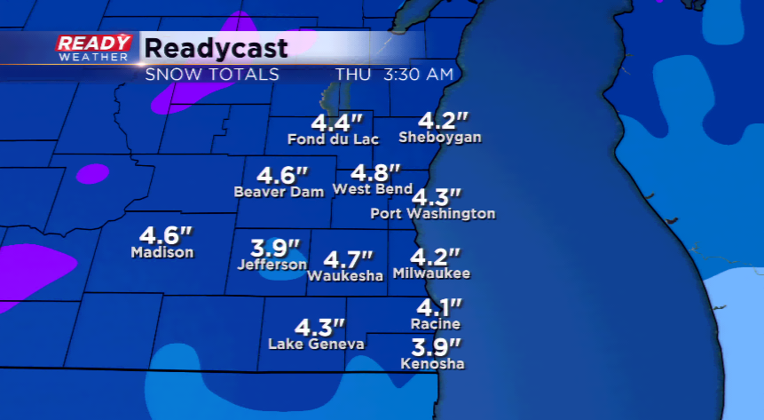
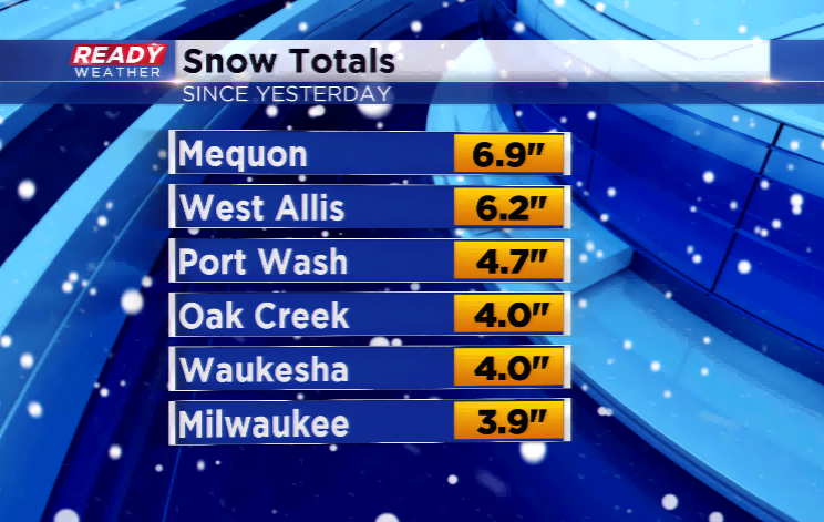
Areas of light snow will be possible this morning, especially along the lake front. Totals will range between 3”-7” along the lake and in most sections of the viewing area. Temperatures will not cool off much the next 24-48 hours with sunshine and high pressure rolling in.
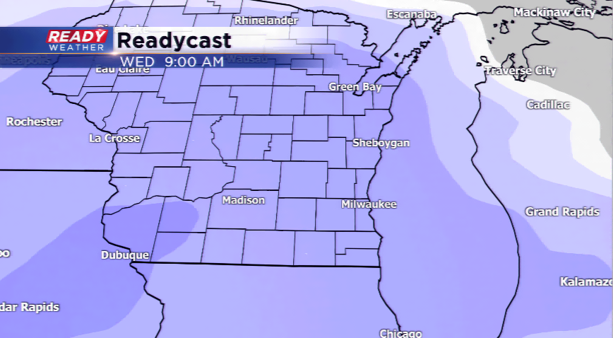
Don’t get used to the sun. We are expecting another round of snowfall heading our way by Tuesday night and Wednesday. Most of this will be snow, but a mix could get thrown in to make things even uglier. Totals will be lower if the mix does come into fruition. We are still anticipating 3”-5” of snowfall with this next storm system.
Warmer weather returns for the weekend with a third system. With the temps getting into the 30s and 40s, this could be a rain storm and a mix eventually once the cold air filters in. We’ll be watching it closely!