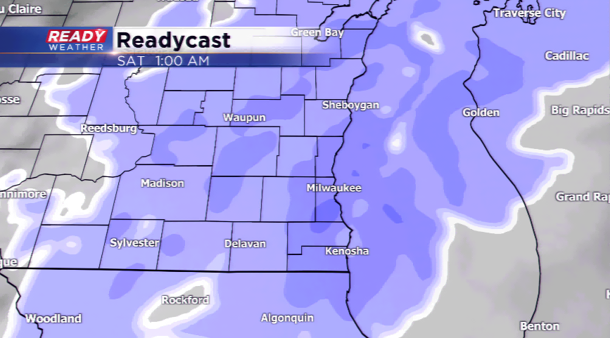
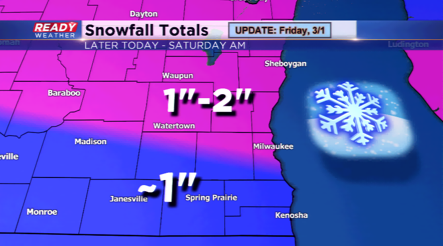
Can you believe today is the start of Meteorological Spring? It won’t look or feel like it today or this weekend. The morning will be quiet with increasing clouds on your Friday as another weak disturbance drives in the chance of snowfall. Expect the snow to overspread the Badger State by this afternoon and evening. It’ll be a light snowfall that will last until early Saturday morning. Total snow range will be between an inch or two, with lesser amounts in the southern parts of the viewing area.
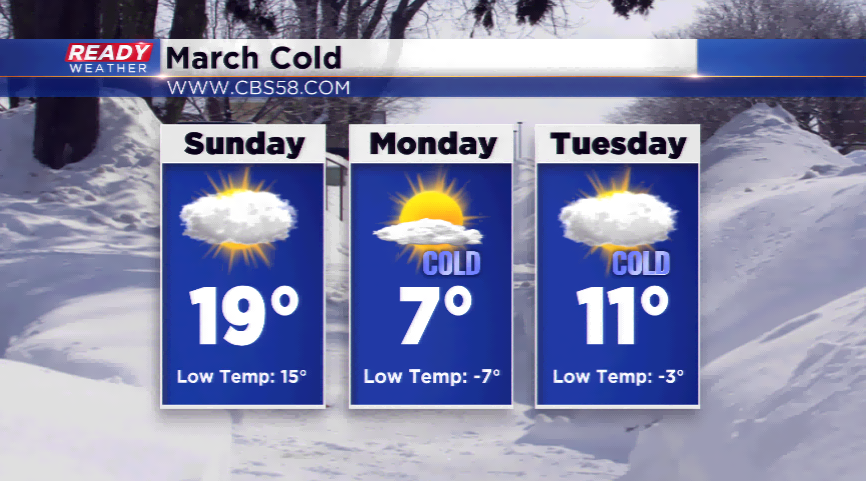
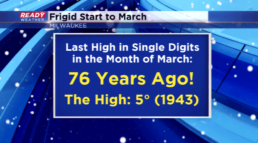
The second story will be the extreme cold. This will be sent down from a drive of arctic air later this weekend. The lows will drop below zero from Sunday night into Tuesday. The coldest day will be on Monday with highs in the single digits. Believe it or not, the last time we had a high in the single digits in March in Milwaukee was 1943. This is cold air in March we haven’t seen in a long time. The cold snap ends by midweek with temps climbing closer to 30 by week’s end, still well below average.