Gusty winds expected tonight with only a small shower chance far north


Updated: 7:10 pm Sunday, June 13th:
A few isolated storms are starting to develop in the Northwoods, including a severe storm riding along the UP border.
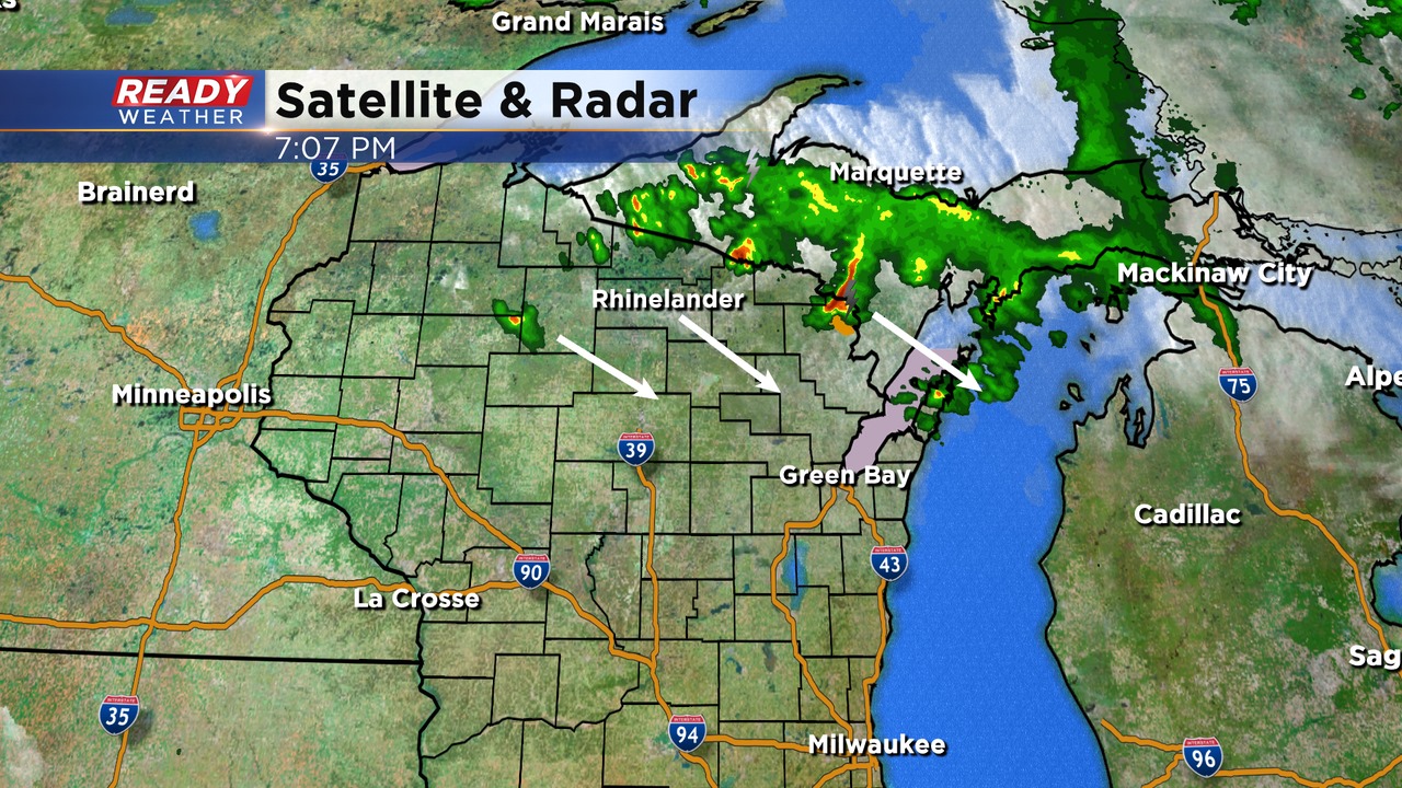
We're expecting these to increase in coverage across northeast Wisconsin over the next few hours, however it looks like most, if not all of the showers and storms will remain to our north. Only about a 20% chance a few showers sneak in Fond du Lac and Sheboygan counties after 11 pm.
We're still expected the gust front to track across southeast Wisconsin overnight, which could produce wind gusts between 25-40 mph.
---------------------------------------------------------------------------
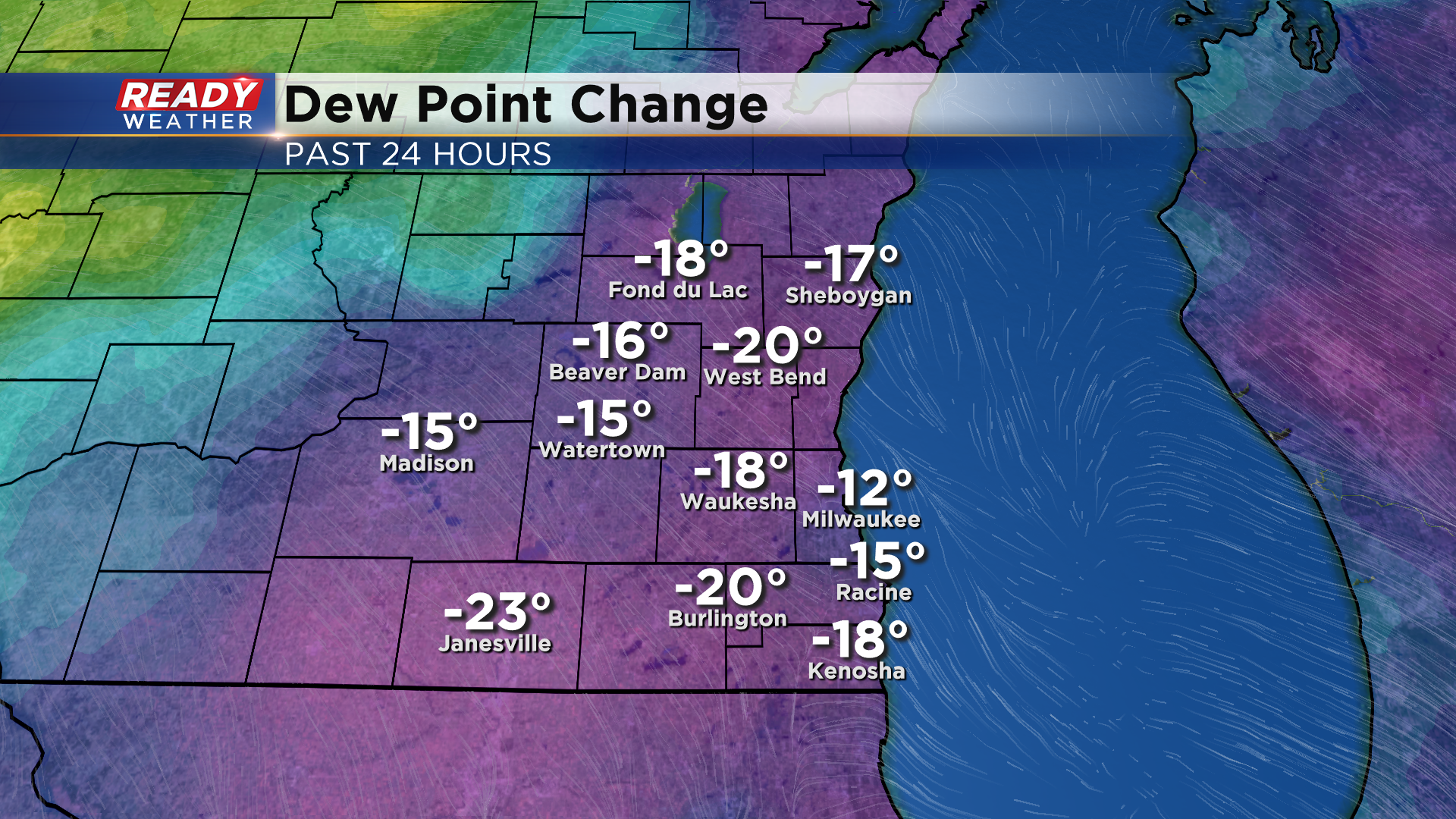
It's been a fantastic early summer day across southeast Wisconsin with abundant sunshine and temperatures in the 80s, and much lower humidity! Dew points are sitting in the upper 40s to low 50s, which is a big change from yesterday's dew points in the 60s to around 70°.
While we're seeing abundant sunshine right now, there's a low pressure system working it's way through northern Minnesota.
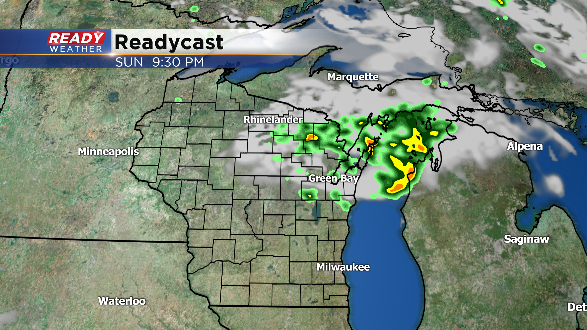
This wave has produced some rain today north of Wisconsin, but we'll be watching for additional shower and thunderstorm development across the Northwoods after 6 pm as the wave slides into the UP. The best chance for scattered storms will be across northeast Wisconsin, with the storms weakening as they approach the Fox Valley after sunset.
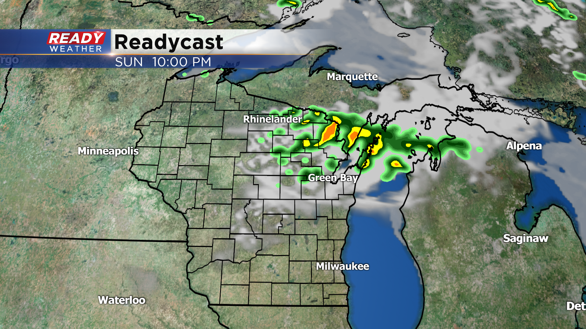
Most of these showers and storms will fall apart or stay north of our area tonight, but we can't rule out a few isolated showers between 11pm - 1 am well north of Milwaukee.
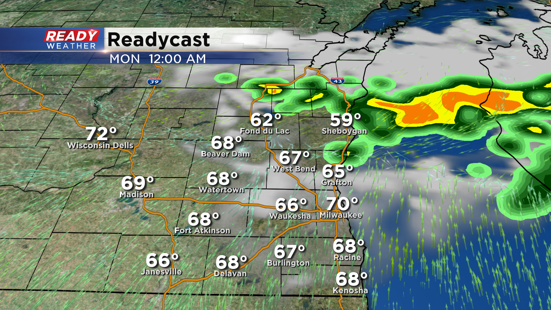
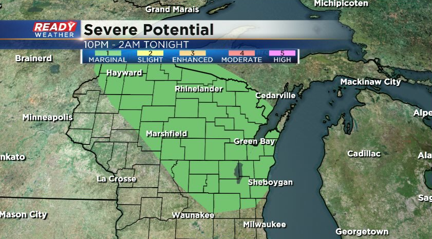
We're expecting a gust front to race ahead of this dying area of showers and storms tonight, which could produce wind gusts of 25-35 mph as it shifts our winds to the NNE. The isolated showers may also produce strong wind gusts. Due to this threat, areas north and northwest of Milwaukee are under a level 1, Marginal Risk, for severe storms this evening.
However, the better chance for a few of those storms with gusty winds will be in northeast Wisconsin. Another weak wave rotates through the Great Lakes tomorrow afternoon, which may spark a few showers near the lake.
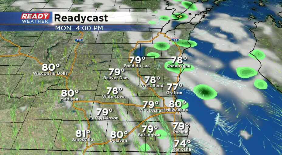
A better chance for some rain and storms arrives Thursday night. Download the CBS 58 Ready Weather App to see how warm temperatures will be this week.