Severe storms with damaging straight-line winds possible Friday afternoon
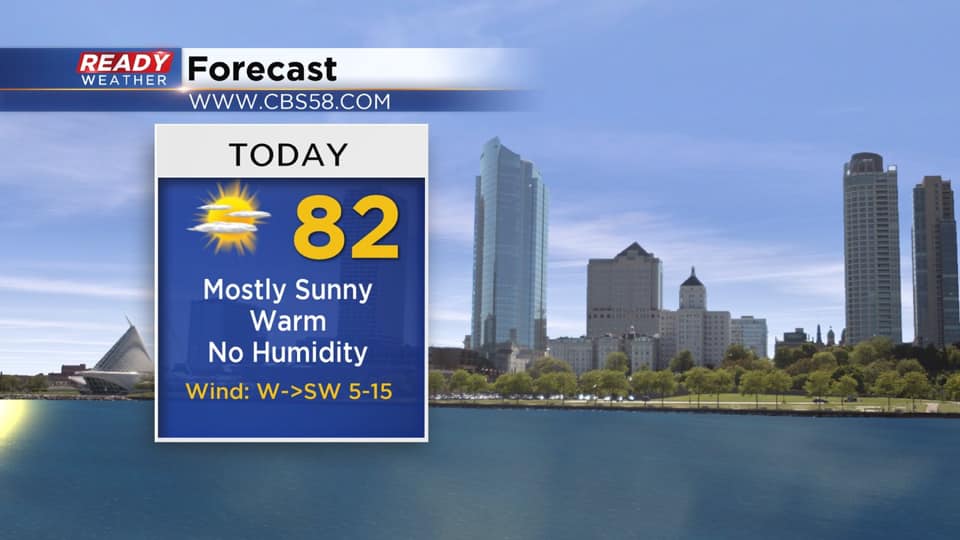
Today is shaping up to be a perfect summer day across southeast Wisconsin with plenty of sunshine, low humidity, and a nice breeze.
Tomorrow won’t be as nice as heat and humidity return, along with the potential for severe storms in the afternoon and evening.
Quiet conditions will continue for tonight, but a warm front will work through the area Friday morning. This could trigger a few isolated showers or storms, but no severe weather is expected with this round. There is a chance these morning storms fall apart before reaching SE Wisconsin. After a break in the action, a potentially potent squall line will develop along the cold front in the afternoon, tracking through the area into the early evening. Current timing of this squall line looks to be between 2-7 pm.

Damaging straight-line winds will be the main threat, especially if we see some sunshine. The more sunshine we see before the cold front, the more likely we’ll have widespread severe wind gusts. There's also a chance for embedded spin ups within the squall line. Right now, most of southeast Wisconsin under an Enhanced Risk (Level 3 of 5) for severe weather.
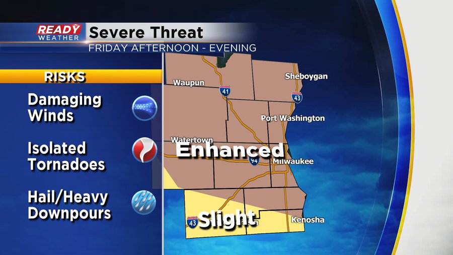
Hail and heavy downpours will also be a threat. There's a chance this cold front will be more oriented in a west to east fashion across the WI/IL border during the evening, which could lead to multiple storms tracking over the same area and a higher risk for heavy rain/flooding.
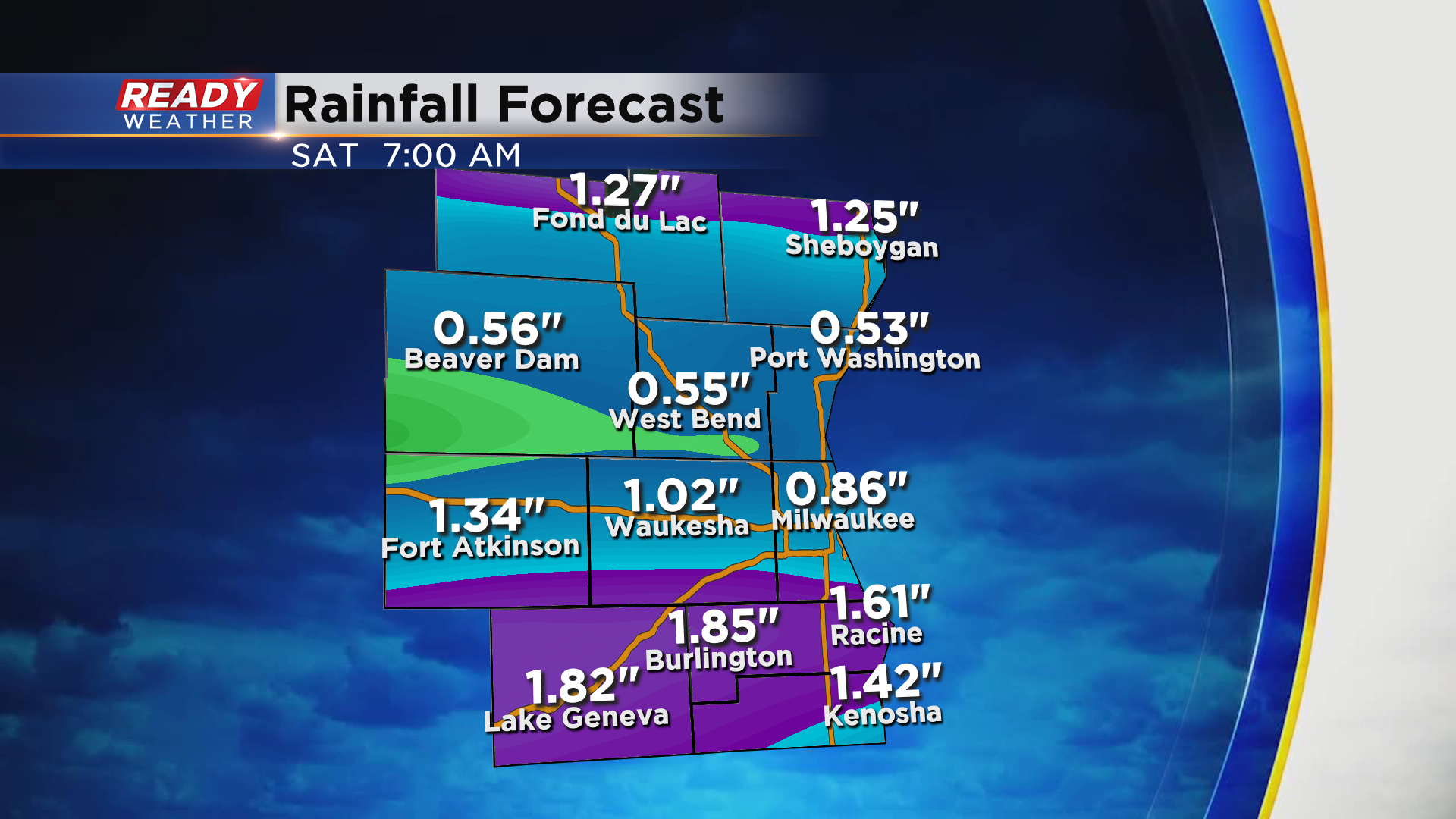
The front will move south of the state by Saturday morning, ending any rain threat. This forecast is not set in stone, so check back for updates over the next 24 hours, and download the CBS 58 Ready Weather App to get all severe alerts sent to your phone. Remain weather aware tomorrow!
